- Arraiolos
-
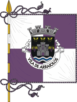
Arraiolos Wappen Karte 

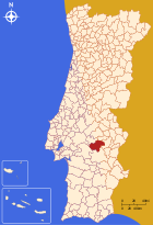
Basisdaten Region: Alentejo Unterregion: Alentejo Central Distrikt: Évora Concelho: Arraiolos Koordinaten: 38° 43′ N, 7° 59′ W38.716666666667-7.9833333333333Koordinaten: 38° 43′ N, 7° 59′ W Einwohner: 3.500 (Stand: 2001) Kreis Arraiolos Flagge Karte 
Einwohner: 7616 (Stand: 2001) Fläche: 684,08 km² Bevölkerungsdichte: 11,13 Einwohner pro km² Anzahl der Gemeinden: 7 Verwaltung Adresse der Verwaltung: Câmara Municipal de Arraiolos
Praça Lima e Brito
7040-027 ArraiolosWebpräsenz: www.cm-arraiolos.pt Arraiolos ist eine Kleinstadt (Vila) in Portugal.
Inhaltsverzeichnis
Geschichte
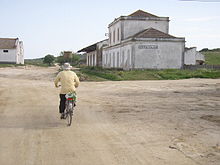 Arraiolos - alter Bahnhof mit Ecopista (Radwanderweg)
Arraiolos bekam das Stadtrecht im Jahr 1290. Der Ort liegt direkt an der historischen Bahnstrecke von Évora nach Ramal de Mora. Diese Strecke wurde kürzlich in einen Ecovia (Radwanderweg) umgewandelt.
Bauwerke
- Castelo de Arraiolos
- Pousada Nossa Senhora da Assunção
Verwaltung
Arraiolos ist Sitz eines gleichnamigen Kreises. Die Nachbarkreise sind (im Uhrzeigersinn im Norden beginnend): Mora, Sousel, Estremoz, Évora, Montemor-o-Novo sowie Coruche.
Die folgenden Gemeinden (freguesias) liegen im Kreis Arraiolos:
- Arraiolos
- Igrejinha (Arraiolos)
- Sabugueiro
- Santa Justa
- São Gregório
- São Pedro de Gafanhoeira
- Vimieiro
Söhne und Töchter der Stadt
- José Caeiro da Mata (1877–1963), Außenminister
Weblinks
-
 Commons: Arraiolos – Sammlung von Bildern, Videos und Audiodateien
 - Karte der Freguesia Arraiolos beim Instituto Geográfico do Exército
- Fotos von Arraiolos

Alandroal | Arraiolos | Borba | Estremoz | Montemor-o-Novo | Mora | Mourão | Portel | Redondo | Reguengos de Monsaraz | Vendas Novas | Viana do Alentejo | Vila Viçosa
Wikimedia Foundation.
Schlagen Sie auch in anderen Wörterbüchern nach:
Arraiolos — Saltar a navegación, búsqueda Arraiolos Escudo Bandera … Wikipedia Español
Arraiolos — Géolocalisation sur la carte : Portugal … Wikipédia en Français
Arraiolos — Infobox Municipality pt official name = Arraiolos image coat of arms = ARL.png Region = Alentejo Subregion = Alentejo Central District = Évora Mayor name = Jerónimo Loios Mayor party = CDU area total = 683.8 population total = 7,382 population… … Wikipedia
Arraiolos — Arraiọlos [ luʃ], portugiesische Stadt, nördlich von Évora, 6 000 Einwohner; Wirtschaft: seit Ende des 17. Jahrhunderts wegen seiner Teppichherstellung bekannt. Stadtbild: Arraiolos wird überragt von der mächtigen Ruine eines Kastells… … Universal-Lexikon
Arraiolos — Sp Arajòlosas Ap Arraiolos L Portugalija … Pasaulio vietovardžiai. Internetinė duomenų bazė
Arraiolos — Admin ASC 2 Code Orig. name Arraiolos Country and Admin Code PT.08.0702 PT … World countries Adminstrative division ASC I-II
Arraiolos rug — embroidered floor covering made at Arraiolos, north of Évora in Portugal. The technique is a form of cross stitch that completely covers the linen cloth foundation. Today most rugs are made as a cottage industry by the women of Arraiolos.… … Universalium
Count of Arraiolos — The Coat of Arms of Nuno Álvares Pereira, who bore the title of Count of Arraiolos … Wikipedia
Igrejinha (Arraiolos) — Igrejinha Freguesia de Portugal … Wikipedia Español
São Gregório (Arraiolos) — São Gregório Freguesia de Portugal … Wikipedia Español
Arraiolos


18+
© Academic, 2000-2024
- Kontaktieren Sie uns: Unterstützung, Werbung
Wörterbücher Export, schritte mit PHP, Joomla, Drupal, WordPress, MODx.