Nong Suea

Nong Suea
Nong Suea
หนองเสือ
Provinz: Pathum Thani
Fläche: 413,6 km²
Einwohner: 48.439 (2007)
Bev.dichte: 117 E./km²
PLZ: 12170
Geocode: 1304
Karte
Karte von Pathum Thani, Thailand mit Nong Suea

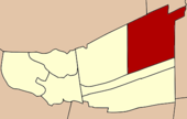
Amphoe Nong Suea (Thai: อำเภอ หนองเสือ) ist ein Landkreis (Amphoe - Verwaltungs-Distrikt) im östlichen Teil der Provinz Pathum Thani in Zentral-Thailand.

Inhaltsverzeichnis

Etymologie

Im Gebiet des heutigen Landkreises Nong Suea gab es früher einen Teich, der oft von wilden Tigern besucht wurde, die in den Bergen der Nachbarprovinzen Saraburi und Nakhon Nayok lebten. Daher nannten die Bewohner diese Gegend „Tiger-Teich“ (Nong Suea).

Geographie

Benachbarte Distrikte (von Norden im Uhrzeigersinn): Amphoe Wang Noi der Provinz Ayutthaya, die Amphoe Nong Khae und Wihan Daeng der Provinz Saraburi, die Amphoe Ban Na und Ongkharak der Provinz Nakhon Nayok sowie die Amphoe Thanyaburi und Khlong Luang der Provinz Pathum Thani.

Verwaltungsgliederung

Amphoe Nong Suea ist in sieben Gemeinden (Tambon) gegliedert, welche wiederum in 70 Dorfgemeinschaften (Muban) unterteilt sind.

Nong Suea (Thai: เทศบาลตำบลหนองเสือ) selbst hat einen Kleinstadt-Status (Thesaban Tambon) und besteht aus Teilen des Tambon Nong Suea.

Es gibt weiterhin sieben Tambon Administrative Organizations (TAO - Verwaltungs-Organisationen, องค์การบริหารส่วนตำบล).

Nr. Name Thai Muban
1. Bueng Ba บึงบา 09
2. Bueng Bon บึงบอน 09
3. Bueng Ka Sam บึงกาสาม 09
4. Bueng Cham O บึงชำอ้อ 12
5. Nong Sam Wang หนองสามวัง   13
6. Sala Khru ศาลาครุ 10
7. Noppharat นพรัตน์ 08

Weblinks


14.134937026944100.824269056397Koordinaten: 14° 8′ N, 100° 49′ O


Wikimedia Foundation.

Игры ⚽ Нужен реферат?

Schlagen Sie auch in anderen Wörterbüchern nach:

  • Nong Suea — 1 Original name in latin Nong Suea Name in other language Amphoe Nong Sua, Ban Bung Ba, Ban Bung Pa, Boeng Ba, Nong Sua, Nong Suea, hnxngseux State code TH Continent/City Asia/Bangkok longitude 14.13478 latitude 100.82503 altitude 9 Population 0… …   Cities with a population over 1000 database

  • Nong Suea District — Nong Suea หนองเสือ   Amphoe   Amphoe location in Pathum Thani Province …   Wikipedia

  • Amphoe Nong Suea — Nong Suea หนองเสือ Provinz: Pathum Thani Fläche: 413,6 km² Einwohner: 48.439 (2007) Bev.dichte: 117 E./km² PLZ: 12170 …   Deutsch Wikipedia

  • Amphoe Nong Suea — Infobox Amphoe thai=หนองเสือ name=Nong Suea province=Pathum Thani capital=Bueng Ba coordinates=coord|14|8|6|N|100|49|27|E|type:adm2nd region:TH area=413.6 population=46,565 population as of=2000 density=112.6 postal code=12170 geocode=1304Nong… …   Wikipedia

  • Amphoe Nong Suea — Admin ASC 2 Code Orig. name Amphoe Nong Suea Country and Admin Code TH.39.1608162 TH …   World countries Adminstrative division ASC I-II

  • Nong Yai District — Nong Yai หนองใหญ่   Amphoe   Amphoe location in Chonburi Province Coord …   Wikipedia

  • Nong Khae District — Nong Khae หนองแค   Amphoe   Amphoe location in Saraburi Province …   Wikipedia

  • Nong Yai — หนองใหญ่ Provinz: Chonburi Fläche: 397,5 km² Einwohner: 21.984 (2005) Bev.dichte: 55,3 E./km² PLZ: 20190 …   Deutsch Wikipedia

  • Amphoe Nong Khae — Nong Khae หนองแค Provinz: Saraburi Fläche: 262,867 km² Einwohner: 88.213 (2005) Bev.dichte: 335,5 E./km² PLZ: 18140 …   Deutsch Wikipedia

  • Amphoe Nong Yai — Nong Yai หนองใหญ่ Provinz: Chonburi Fläche: 397,5 km² Einwohner: 21.984 (2005) Bev.dichte: 55,3 E./km² PLZ: 20190 …   Deutsch Wikipedia

Share the article and excerpts

Direct link
Do a right-click on the link above
and select “Copy Link”