- Oldonyo Lengai
-
Ol Doinyo Lengai 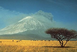
Während der Eruption von 1966
Höhe 2.960 m Lage Tansania, Ostafrika Geographische Lage 2° 45′ 5″ S, 35° 54′ 8″ O-2.751388888888935.9022222222222960Koordinaten: 2° 45′ 5″ S, 35° 54′ 8″ O 

Typ Schichtvulkan Der Ol Doinyo Lengai ist ein aktiver Vulkan des Ostafrikanischen Grabenbruchs im Norden Tansanias. Er liegt ca. 120 km nordwestlich von Arusha am Natronsee.
In der Sprache der Massai bedeutet Ol Doinyo Lengai so viel wie Gottesberg. Der ca. 2960 Meter hohe Vulkan ist für die Massai der Sitz ihres Gottes Engai und die Vulkanausbrüche symbolisieren den Zorn des Gottes.
Der Ol Doinyo Lengai ist der weltweit einzige Vulkan, der Karbonatitlava fördert. Diese Lava ist sehr dünnflüssig, hat etwa die Viskosität von Wasser. Kürzlich erstarrte Lava hat eine dunkle Farbe, die sich schnell in ein helles Beige verwandelt. Die Lava dieses Vulkans erreicht mit maximal 590 °C im Vergleich zur Lava anderer Vulkane eine relativ geringe Temperatur, entstammt aber wesentlich tieferen Schichte des Erdinneren.
Die hauptsächliche Förder-Aktivität findet in einem Kratersee-Bereich statt, der mit den Eruptionsprodukten gefüllt ist. Das Niveau der Füllung ist einem steten Wandel unterworfen. Der Pegel der Karbonatitlava kann plötzlich absacken und wieder ansteigen. Es bilden sich ständig Gasblasen mit bis zu 3 m Durchmesser. Oft wird wird auch ein Lavastrom über den Kraterrand gefördert.
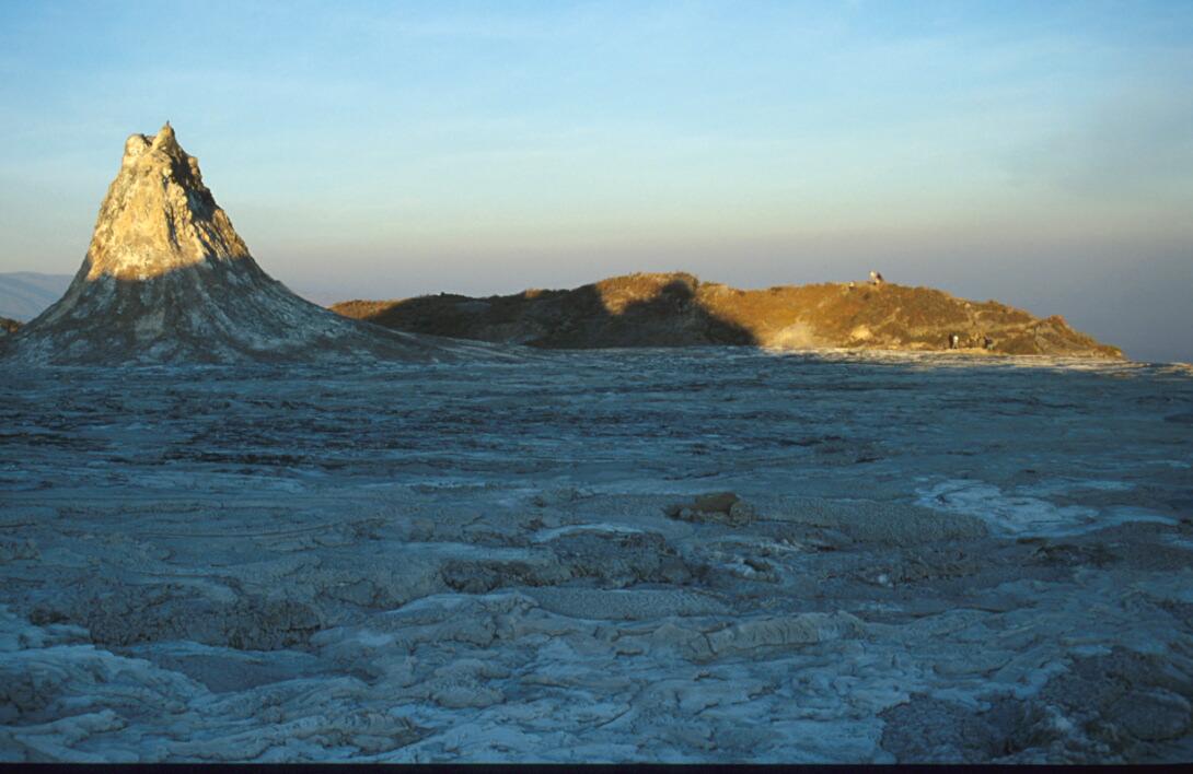
An kleineren Austrittsstellen der Lava bilden sich steile Kegel mit bis zu einigen Metern Höhe, sogenannte Hornitos.

Erstarrte Lava im Krater des Ol Doinyo Lengai, August 2001

Öfchen oder „Hornito“ im Vulkankrater, August 2001
Weblinks


Wikimedia Foundation.