Parsons, West Virginia — Infobox Settlement official name = Parsons, West Virginia settlement type = City nickname = motto = imagesize = 250px image caption = Central Parsons, with the Tucker County Courthouse visible in the lower left corner image mapsize = 250x200px… … Wikipedia
West Virginia locations by per capita income — West Virginia is the second poorest state in the United States of America, with a per capita income of $16,477 (2000). West Virginia counties ranked by per capita income There are fifty five counties located in West Virginia, none of which are in … Wikipedia
Romney, West Virginia — Infobox Settlement official name = City of Romney, West Virginia settlement type = City nickname = West Virginia s Oldest Town |Early 20th Century view of Romney imagesize = image caption = image mapsize = 250x200px map caption = Location of… … Wikipedia
Osceola, West Virginia — Osceola Unincorporated area Wildflowers add a splash of color to grazing fields near Osceola, West Virginia in July 2006 … Wikipedia
Hendricks, West Virginia — Infobox Settlement official name = Hendricks, West Virginia settlement type = Town nickname = motto = imagesize = image caption = image mapsize = 250x200px map caption = Location of Hendricks, West Virginia mapsize1 = map caption1 = subdivision… … Wikipedia
West Virginia Route 72 — Infobox road state=WV type=WV route=72 length mi=55.7 length round=1 length ref=Distance calculated using Microsoft MapPoint mapping software.] established= direction a=South starting terminus= junction= direction b=North ending terminus=… … Wikipedia
U.S. Route 48 in West Virginia — The U.S. Route 48 designation has not yet been applied in West Virginia due to major segments of highway either under construction or under planning. The designation will follow Corridor H from Interstate 79 in Weston eastward to Virginia.West… … Wikipedia
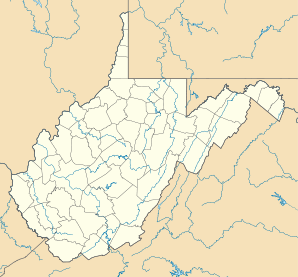
Monongalia County, West Virginia — Location in the state of West Virginia … Wikipedia
Hampshire County, West Virginia — Infobox U.S. County county = Hampshire County state = West Virginia founded year = 1753 founded date = seat wl = Romney largest city wl = Romney area total sq mi = 645 area total km2 = 1670 area land sq mi = 642 area land km2 = 1662 area water sq … Wikipedia
Romney, West Virginia, in the American Civil War — The city of Romney, Virginia (now West Virginia) traded hands between the Union Army and Confederate States Army approximately 56 times during the American Civil War. The story of the small town is emblematic of the many military campaigns that… … Wikipedia