- Pine Cay
-
Pine Cay Lage der Insel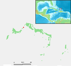
Gewässer Atlantischer Ozean Inselgruppe Caicos-Inseln Geographische Lage 21° 52′ 16″ N, 72° 5′ 37″ W21.871194444444-72.0935361111115Koordinaten: 21° 52′ 16″ N, 72° 5′ 37″ W 

Länge 2,7 km Breite 900 m Fläche 2,8 km² Höchste Erhebung 5 m Einwohner 30 Hauptort --- Pine Cay ist eine kleine Insel in der Kette der westlichen Caicos-Inseln. Sie gehört geopolitisch zum britischen Überseegebiet der Turks- und Caicosinseln und ist heute in Privatbesitz.
Die Insel ist Teil einer Gruppe von etwa 20 flachen Sandinseln, die zwischen der Westküste von North Caicos und der Nordostküste von Providenciales liegen. Pine Cay ist nur durch einen schmalen Meeresarm von dem westlich angrenzenden Water Cay getrennt; der Durchgang ist heute im Norden so stark versandet, dass die Nachbarinsel zumindest bei Ebbe zu Fuß erreichbar ist.
Auf Pine Cay betreibt der Besitzer der Insel, der Meridian Club, seit 1970 eine kleine luxuriöse Bungalowanlage. Die Insel verfügt über einige Versorgungseinrichtungen und eine 800 Meter lange Start- und Landebahn für Kleinflugzeuge.
Weblinks
- Webseite des Meridian Club (mit Bildern und Karten der Insel) (engl.)
- Seite der Turks- und Caicosinseln (engl.)

Turks-Inseln: Grand Turk | Salt Cay | Cotton Cay | East Cay | Gibbs Cay
Caicos-Inseln: West Caicos | Providenciales | Water Cay | Pine Cay | Stubbs Cay | Fort George Cay | Dellis Cay | Parrot Cay | North Caicos | Middle Caicos | East Caicos | South Caicos | Long Cay | Ambergris Cays
Wikimedia Foundation.
Schlagen Sie auch in anderen Wörterbüchern nach:
Pine Cay — is an island of about 30 people population in the Turks and Caicos Islands. It is privately owned by the Meridian Club and rents the area to its employees and customers.Pine Cay was the site of the first tourist development on the Turks and… … Wikipedia
Water Cay — Lage der Insel Gewässer Pazifischer Ozean Inselgrupp … Deutsch Wikipedia
Dellis Cay — Vorlage:Infobox Insel/Wartung/Bild fehltVorlage:Infobox Insel/Wartung/Höhe fehlt Dellis Cay Gewässer Atlantischer Ozean Inselgruppe Caicos Inseln Geographische Lage … Deutsch Wikipedia
Fort George Cay — Vorlage:Infobox Insel/Wartung/Bild fehltVorlage:Infobox Insel/Wartung/Höhe fehlt Fort George Cay Gewässer Atlantischer Ozean Inselgruppe Caicos Inseln Geographische Lage … Deutsch Wikipedia
Cotton Cay — Satellitenbild von Cotton Cay (Mitte) Gewässer Atlantischer Ozean Inselgruppe … Deutsch Wikipedia
Long Cay (Turks- und Caicosinseln) — Long Cay Lage der Insel Gewässer Atlantischer Ozean Inselgruppe … Deutsch Wikipedia
Salt Cay (Turks-Inseln) — Salt Cay Satellitenbild von Salt Cay (links) Gewässer Atlantischer Ozean Inselgruppe … Deutsch Wikipedia
Parrot Cay — Position der Insel Gewässer Atlantischer Ozean … Deutsch Wikipedia
Dellis Cay — Dellis Cay[1] is a 560 acre (2.3 km2) private island located in the Turks and Caicos Islands[2] archipelago. This island sits south of Parrot Cay and north of Pine Cay and can be easily noted in the chain of Caicos Islands.[3] Dellis Cay is… … Wikipedia
Parrot Cay — is a tiny island, part of Turks and Caicos Islands and is dominated by a large hotel beach resort, which over the years has seen many visits by celebrities such as Bruce Willis and Michael J Fox. It is located near Pine Cay, Seal Cay and South… … Wikipedia
Pine Cay


18+
© Academic, 2000-2024
- Kontaktieren Sie uns: Unterstützung, Werbung
Wörterbücher Export, schritte mit PHP, Joomla, Drupal, WordPress, MODx.