Avra Valley

Avra Valley
Avra Valley
Pima County Incorporated and Unincorporated areas Avra Valley highlighted.svg
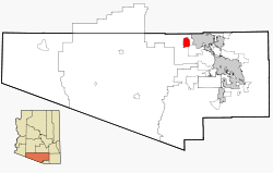
Lage im County und in Arizona
Basisdaten
Staat: Vereinigte Staaten
Bundesstaat: Arizona
County:

Pima County

Koordinaten: 32° 25′ N, 111° 20′ W32.418611111111-111.32805555556585Koordinaten: 32° 25′ N, 111° 20′ W
Zeitzone: Mountain Standard Time (UTC−7)
Einwohner: 5038 (Stand: 2000)
Bevölkerungsdichte: 88,1 Einwohner je km²
Fläche: 57,2 km² (ca. 22 mi²)
davon 57,2 km² (ca. 22 mi²) Land
Höhe: 585 m
FIPS: 04-04880
GNIS-ID: 1866979

Avra Valley ist ein Census-designated place im Pima County im US-Bundesstaat Arizona.

Die Stadt hat ca. 5.000 Einwohner auf einer Fläche von 57 km². Avra Valley liegt an der Interstate 10 nahe Tucson, und verfügt mit dem Avra Valley Airport über einen Flughafen. Unweit der Stadt befindet sich der El Trio Gliderport.

Das Ironwood Forest National Monument, ein 76.800 Hektar großer Park, liegt südwestlich.


Wikimedia Foundation.

Игры ⚽ Поможем сделать НИР

Schlagen Sie auch in anderen Wörterbüchern nach:

  • Avra Valley — Avra Valley, AZ U.S. Census Designated Place in Arizona Population (2000): 5038 Housing Units (2000): 1895 Land area (2000): 22.072264 sq. miles (57.166900 sq. km) Water area (2000): 0.000000 sq. miles (0.000000 sq. km) Total area (2000):… …   StarDict's U.S. Gazetteer Places

  • Avra Valley, AZ — U.S. Census Designated Place in Arizona Population (2000): 5038 Housing Units (2000): 1895 Land area (2000): 22.072264 sq. miles (57.166900 sq. km) Water area (2000): 0.000000 sq. miles (0.000000 sq. km) Total area (2000): 22.072264 sq. miles (57 …   StarDict's U.S. Gazetteer Places

  • Avra Valley — Original name in latin Avra Valley Name in other language State code US Continent/City America/Phoenix longitude 32.43785 latitude 111.31538 altitude 580 Population 6050 Date 2011 05 14 …   Cities with a population over 1000 database

  • Avra Valley, Arizona — Infobox Settlement official name = Avra Valley, Arizona settlement type = CDP imagesize = image caption = imagesize = image caption = mapsize = 250px map caption = Location in Pima County and the state of Arizona mapsize1 = map caption1 =… …   Wikipedia

  • Avra — Cette page d’homonymie répertorie les différents sujets et articles partageant un même nom. Avra peut faire référence à : Avra Velis, une actrice, danceuse, chanteuse, productrice gréco australienne, Avra Valley, un census designated place… …   Wikipédia en Français

  • Oro Valley, Arizona — Town of Oro Valley, Arizona   Town   View of Pusch Ridge in the Santa Catalina Mountains from Oro Valley. September 2004 …   Wikipedia

  • Tucson, Arizona — Tucson redirects here. For other uses, see Tucson (disambiguation). Tucson   City   From upper left: Downtown Tucson Skyline, Pima County Courthouse, Old Main, Un …   Wikipedia

  • Interstate 10 in Arizona — This article is about the section of Interstate 10 in Arizona. For the entire length of the highway, see Interstate 10. Interstate 10 Papago Freeway, Maricopa Freeway, Pearl Harbor Memorial Highway …   Wikipedia

  • List of mountain ranges of Arizona — There are 194 named mountain ranges in Arizona. The extra items listed may include::Mingus Mountain, the high, NW section of the Black Hills:Shiprock:Sierra Madre Occidental (of W continental Mexico) The list*Agua Caliente Mountains ndash;Yuma… …   Wikipedia

  • Marana Regional Airport — IATA: AVW – ICAO: KAVQ – FAA LID: AVQ Summary Airport type Public Owner Town of Marana …   Wikipedia

Share the article and excerpts

Direct link
Do a right-click on the link above
and select “Copy Link”