- Salcedo (Eastern Samar)
-
Municipality of Salcedo Lage von Salcedo in der Provinz Eastern Samar 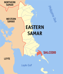
Basisdaten Bezirk: Eastern Visayas Provinz: Eastern Samar Barangays: 41 Distrikt: 1. Distrikt von Eastern Samar PSGC: 082619000 Einkommensklasse: 5. Einkommensklasse Haushalte: 3452 Zensus 1. Mai 2000Einwohnerzahl: 18.680 Zensus 1. August 2007Koordinaten: 11° 9′ N, 125° 40′ O11.147125.665Koordinaten: 11° 9′ N, 125° 40′ O Postleitzahl: 6807 Offizielle Webpräsenz: Salcedo Geographische Lage auf den Philippinen 

Salcedo Salcedo ist eine philippinische Stadtgemeinde in der Provinz Eastern Samar. Nach dem Zensus vom 1. Mai 2000 hat sie 16.971 Einwohner in 3452 Haushalten.
Barangays
Salcedo ist politisch in 41 Baranggays unterteilt.
- Abejao
- Alog
- Asgad
- Bagtong
- Balud
- Barangay 1 (Pob.)
- Barangay 13 (Pob.)
- Barangay 2 (Pob.)
- Barangay 3 (Pob.)
- Barangay 4 (Pob.)
- Barangay 5 (Pob.)
- Barangay 6 (Pob.)
- Barangay 7 (Pob.)
- Barangay 8 (Pob.)
- Barangay 9 (Pob.)
- Barangay 10 (Pob.)
- Barangay 11 (Pob.)
- Barangay 12 (Pob.)
- Buabua
- Burak
- Butig
- Cagaut
- Camanga
- Cantomoja
- Carapdapan
- Caridad
- Casili-on
- Iberan
- Jagnaya
- Lusod
- Malbog
- Maliwaliw
- Matarinao
- Naparaan
- Seguinon
- San Roque (Bugay)
- Santa Cruz
- Tacla-on
- Tagbacan
- Palanas
- Talangdawan
Städte und Stadtgemeinden in der Provinz Eastern SamarStädte: Borongan City
Stadtgemeinden: Arteche | Balangiga | Balangkayan | Can-avid | Dolores | General MacArthur | Giporlos | Guiuan | Hernani | Jipapad | Lawaan | Llorente | Maslog | Maydolong | Mercedes | Oras | Quinapondan | Salcedo | San Julian | San Policarpo | Sulat | Taft
Wikimedia Foundation.
Schlagen Sie auch in anderen Wörterbüchern nach:
Salcedo, Eastern Samar — Salcedo is a 5th class municipality in the province of Eastern Samar, Philippines. According to the 2000 census, it has a population of 16,971 people in 3,452 households.BarangaysSalcedo is politically subdivided into 41 barangays. * Abejao *… … Wikipedia
Eastern Samar — Lage der Provinz Eastern Samar Die Provinz Eastern Samar liegt im Osten der Insel Samar auf den Philippinen und wird politisch dem Bezirk Eastern Visayas (Region VIII) zugeordnet. Der Hauptstadt der Provinzregierung, Borongan, befindet sich im… … Deutsch Wikipedia
Eastern Samar — Infobox Philippine province name = Eastern Samar sealfile = Ph seal eastern samar.png region = Eastern Visayas (Region VIII) capital = Borongan founded = June 19, 1965 pop2000 = 375,822 pop2000rank = 20th smallest popden2000 = 87 popden2000rank … Wikipedia
Maydolong, Eastern Samar — Municipality of Maydolong Municipality Map of Eastern Samar showing the location of Maydolong … Wikipedia
Oras, Eastern Samar — Oras redirects here. For the Romanian town designation, see Oraş. Oras is a 4th class municipality in the province of Eastern Samar, Philippines. According to the 2000 census, it has a population of 31,315 people in 6,201 households. In 1948, San … Wikipedia
Dolores, Eastern Samar — Dolores is a 4th class municipality in the province of Eastern Samar, Philippines. According to the 2000 census, it has a population of 32,812 people in 6,313 households. In 1948, the barrios of Can avid, Carolina, Barok, Cansangaya, Mabuhay,… … Wikipedia
Dolores (Eastern Samar) — Municipality of Dolores Lage von Dolores in der Provinz Eastern Samar Basisdaten Bezirk … Deutsch Wikipedia
Hernani (Eastern Samar) — Municipality of Hernani Lage von Hernani in der Provinz Eastern Samar Basisdaten Bezirk … Deutsch Wikipedia
Llorente (Eastern Samar) — Municipality of Llorente Lage von Llorente in der Provinz Eastern Samar Basisdaten Bezirk … Deutsch Wikipedia
Mercedes (Eastern Samar) — Municipality of Mercedes Lage von Mercedes in der Provinz Eastern Samar Basisdaten Bezirk … Deutsch Wikipedia
Salcedo (Eastern Samar)


18+
© Academic, 2000-2024
- Kontaktieren Sie uns: Unterstützung, Werbung
Wörterbücher Export, schritte mit PHP, Joomla, Drupal, WordPress, MODx.