Santa Susana Mountains

Santa Susana Mountains

p1f1p5

Santa Susana Mountains
Höchster Gipfel Oat Mountain (1.142 m)
Lage Kalifornien (USA)
Teil der Transverse Ranges
Santa Susana Mountains (Kalifornien)
Santa Susana Mountains
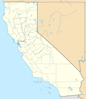
Koordinaten 34° 20′ N, 118° 36′ W34.329722222222-118.600555555561142Koordinaten: 34° 20′ N, 118° 36′ W

Die Santa Susana Mountains sind eine Gebirgskette in Südkalifornien in den Counties Los Angeles und Ventura. Die Gebirgskette verläuft von Ost nach West. Begrenzt werden sie im Süden durch das San Fernando Valley und durch das Simi Valley, im Süden durch das Santa Clara River Valley und im Nordosten durch das Santa Clarita Valley.

Klima

In den Bergen herrscht ein mildes bis feuchtes Klima.

Erhebungen

Der Oat Mountain ist mit 1142 m.ü.M. der höchste Punkt gefolgt vom Mission Point (845 m.ü.M.), Rocky Peak (827 m.ü.M.) und dem Sand Rock Point (765 m.ü.M.).


Wikimedia Foundation.

Игры ⚽ Поможем сделать НИР

Schlagen Sie auch in anderen Wörterbüchern nach:

  • Santa Susana Mountains — Geobox|Range name=Santa Susana Mountains image caption=Scrubland in Aliso Canyon country=United States state=California parent=Transverse Ranges border= San Gabriel Mountains|border1=Simi Hills region type = Counties region=Los Angeles… …   Wikipedia

  • Santa Monica Mountains — Geobox|Range name=Santa Monica Mountains image caption=Malibu Canyon in the Santa Monica Mountains country=United States state = California region type = Counties region= Los Angeles region1= Ventura region2= parent=Transverse Ranges border=Santa …   Wikipedia

  • Santa Ynez Mountains — The Santa Ynez Mountains are a portion of the Transverse Ranges, part of the Pacific Coast Ranges of the west coast of North America, and are one of the northernmost mountain ranges in Southern California. GeographyThey are principally in Santa… …   Wikipedia

  • Santa Susana — can refer to several places: * The Santa Susana Mountains in southern California * Santa Susana Pass, running through the abovementioned mountains * Santa Susana Field Laboratory, near Los Angeles, a test facility for rockets and (formerly)… …   Wikipedia

  • Santa Susana Pass State Historic Park — located in Los Angeles County where the Simi Hills meet the Santa Susana Mountains and is rich in natural, historical and cultural significance. Here in the western part of the Transverse Ranges, the land is dominated by high, narrow ridges and… …   Wikipedia

  • Santa Susana Field Laboratory — The Santa Susana Field Laboratory (SSFL) is a once prolific rocket and nuclear reactor test facility located convert|30|mi|km|0 north of downtown Los Angeles, California. SSFL continues to operate today, serving as a research facility for The… …   Wikipedia

  • Santa Susana Pass — Infobox Mountain Pass Name = Santa Susana Pass Photo = Caption = Elevation = Location = California, USA Range = Santa Susana Mountains/Simi Hills Coordinates = coord|34|15|53|N|118|37|58|W|type:pass Topographic Traversed by = State Route 118Santa …   Wikipedia

  • Santa Susana Field Laboratory — Das SRE Kernkraftwerk auf dem SSFL Gelände im Jahre 1958 Das Santa Susana Field Laboratory (SSFL) ist ein ehemals sehr bedeutendes Testzentrum für Raketen und Atomtechnologie der Vereinigten Staaten. Es liegt etwa 48 km nördlich von Zentrum Los… …   Deutsch Wikipedia

  • Santa Monica Mountains Conservancy — The Santa Monica Mountains Conservancy is an agency of the state of California in the United States founded in 1979 and dedicated to the acquisition of land in the Santa Susana and Santa Monica Mountains and the Simi Hills, north and west of Los… …   Wikipedia

  • Old Santa Susana Stage Road — U.S. National Register of Historic Places …   Wikipedia

Share the article and excerpts

Direct link
Do a right-click on the link above
and select “Copy Link”