- Seen-Route
-
Die Seen-Route (auch: Route des lacs) ist die nationale Fahrradroute 9 in der Schweiz. Sie beginnt in Montreux, verläuft über Thun, Luzern, Zug und Sargans nach Rorschach. Sie hat eine Länge von 497 km. In West-Ost-Richtung sind 3320 Höhenmeter zu bewältigen, in Gegenrichtung 3300 m.
Namensgebend sind die vielen grossen Seen entlang der Route:
- Genfersee
- Thunersee
- Brienzersee
- Lungerersee
- Sarnersee
- Alpnachersee
- Vierwaldstättersee
- Zugersee
- Ägerisee
- Sihlsee
- Zürichsee
- Walensee
- Bodensee
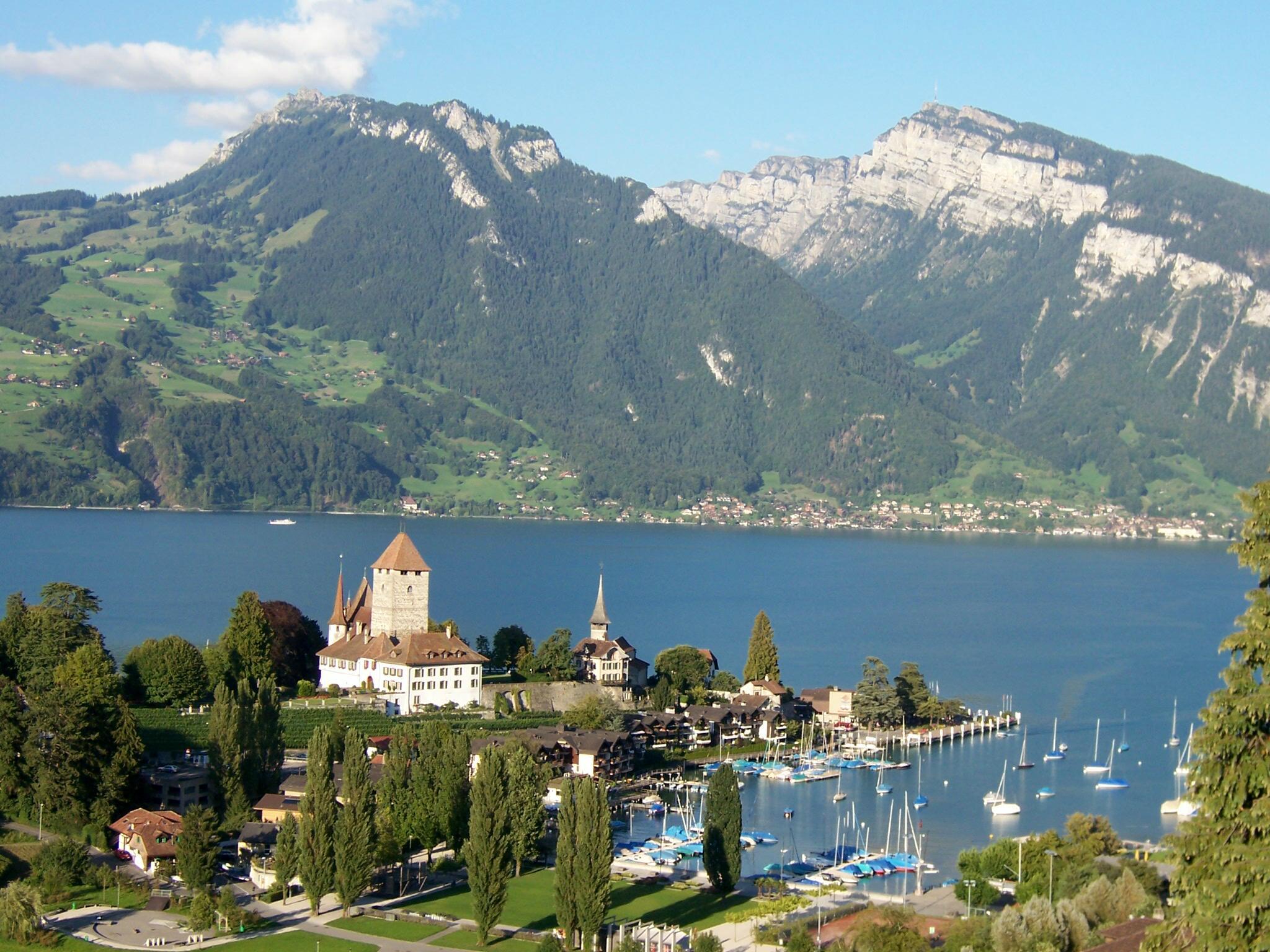
 Spiez am Thunersee
Die Route ist wie die anderen nationalen Fahrradrouten in der Schweiz mit roten Hinweisschildern gekennzeichnet.
Veloverlad
Durch einen sogenannten Veloverlad können Höhenmeter eingespart werden. Bei Benutzung der vorgeschlagenen Veloverlade sind es von West nach Ost nur 1430 Höhenmeter, in Gegenrichtung 1490m.
Siehe auch
Weblinks
- Thorsten Brönner: Blaue Wunder – per Velo durch die Schweiz, 4-Seasons-Magazin 17/08 (PDF-Datei; 2,1 MB)
- Seen-Route im Radreise-Wiki
Nationale Routen: 1 Rhone-Route | 2 Rhein-Route | 3 Nord-Süd-Route | 4 Alpenpanorama-Route | 5 Mittelland-Route | 6 Graubünden-Route | 7 Jura-Route | 8 Aare-Route | 9 Seen-Route
Wikimedia Foundation.
Schlagen Sie auch in anderen Wörterbüchern nach:
Route 177 (Rhode Island — Route 177 Route information Maintained by the Rhode Island Department of Transportation … Wikipedia
Route 158 (Prince Edward Island) — Route 158, officially named Harper Road, and sometimes referred to sectionally as Leoville Road (see below), is a 2 lane collector highway in western Prince County, Prince Edward Island, Canada. It is located 0 mdash;4 miles SW of the community… … Wikipedia
Route 11 (MTA Maryland) — Route 11 City Baltimore Operating Agency Maryland Transit Administration … Wikipedia
Route 33 (MTA Maryland) — Route 33 City Baltimore Operating Agency Maryland Transit Administration … Wikipedia
Route Trident — (known locally as the New or Big Road)[1] was built by the British Army s Royal Engineers in Helmand Province, Afghanistan. The construction of the road was codenamed Operation Lar Jarowel by the Ministry of Defence.[2] Route Trident replaced an… … Wikipedia
Route um Oldenburg — Gesamtlänge 100 km Lage Oldenburg (Oldenburg) … Deutsch Wikipedia
Route 66 (TV series) — infobox television show name = Route 66 caption = Tod and Buz take a ferry to trouble in the series premiere. format = Drama runtime = approx. 0:52 (per episode) creator = Stirling Silliphant starring = Martin Milner George Maharis (1960 1963)… … Wikipedia
Route 27 (MTA Maryland) — This article is about the MTA bus route. For the numbered road, see Maryland Route 27. Route 27 City Baltimore Operating Agency Maryland Transit Administration … Wikipedia
Rhone-Route — Veloroute 1 – Rhone Route Basisdaten Gesamtlänge 345 km ungeteert 26 km Höhenmeter Andermatt Genf 2300 m Höhenmeter Genf Andermatt 3400 m … Deutsch Wikipedia
Alpenpanorama-Route — Die Glarneralpen und der Zürichsee Die Alpenpanorama Route ist die nationale Fahrradroute 4 in der Schweiz. Sie beginnt in St. Margrethen, verläuft über St. Gallen, Stans, Sarnen, Thun und Freiburg nach Aigle. Sie hat eine Länge von 483 km.… … Deutsch Wikipedia
Seen-Route
18+
© Academic, 2000-2024
- Kontaktieren Sie uns: Unterstützung, Werbung
Wörterbücher Export, schritte mit PHP, Joomla, Drupal, WordPress, MODx.