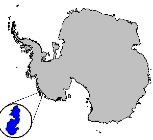
Siple Island — Infobox Islands name = Siple image caption = Location of Siple Island locator map custom = nickname = location = Antarctica coordinates = coord|73|39|S|125|12|W|display=inline archipelago = total islands = major islands = area =… … Wikipedia
Siple — * Siple Island, an island in Wrigley Gulf. * Mount Siple, a volcano in Siple Island. * Paul Siple, an American Antarctic explorer. * Siple Coast, a coast in Ross Ice Shelf. * Siple Station, an antarctic station, established in 1973 … Wikipedia
Siple-Insel — Vorlage:Infobox Insel/Wartung/Bild fehlt Siple Insel Gewässer Südlicher Ozean Geographische Lage … Deutsch Wikipedia
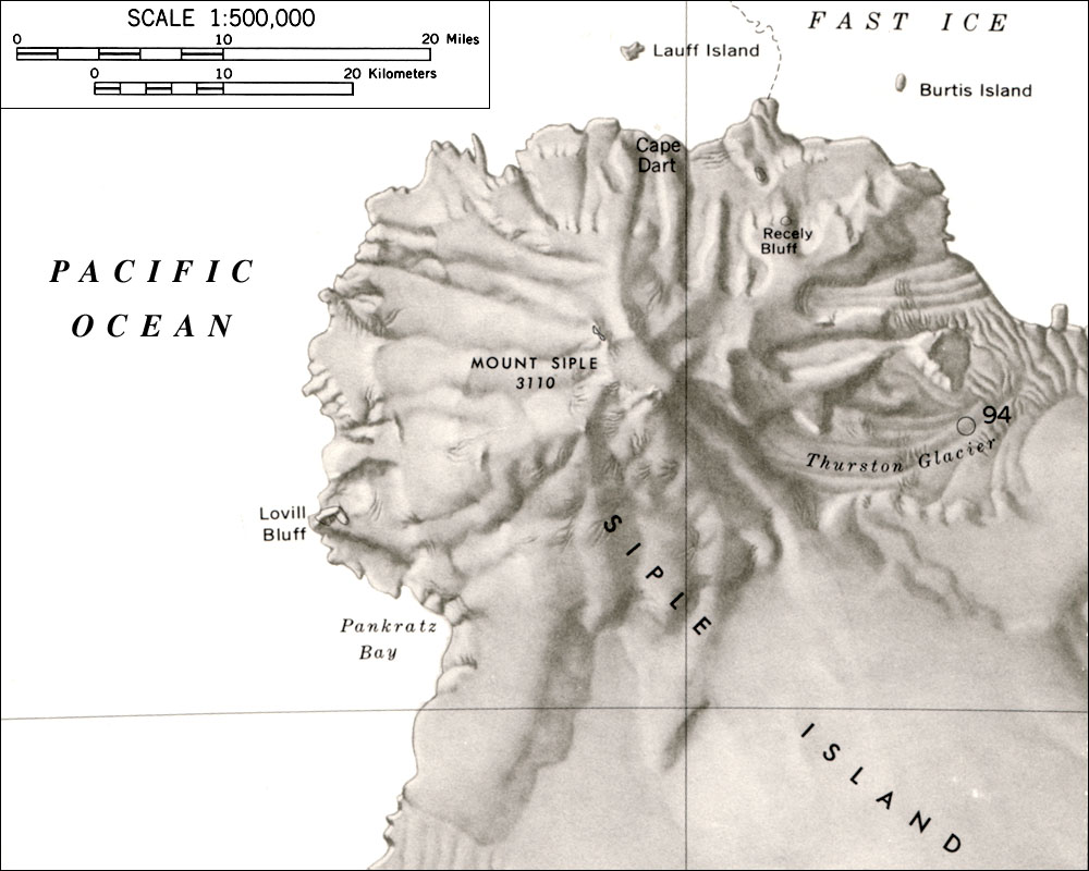
Mount Siple — Aerial view of Mount Siple from the west Elevation 3,110 m (10,203 ft) … Wikipedia
Paul Siple — Paul Allman Siple (December 18, 1908 ndash;November 25, 1968) was an American Antarctic explorer and geographer who took part in six Antarctic expeditions, including the two Byrd expeditions of 1928–1930 and 1933–1935, having first gone… … Wikipedia
Carney Island — Infobox Islands name = Carney image caption = Location of Carney Island locator map custom = nickname = location = Antarctica coordinates = coord|73|57|S|121|00|W|display=inline archipelago = total islands = major islands = area =… … Wikipedia
Maher Island — (72°58′S 126°22′W / 72.967°S 126.367°W / 72.967; 126.367) is a small horseshoe shaped island which has numerous areas of exposed rock, lying 7 nautical miles (13 km) north of the northwest end of … Wikipedia
Dean Island — is an ice covered island, 20 miles long and 10 miles wide, lying within the Getz Ice Shelf and midway between Grant Island and Siple Island, off the coast of Marie Byrd Land which is unclaimed territory in Antarctica. First sighted from a… … Wikipedia
Pranke Island — (coord|73|14|S|124|55|W|) is a small ice covered island lying close to Siple Island in the west extremity of Russell Bay, off the coast of Marie Byrd Land. Mapped by United States Geological Survey (USGS) from ground surveys and U.S. Navy air… … Wikipedia
List of Ultras of Antarctica — This is a list of all the Ultra prominent peaks (with topographic prominence greater than 1,500 metres) in Antarctica. Some islands in the South Atlantic have also been included and can be found at the end of the list. Antarctica Mount Erebus,… … Wikipedia
 Lage der Siple-Insel
 Mount Siple auf Siple Island