- Sitkalidak Island
-
Sitkalidak Island Gewässer Pazifischer Ozean Inselgruppe Kodiak-Archipel Geographische Lage 57° 8′ N, 153° 11′ W57.1269444-153.1794444500Koordinaten: 57° 8′ N, 153° 11′ W 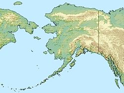

Länge 29 km Breite 24 km Fläche 300,84 km² Höchste Erhebung 500 m Einwohner (unbewohnt) Sitkalidak Island ist eine Insel des Kodiak-Archipels in Alaska in den Vereinigten Staaten. Sie liegt auf der südöstlichen Flanke von Kodiak Island. Die Sitkalidak Passage trennt Sitkalidak von Kodiak Island und der nahe liegenden Ortschaft Old Harbor. Die Insel ist 300,84 km² groß und unbewohnt.[1]
Einzelnachweise
- ↑ Sitkalidak Island: Block 1055, Census Tract 1, Kodiak Island Borough, Alaska United States Census Bureau
Weblinks
Schlagen Sie auch in anderen Wörterbüchern nach:
Sitkalidak Island — is an island the western Gulf of Alaska in the Kodiak Island Borough of the state of Alaska, USA. It lies just off the southeast shore of Kodiak Island, across the Sitkalidak Strait from the city of Old Harbor. The island has a land area of… … Wikipedia
Sitkalidak — Vorlage:Infobox Insel/Wartung/Bild fehlt Sitkalidak Island Gewässer Pazifischer Ozean Inselgruppe Kodiak Archipel Geographische Lage … Deutsch Wikipedia
Chirikof Island — Vorlage:Infobox Insel/Wartung/Bild fehlt Tschirikow Insel Gewässer Pazifischer Ozean Inselgruppe Kodiak Archipel Geographische Lage … Deutsch Wikipedia
Kodiak Island — Vorlage:Infobox Insel/Wartung/Bild fehlt Kodiak Island Gewässer Pazifischer Ozean Inselgruppe Kodiak Archipel Geographische Lage … Deutsch Wikipedia
Sitkinak Island — Trinity Islands Gewässer Pazifischer Ozean Archipel Kodiak Archipel Anzahl der Inseln 3 Hauptinsel Tugidak Island und Sitkinak Island Gesamtfläche 408,65 km² … Deutsch Wikipedia
Tschirikow Island — Vorlage:Infobox Insel/Wartung/Bild fehlt Tschirikow Insel Gewässer Pazifischer Ozean Inselgruppe Kodiak Archipel Geographische Lage … Deutsch Wikipedia
Tugidak Island — Trinity Islands Gewässer Pazifischer Ozean Archipel Kodiak Archipel Anzahl der Inseln 3 Hauptinsel Tugidak Island und Sitkinak Island Gesamtfläche 408,65 km² … Deutsch Wikipedia
Kodiak Island Borough, Alaska — Infobox U.S. County county = Kodiak Island Borough state = Alaska founded = seat wl = Kodiak | area total sq mi =12024 area water sq mi =5464 area land sq mi =6560 area percentage = 45.44% census yr = 2000 pop = 13913 density km2 =1 web =… … Wikipedia
Raspberry Island (Alaska) — Vorlage:Infobox Insel/Wartung/Bild fehltVorlage:Infobox Insel/Wartung/Höhe fehlt Raspberry Island Gewässer Pazifischer Ozean Inselgruppe Kodiak Archipel Geographische Lage … Deutsch Wikipedia
Woody Island (Alaska) — Vorlage:Infobox Insel/Wartung/Bild fehlt Woody Island Gewässer Pazifischer Ozean Inselgruppe Kodiak Archipel Geographische Lage … Deutsch Wikipedia
Sitkalidak Island

18+
© Academic, 2000-2024
- Kontaktieren Sie uns: Unterstützung, Werbung
Wörterbücher Export, schritte mit PHP, Joomla, Drupal, WordPress, MODx.