- Bagulin
-
Municipality of Bagulin Lage von Bagulin in der Provinz La Union 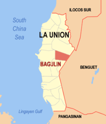
Basisdaten Bezirk: Ilocos-Region Provinz: La Union Barangays: 10 Distrikt: 2. Distrikt von La Union PSGC: 013304000 Einkommensklasse: 5. Einkommensklasse Haushalte: 2171 Zensus 1. Mai 2000Einwohnerzahl: 12.521 Zensus 1. August 2007Koordinaten: 16° 36′ N, 120° 26′ O16.608333333333120.43944444444Koordinaten: 16° 36′ N, 120° 26′ O Postleitzahl: 2512 Bürgermeister: Salcedo A. Tumbaga Offizielle Webpräsenz: www.bagulin.gov.ph Geographische Lage auf den Philippinen 

Bagulin Bagulin ist eine Stadtgemeinde in der philippinischen Provinz La Union. Das Gebiet ist bergig und stark bewaldet. Im Jahre 2000 zählte Bagulin 11.857 Einwohner und 2.171 Haushalte.
Bagulin ist in folgende zehn Baranggays aufgeteilt:
- Alibangsay
- Baay
- Cambaly
- Cardiz
- Dagup
- Libbo
- Suyo
- Tagudtud
- Tio-angan
- Wallayan
Schlagen Sie auch in anderen Wörterbüchern nach:
Bagulin — Original name in latin Bagulin Name in other language Bagulin, Cambaly State code PH Continent/City Asia/Manila longitude 16.60833 latitude 120.43944 altitude 67 Population 2083 Date 2011 07 31 … Cities with a population over 1000 database
Bagulin, La Union — Infobox Philippine municipality infoboxtitle = Bagulin sealfile = Ph seal la union bagulin.jpg locatormapfile = Ph locator la union bagulin.png caption = Map of La Union showing the location of Bagulin region = Ilocos Region (Region I) province … Wikipedia
Naguilian, La Union — Naguilian Municipality Seal … Wikipedia
PH-LUN — Lage der Provinz La Union ist eine philippinische Provinz in dem Bezirk Ilocos auf der Hauptinsel Luzón. Die Provinzhauptstadt ist San Fernando. An La Union grenzen auch andere Provinzen, wie Ilocos Sur im Norden, Benguet im Osten und Pangasinán… … Deutsch Wikipedia
San Fernando (Philippinen) — City of San Fernando Lage von San Fernando in der Provinz La Union Basisdaten Bezirk: Ilocos Region … Deutsch Wikipedia
La Union — La Union, without an accented o, refers to a province in the Philippines. For places in Latin America and Spain, see La Unión. Infobox Philippine province name = La Union sealfile = Ph seal la union.png region = Ilocos Region (Region I) capital … Wikipedia
San Juan, La Union — Infobox Philippine municipality infoboxtitle = Municipality of San Juan sealfile = Ph seal la union san juan.jpg| locatormapfile = Ph locator la union san juan.png caption = Map of La Union showing the location of San Juan region = Region I… … Wikipedia
List of cities and municipalities in the Philippines — This is a list of cities and municipalities in the Philippines arranged by province and in alphabetical order. As of 2006, there are 118 cities and 1509 municipalities.As of September 4, 2007, there are 136 cities, 1,495 municipalities, 81… … Wikipedia
List of ZIP Codes in the Philippines — In the Philippines, the Philippine ZIP code is used by the Philippine Postal Corporation (Philpost) to simplify the distribution of mail. While in function it is similar to the ZIP code used in the United States, its form and its usage is quite… … Wikipedia
Legislative districts of La Union — Philippines This article is part of the series: Politics and government of the Philippines … Wikipedia
Bagulin


18+
© Academic, 2000-2024
- Kontaktieren Sie uns: Unterstützung, Werbung
Wörterbücher Export, schritte mit PHP, Joomla, Drupal, WordPress, MODx.