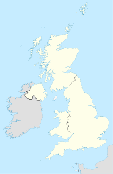
Spilsby

Spilsby
53.17270.093099999999993
Spilsby (Vereinigtes Königreich)
Spilsby
Spilsby

Spilsby ist eine Kleinstadt mit 2.236 Einwohnern (Zählung im Jahr 2001) in Lincolnshire im mittleren Osten (East Midlands) von England.

Inhaltsverzeichnis

Geografie

Lage

Spilsby liegt am südlichen Rand der Lincolnshire Wolds und ist 25 km von der östlich gelegenen Nordsee entfernt. Es liegt 21 km nordwestlich von Skegness, 27 km nordöstlich von Boston und 53 Kilometer östlich der Kreisstadt Lincoln.

Die Umgebung von Spilsby ist im Norden gekennzeichnet durch eine sanft hügelige englische "Bilderbuchlandschaft", die Wolds; im Osten durch eine sich zur Nordsee erstreckende Marschlandschaft; im Süden durch eine Geestlandschaft mit intensivem Ackerbau und im Westen durch satte Weiden.

Verkehr

Spilsby befindet sich direkt neben der Hauptverkehrsstraße 16, die in Nord-Süd-Richtung von Grimsby nach Boston verläuft. Der Ort befindet sich unweit der Hauptstraße 158, die von Lincoln nach Skegness führt.

Partnerstädte

Söhne und Töchter der Stadt

Weblinks

 Commons: Spilsby – Sammlung von Bildern, Videos und Audiodateien

Wikimedia Foundation.

Игры ⚽ Нужен реферат?

Schlagen Sie auch in anderen Wörterbüchern nach:

  • Spilsby — Infobox UK place official name= Spilsby country= England region= East Midlands population= 2,336 (Parish) os grid reference= TF4066 latitude= 53.17270 longitude= 0.09310 post town= SPILSBY postcode area= PE postcode district= PE23 dial code=… …   Wikipedia

  • Spilsby — 53° 10′ 22″ N 0° 05′ 35″ E / 53.1727, 0.0931 …   Wikipédia en Français

  • Spilsby — Original name in latin Spilsby Name in other language State code GB Continent/City Europe/London longitude 53.17363 latitude 0.09373 altitude 50 Population 2807 Date 2010 05 24 …   Cities with a population over 1000 database

  • Spilsby railway station — Infobox UK disused station name = Spilsby gridref = TF677334 caption = Spilsby railway station c.1890. owner = Great Northern Railway Eastern Region of British Railways locale = Spilsby borough = East Lindsey, Lincolnshire platforms = 2 years = 1 …   Wikipedia

  • Spilsby Rural District — infobox historic subdivision Name= Spilsby HQ= Spilsby Status= Rural district Start= 1894 End= 1974 Replace= East Lindsey PopulationFirst= 20,506 PopulationLast= 22,459 PopulationFirstYear= 1901 PopulationLastYear= 1971 AreaFirst=… …   Wikipedia

  • RAF Spilsby — Infobox Airport name = RAF Spilsby nativename = nativename a = nativename r = image width = caption = A memorial in All Saints Church, Great Steeping to the members of 44 Squadron who flew from Spilsby type = Decommissioned and closed in the… …   Wikipedia

  • Asgarby, Spilsby — infobox UK place country = England static static image caption= latitude= 53.17 longitude= 00.01 official name =Asgarby population = shire district= shire county= Lincolnshire metropolitan borough= metropolitan county = region=East Midlands… …   Wikipedia

  • Firsby — Infobox UK place official name= Firsby country= England region= East Midlands population= 276 os grid reference= latitude= 53.149 longitude= 00.182 map type= Lincolnshire post town= SKEGNESS postcode area= PE postcode district= PE24 dial code=… …   Wikipedia

  • Keal Cotes — Infobox UK place official name= Keal Cotes country= England region= East Midlands population= Approx 100 os grid reference= TF365611 latitude= 53.125 longitude= 00.038 map type= Lincolnshire post town= SPILSBY postcode area= PE postcode district …   Wikipedia

  • Telephone numbers in the United Kingdom — +44 redirects here. For the band, see +44 (band). United Kingdom telephone numbers Location of United Kingdom (dark green) Location Country United Kingdom Continent …   Wikipedia

Share the article and excerpts

Direct link
Do a right-click on the link above
and select “Copy Link”