- Sumter County (South Carolina)
-
Verwaltung US-Bundesstaat: South Carolina Verwaltungssitz: Sumter Adresse des
Verwaltungssitzes:County Courthouse
13 East Canal Street
Sumter, SC 29150-4925Gründung: 1798 Vorwahl: 001 803 Demographie Einwohner: 105.517 (2005) Bevölkerungsdichte: 61,2 Einwohner/km² Geographie Fläche gesamt: 1.766 km² Wasserfläche: 43 km² Karte 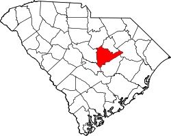
Website: www.sumtercountysc.org Sumter County[1] ist ein County im Bundesstaat South Carolina der Vereinigten Staaten von Amerika. Der Verwaltungssitz (County Seat) ist Sumter.
Inhaltsverzeichnis
Geografie
Das County liegt nordöstlich des geographischen Zentrums von South Carolina und hat eine Fläche von 1766 Quadratkilometern, wovon 43 Quadratkilometer Wasserfläche sind. Es grenzt im Uhrzeigersinn an folgende Countys: Lee County, Florence County, Clarendon County, Calhoun County, Richland County und Kershaw County.
Geschichte
Sumter County wurde 1798 gebildet. Benannt wurde es nach Thomas Sumter, einem General der USA im US-amerikanischen Unabhängigkeitskrieg und ein langjähriges Mitglied des US-Kongresses.
Demografische Daten
Historische Einwohnerzahlen Census Einwohner ± in % 1790 6940 — 1800 13.103 90 % 1810 19.054 50 % 1820 25.369 30 % 1830 28.277 10 % 1840 27.892 -1 % 1850 33.220 20 % 1860 23.859 -30 % 1870 25.208 6 % 1880 37.037 50 % 1890 43.605 20 % 1900 51.237 20 % 1910 38.472 -20 % 1920 43.040 10 % 1930 45.902 7 % 1940 52.463 10 % 1950 57.634 10 % 1960 74.941 30 % 1970 79.425 6 % 1980 88.243 10 % 1990 102.637 20 % 2000 104.646 2 % Vor 1900[2] Nach der Volkszählung im Jahr 2000 lebten im Sumter County 104.646 Menschen in 37.728 Haushalten und 27.616 Familien. Die Bevölkerungsdichte betrug 61 Einwohner pro Quadratkilometer. Ethnisch betrachtet setzte sich die Bevölkerung zusammen aus 70,13 Prozent Weißen, 26,68 Prozent Afroamerikanern, 0,27 Prozent amerikanischen Ureinwohnern, 0,90 Prozent Asiaten, 0,06 Prozent Bewohnern aus dem pazifischen Inselraum und 0,80 Prozent aus anderen ethnischen Gruppen; 1,16 Prozent stammten von zwei oder mehr Ethnien ab. 1,83 Prozent der Bevölkerung waren spanischer oder lateinamerikanischer Abstammung.
Von den 37.728 Haushalten hatten 36,5 Prozent Kinder unter 18 Jahre, die bei ihnen lebten. 50,2 Prozent waren verheiratete, zusammenlebende Paare, 18,3 Prozent waren allein erziehende Mütter, 26,8 Prozent waren keine Familien, 23,2 Prozent waren Singlehaushalte und in 8,5 Prozent lebten Menschen mit 65 Jahren oder darüber. Die Durchschnittshaushaltsgröße betrug 2,68 und die durchschnittliche Familiengröße betrug 3,17 Personen.
28,1 Prozent der Bevölkerung war unter 18 Jahre alt. 10,5 Prozent zwischen 18 und 24, 29,4 Prozent zwischen 25 und 44, 20,7 Prozent zwischen 45 und 64 und 11,2 Prozent waren 65 Jahre alt oder älter. Das Durchschnittsalter betrug 33 Jahre. Auf 100 weibliche Personen kamen 93,9 männliche Personen und auf 100 Frauen im Alter von 18 Jahren und darüber kamen 90,2 Männer.
Das jährliche Durchschnittseinkommen eines Haushalts betrug 33.278 USD, das Durchschnittseinkommen einer Familie betrug 38.970 USD. Männer hatten ein Durchschnittseinkommen von 28.083 USD, Frauen 21.162 USD. Das Prokopfeinkommen betrug 15.657 USD. 13,1 Prozent der Familien und 16,2 Prozent der Bevölkerung lebten unterhalb der Armutsgrenze. [5]
Siehe auch
Einzelnachweise
- ↑ Sumter County im Geographic Names Information System des United States Geological Survey. Abgerufen am 22. Februar 2011
- ↑ U.S. Census Bureau - Census of Population and Housing. Abgerufen am 15. März 2011
- ↑ Auszug aus Census.gov. Abgerufen am 28. Februar 2011
- ↑ Auszug aus factfinder.census.gov Abgerufen am 28. Februar 2011
- ↑ Sumter County, South Carolina, Datenblatt mit den Ergebnissen der Volkszählung im Jahre 2000 bei factfinder.census.gov.

Liste der Countys in South Carolina
Abbeville | Aiken | Allendale | Anderson | Bamberg | Barnwell | Beaufort | Berkeley | Calhoun | Charleston | Cherokee | Chester | Chesterfield | Clarendon | Colleton | Darlington | Dillon | Dorchester | Edgefield | Fairfield | Florence | Georgetown | Greenville | Greenwood | Hampton | Horry | Jasper | Kershaw | Lancaster | Laurens | Lee | Lexington | Marion | Marlboro | McCormick | Newberry | Oconee | Orangeburg | Pickens | Richland | Saluda | Spartanburg | Sumter | Union | Williamsburg | York
Wikimedia Foundation.
Schlagen Sie auch in anderen Wörterbüchern nach:
Sumter County, South Carolina — Infobox U.S. County county = Sumter County state = South Carolina map size = 200 founded = 1798 seat = Sumter | area total sq mi =682 area land sq mi =665 area water sq mi =17 area percentage = 2.44% census yr = 2000 pop = 104646 density km2 =61… … Wikipedia
National Register of Historic Places listings in Sumter County, South Carolina — Location of Sumter County in South Carolina This is a list of the National Register of Historic Places listings in Sumter County, South Carolina. This is intended to be a complete list of the properties and districts on the National Register of… … Wikipedia
List of Registered Historic Places in Sumter County, South Carolina — List of Registered Historic Places in Sumter County, South Carolina::This list has been transferred fromo List of Registered Historic Places in South Carolina =Sumter County= References … Wikipedia
Shiloh, Sumter County, South Carolina — Shiloh is a town in Sumter County, South Carolina, United States. The population was 259 at the 2000 census. It is included in the Sumter, South Carolina Metropolitan Statistical Area.GeographyShiloh is located at coor… … Wikipedia
Clarendon County, South Carolina — Location in the state of South Carolina … Wikipedia
Richland County, South Carolina — Infobox U.S. County county = Richland County state = South Carolina map size = 225 founded = 1785 seat = Columbia | largest city = Columbia area total sq mi =772 area land sq mi =756 area water sq mi =15 area percentage = 1.98% census yr = 2000… … Wikipedia
Kershaw County, South Carolina — Infobox U.S. County county = Kershaw County state = South Carolina map size = 200 founded = 1801 seat = Camden | area total sq mi =740 area land sq mi =726 area water sq mi =14 area percentage = 1.89% census yr = 2000 pop = 52647 density km2 =28… … Wikipedia
Florence County, South Carolina — Infobox U.S. County county = Florence County state = South Carolina map size = 200 founded = 1888 seat = Florence | area total sq mi =804 area land sq mi =800 area water sq mi =4 area percentage = 0.49% census est = 2005 pop = 131097 density km2 … Wikipedia
Calhoun County, South Carolina — Infobox U.S. County county = Calhoun County state = South Carolina map size = 200 founded = 1908 seat = St. Matthews | area total sq mi =392 area land sq mi =380 area water sq mi =12 area percentage = 3.09% census yr = 2000 pop = 15185 density… … Wikipedia
Lee County, South Carolina — Infobox U.S. County county = Lee County state = South Carolina map size = 200 founded = 1902 seat = Bishopville | area total sq mi =411 area land sq mi =410 area water sq mi =1 area percentage = 0.24% census yr = 2000 pop = 20119 density km2 =19… … Wikipedia
Sumter County (South Carolina)

18+
© Academic, 2000-2024
- Kontaktieren Sie uns: Unterstützung, Werbung
Wörterbücher Export, schritte mit PHP, Joomla, Drupal, WordPress, MODx.