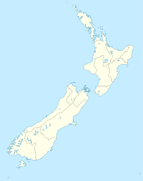
Tapanui

Tapanui
Tapanui
Tapanui (Neuseeland)
Tapanui
Koordinaten 45° 57′ S, 169° 16′ O-45.943169.261Koordinaten: 45° 57′ S, 169° 16′ O
Einwohner 846 (2001)
Region Otago
Distrikt Clutha-Distrikt


Tapanui ist der größte Ort des lokal als West Otago bekannten Teils der Region Otago auf der Südinsel Neuseelands. Er liegt nahe der Grenze zur Region Southland am State Highway 90. Als von der Land- und Forstwirtschaft sowie der Fischerei [1] geprägter Ort liegt er am Fuß der Blue Mountains und am Pomahaka River. Die Hirschjagd und das Angeln von Forellen sind in der Gegend beliebte Freizeitbeschäftigungen. Beim Zensus 2001 hatte Tapanui 846 Einwohner, ein Rückgang um 4,4 % seit 1996.[2]

Für fast 100 Jahre war der Ort durch den Tapanui Branch, einen Abzweig der Main South Line, an das neuseeländische Eisenbahnnetz angeschlossen. Trotz des Namens endete er allerdings nicht in Tapanui, sondern reichte seit dem 1. Dezember 1880 bis Kelso und ab dem 1. April 1884 bis Heriot. Die Linie wurde in Folge von Schäden durch eine schwere Flut des Pomahaka River im Oktober 1978 aufgegeben.

In Neuseeland wird Tapanui mit dem Chronic fatigue syndrome verbunden, das anfangs als "Tapanui 'flu" (Tapanui-Grippe) bekannt wurde. Der Arzt Peter Snow, der den Anstieg dieser Erkrankung in Neuseeland erstmals dokumentierte, wohnte in Tapanui. [3] [4] [5]

Der nahegelegene Landslip Hill ist ein in Neuseeland bekannter Fossilienfundort.

Quellen

  1. [1] Statistics New Zealand] abgerufen 1. Mai 2009
  2. Statistics New Zealand, abgerufen 1. Mai 2009
  3. Peter Snow (December 2002): Reminiscences of the chronic fatigue syndrome (PDF). Royal New Zealand College of General Practitioners. Abgerufen am 24. Juli 2006.
  4. Royal New Zealand College of General Practitioners: New Zealand loses a fine GP. www.scoop.co.nz. Abgerufen am 24. Juli 2006.
  5. RNZCGP Annual Report, with elegy on page 37 (pdf). Royal New Zealand College of General Practitioners. Abgerufen am 24. Juli 2006.

Wikimedia Foundation.

Игры ⚽ Поможем написать курсовую

Schlagen Sie auch in anderen Wörterbüchern nach:

  • Tapanui — The picturesque town of Tapanui lies in West Otago in New Zealand s South Island, close to the boundary with Southland region. A forestry town, it lies between the foot of the Blue Mountains and the Pomahaka River. Deer stalking and trout fishing …   Wikipedia

  • Tapanui Branch — The Tapanui Branch was a railway line located near the border of the regions of Southland and Otago, New Zealand. Although the name suggests that it terminated in Tapanui, its furthest terminus was actually in Edievale. Construction of the line… …   Wikipedia

  • Peter Snow (doctor) — Dr Peter Snow (died March 1 2006) was a general practitioner who served the New Zealand rural community of Tapanui for over 30 years. He was president of the Royal New Zealand College of GPs from 1998 99, and received their highest honour,… …   Wikipedia

  • Landslip Hill — Landslip Hill, near Tapanui, in Southland, in the South Island of New Zealand is a debris flow feature associated with the Manuherikia Group of fluvial quartz sandstones. Geologists have described the fossil bearing rocks as forming part of a… …   Wikipedia

  • Main South Line — This article is about the railway in New Zealand. For the railway in NSW, Australia, see Main Southern railway line, New South Wales. Main South Line Main South Line and shunting yards at Dunedin. Ov …   Wikipedia

  • Kelso, New Zealand — Kelso was a small settlement in Otago, New Zealand, located ten kilometres north of Tapanui on the Kelso River, close to its junction with the larger Pomahaka River. Its population during the 1960s and 1970s was close to 300, with most of its… …   Wikipedia

  • Blue Mountains (Neuseeland) — Die Blue Mountains sind ein kleines, bis etwa 1000 m hohes Gebirge in der Region Otago auf der Südinsel Neuseelands. Es trennt den westlich des Gebirges gelegenen, als West Otago bekannten Landstrich von Süd Otago ab. Das Gebirge verläuft vom… …   Deutsch Wikipedia

  • Kelso (Neuseeland) — Kelso …   Deutsch Wikipedia

  • Pomahaka River — Pomahaka RiverVorlage:Infobox Fluss/GKZ fehlt Lage South Otago, Südinsel, Neuseeland Flusssystem Clutha River Abfluss über Clutha River …   Deutsch Wikipedia

  • Pomahaka River — The Pomahaka River is located in South Otago in New Zealand s South Island. It is a tributary of the Clutha River, flowing south for 80 kilometres from the Old Man Range of mountains to join the Clutha just north of Balclutha. Along its path it… …   Wikipedia

Share the article and excerpts

Direct link
Do a right-click on the link above
and select “Copy Link”