- Ugamak Island
-
Ugamak Island Gewässer Pazifischer Ozean Inselgruppe Aleuten Geographische Lage 54° 12′ 44″ N, 164° 49′ 15″ W54.2122222-164.8208333172Koordinaten: 54° 12′ 44″ N, 164° 49′ 15″ W 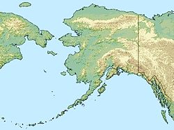

Länge 8 km Höchste Erhebung 172 m Einwohner (unbewohnt) Ugamak Island ist eine Insel der Krenitzin Islands, einer Untergruppe der Inselgruppe der Fox Islands in den östlichen Aleuten, Alaska. Die Insel ist über 8 km lang und liegt etwa 60 km östlich von Akutan Island. Die Ugamak Straße trennt Ugamak von Kaligagan Island im Westen. Im Süden der Insel liegt Aiktak Island und die kleine Seelöwen-Insel Round Island.
Ugamak ist ein Aleuten-Name, überliefert von Innokenti Weniaminow 1840, welches nach R. H. Geoghegan „Zeremonie-Insel“ bedeutet.
Weblinks
- Karte der Insel (PDF-Datei; 259 kB)
- Ugamak Island im Geographic Names Information System des United States Geological Survey
Schlagen Sie auch in anderen Wörterbüchern nach:
Ugamak Island — Location map Alaska label= lat=54.246667 long= 164.8075 position=right width=250 float=right caption=Location in AlaskaUgamak Island (Ugangax̂ [Bergsland, K Aleut Dictionary Fairbanks: Alaska Native Language Center, 1994] in Aleut) is one of the… … Wikipedia
Aiktak Island — Vorlage:Infobox Insel/Wartung/Fläche fehlt Aiktak Island Aiktak Island Gewässer Pazifischer Ozean … Deutsch Wikipedia
Round Island (Krenitzin Islands) — Vorlage:Infobox Insel/Wartung/Bild fehltVorlage:Infobox Insel/Wartung/Fläche fehlt Round Island (Krenitzin Islands) Gewässer Pazifischer Ozean Inselgruppe Aleuten Geographische Lage … Deutsch Wikipedia
Round Island (Aleutian Islands) — Round Island (Imlichin [Bergsland, K Aleut Dictionary Fairbanks: Alaska Native Language Center, 1994] in Aleut) is a 0.1 mile wide (160 m) island in the Krenitzin Islands, a subgroup of the Fox Islands group of the Aleutian Islands in the U.S.… … Wikipedia
Nunivak Island — Nunivak Maskette – Nunivak … Wikipedia
Medny Island — Map showing position of Commander Islands to the east of Kamchatka. The smaller island in the east is Medny and the larger island is Bering Island. Medny Island (also spelled Mednyy, Russian: остров Медный, sometimes called Copper Island in… … Wikipedia
Unalaska Island — Unalaska Native name: Nawan Alaxsxa[1] Map of the island … Wikipedia
Nelson Island (Alaska) — Nelson Native name: Qaluyaaq … Wikipedia
Chagulak Island — Location in Alaska … Wikipedia
Avatanak Island — Vorlage:Infobox Insel/Wartung/Bild fehltVorlage:Infobox Insel/Wartung/Fläche fehlt Avatanak Island Gewässer Pazifischer Ozean Inselgruppe Aleuten Geographische Lage … Deutsch Wikipedia
Ugamak Island

18+
© Academic, 2000-2024
- Kontaktieren Sie uns: Unterstützung, Werbung
Wörterbücher Export, schritte mit PHP, Joomla, Drupal, WordPress, MODx.