- Bayfield County
-
Verwaltung US-Bundesstaat: Wisconsin Verwaltungssitz: Washburn Gründung: 1835 Demographie Einwohner: 15.014 (2010) Bevölkerungsdichte: 3,9 Einwohner/km² Geographie Fläche gesamt: 5.288 km² Wasserfläche: 1.464 km² Karte 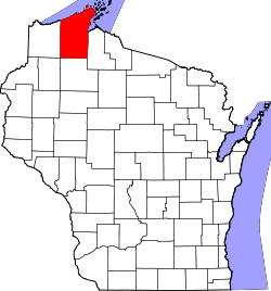
Website: www.bayfieldcounty.org Bayfield County[1] ist ein County, das in Wisconsin liegt. Bei der Volkszählung im Jahr 2010 hatte das County 15.014 Einwohner und eine Bevölkerungsdichte von 3,9 Einwohnern pro Quadratkilometer. Der Sitz der Verwaltung (County Seat) ist Washburn.
Inhaltsverzeichnis
Geografische Lage
Das County hat eine Gesamtfläche von 5.288 Quadratkilometern, die sich auf 3.823 Quadratkilometer Land- und 1.464 Quadratkilometer (27,69 Prozent) Wasserfläche verteilen. Die benachbarten Countys sind:
Douglas County 
Ashland County Sawyer County Washburn County Demografische Daten
Historische Einwohnerzahlen Census Einwohner ± in % 1900 14.392 — 1910 15.987 10 % 1920 17.201 8 % 1930 15.006 -10 % 1940 15.827 5 % 1950 13.760 -10 % 1960 11.910 -10 % 1970 11.683 -2 % 1980 13.822 20 % 1990 14.008 1 % 2000 15.013 7 % 2010 15.014 0,007 % 1900–1990[2] 2010[3]  Bevölkerungspyramide (2000) des Bayfield County
Nach der Volkszählung von 2000 lebten im Bayfield County 15.013 Einwohner; es gab 6.207 Haushalte und 4.276 Familien.[4] Die Bevölkerungsdichte betrug 4 pro Quadratkilometer. Es wurden 11.640 Wohneinheiten erfasst. Ethnisch betrachtet setzte sich die Bevölkerung zusammen aus 88,46 Prozent Weißen, 0,13 Prozent Afroamerikanern, 9,39 Prozent Indianern, 0,27 Prozent Asiaten, 0,01 Prozent Pazifischen Inselbewohnern und 0,26 Prozent aus anderen Ethnien; 1,49 Prozent stammten von zwei oder mehr Ethnien ab. 0,61 Prozent der Bevölkerung waren spanischer oder lateinamerikanischer Abstammung, die verschiedenen der genannten Gruppen angehörten.
Es gibt 289 Haushalte, von denen in 28,9 Prozent Kinder unter 18 Jahren leben, 55,9 Prozent sind Verheiratete, die zusammenleben, 7,8 Prozent haben eine Frau ohne Ehemann als Haushaltsvorstand und 31,1 Prozent sind Nichtfamilien. 26,4 Prozent aller Haushalte bestehen aus jungen Singles und 11,5 Prozent sind Alleinlebende die 65 Jahre oder älter sind. Die durchschnittliche Haushaltsgröße lag bei 2,40 Personen, die durchschnittliche Familiengröße bei 2,64.
In der Stadt ist die Altersverteilung folgendermaßen: 24,6 Prozent ist unter 18 Jahren, 5,3 Prozent 18 bis 24, 25,2 Prozent 25 bis 44, 28,5 Prozent 45 bis 64, und 16,4 Prozent sind 65 Jahre oder älter. Das Durchschnittsalter ist 42 Jahre. Auf 100 Frauen kommen 102,2 Männer. Auf 100 Frauen über 18 Jahren kommen 100,7 Männer.
Städte und Gemeinden
- Mason
- Cornucopia
1 - teilweise im Ashland County
Einzelnachweise
- ↑ Bayfield County im Geographic Names Information System des United States Geological Survey. Abgerufen am 22. Februar 2011
- ↑ Auszug aus Census.gov. Abgerufen am 28. Februar 2011
- ↑ United States Census 2010 Abgerufen am 15. März 2011
- ↑ Daten der Volkszählung 2000 des U.S. Census Bureaus, abgerufen am 12. August 2010
Weblinks
 Commons: Bayfield County, Wisconsin – Sammlung von Bildern, Videos und Audiodateien
Liste der Countys in Wisconsin
Adams | Ashland | Barron | Bayfield | Brown | Buffalo | Burnett | Calumet | Chippewa | Clark | Columbia | Crawford | Dane | Dodge | Door | Douglas | Dunn | Eau Claire | Florence | Fond du Lac | Forest | Grant | Green | Green Lake | Iowa | Iron | Jackson | Jefferson | Juneau | Kenosha | Kewaunee | La Crosse | Lafayette | Langlade | Lincoln | Manitowoc | Marathon | Marinette | Marquette | Menominee | Milwaukee | Monroe | Oconto | Oneida | Outagamie | Ozaukee | Pepin | Pierce | Polk | Portage | Price | Racine | Richland | Rock | Rusk | Sauk | Sawyer | Shawano | Sheboygan | St. Croix | Taylor | Trempealeau | Vernon | Vilas | Walworth | Washburn | Washington | Waukesha | Waupaca | Waushara | Winnebago | Wood
Wikimedia Foundation.
Schlagen Sie auch in anderen Wörterbüchern nach:
Bayfield County — Admin ASC 2 Code Orig. name Bayfield County Country and Admin Code US.WI.007 US … World countries Adminstrative division ASC I-II
Bayfield County, Wisconsin — Infobox U.S. County county = Bayfield County state = Wisconsin founded year = 1845 founded date = seat wl = Washburn largest city wl = Washburn area total sq mi = 2042 area total km2 = 5288 area land sq mi = 1476 area land km2 = 3823 area water… … Wikipedia
National Register of Historic Places listings in Bayfield County, Wisconsin — Buildings, sites, districts, and objects in Bayfield County listed on the National Register of Historic Places See also: National Register of Historic Places listings in Wisconsin This National Park Service list is complete through NPS recent… … Wikipedia
Washburn, Bayfield County, Wisconsin — There is another Town of Washburn in Clark County. Infobox Settlement official name = Washburn, Wisconsin settlement type = Town nickname = motto = imagesize = image caption = image mapsize = map caption = mapsize1 = map caption1 = subdivision… … Wikipedia
Lincoln, Bayfield County, Wisconsin — Infobox Settlement official name = Lincoln, Wisconsin settlement type = Town nickname = motto = imagesize = image caption = image mapsize = 250px map caption = Location of Lincoln, Wisconsin mapsize1 = map caption1 = subdivision type = Country… … Wikipedia
Russell, Bayfield County, Wisconsin — Infobox Settlement official name = Russell, Wisconsin settlement type = Town nickname = motto = imagesize = image caption = image mapsize = map caption = mapsize1 = map caption1 = subdivision type = Country subdivision name = United States… … Wikipedia
Bayfield (Wisconsin) — Bayfield Hafen von Bayfield Lage in Wisconsin … Deutsch Wikipedia
Bayfield, Wisconsin — Bayfield is a city in Bayfield County, Wisconsin, United States. The population was 611 at the 2000 census.Wisconsin Highway 13 serves as a main arterial route in the community. It is a former county seat, lumbering town and commercial fishing… … Wikipedia
Bayfield — ist der Name mehrerer Orte in: den Vereinigten Staaten: Bayfield (Colorado) Bayfield (Indiana) Bayfield (Wisconsin) Kanada: Bayfield (Ontario) Bayfield (New Brunswick) Bayfield (Nova Scotia) Außerdem ist es der Name eines County in den… … Deutsch Wikipedia
Bayfield — may refer to:Places*in the United States: **Bayfield, Colorado, a town **Bayfield, Wisconsin, a city **Bayfield County, Wisconsin*in Canada: **Bayfield, New Brunswick, a town **Bayfield, Nova Scotia, a village **Bayfield, Ontario, a village… … Wikipedia
Bayfield County


18+
© Academic, 2000-2024
- Kontaktieren Sie uns: Unterstützung, Werbung
Wörterbücher Export, schritte mit PHP, Joomla, Drupal, WordPress, MODx.