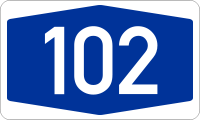
- A102
-
Basisdaten Gesamtlänge: 1 km Bundesland: Berlin Anschlussstellen und Bauwerke 
(1) Kreuz Tempelhof 

(2) Gradestraße Bundesautobahn 102 ist die ehemalige Bezeichnung einer deutschen Bundesautobahn, die zur Auffahrt auf den Berliner Stadtring, die A 100, herabgestuft wurde. Sie führt rund einen Kilometer von der Auffahrt Gradestraße zum Kreuz Tempelhof. Nach der Herabstufung wechselte der Sprachgebrauch in Anlehnung an die ehemalige Nummer zu Zubringer 102 oder in Anlehnung an die letzte Ausfahrt zu Zubringer Gradestraße.
Nach der ursprünglichen Planung als Osttangente Süd im Berliner Flächennutzungsplan von 1965 sollte die A 102 auf Höhe der Fichtestraße von der Hasenheide abzweigen und durch den gleichnamigen Park zum Columbiadamm führen und diesen auf Höhe des Sommerbades Neukölln queren. Der Flughafen Tempelhof wäre östlich umfahren worden und hätte die A 100 am Autobahnkreuz Tempelhof erreicht. Nach Süden hätte die die A 102 den Teltowkanal überquert und sollte der heutigen Ortsteilgrenze nach Süden folgen und an der Mohriner Allee durch den Britzer Garten (teilweise im Tunnel) zur Marienfelder Chaussee führen.
Weitere Planungen sahen einen Weiterbau im Süden bis zum Berliner Süd-Ring (A 10) am Kreuz Rangsdorf vor. Nach Norden sollte die A 102 durch die Urbanstraße zum Oranienplatz geführt werden, an dem ein Kreuz mit der Südtangente (geplante A 106) entstehen sollte. Über das Engelbecken und die Michaelkirchstraße hätte die Autobahn bis zum Platz der Vereinten Nationen geführt, wo ein Kreuz mit der A 107 geplant war. Über den Ernst-Thälmann-Park wäre der Nordring A 100 am Kreuz Prenzlauer Berg erreicht worden, um dann in Pankow auf die heutige A 114 zu stoßen.
Bis zur Wiedervereinigung trug die Autobahn die Bezeichnung „A 12“.
Siehe auch
Weblinks
- Geschichte und Bilder der A 102
- Detaillierte Streckenbeschreibung der Bundesautobahn 102
- Karte der geplanten Trassenführung

Gebaute Strecken:
Hauptstrecken: A 1 | A 2 | A 3 | A 4 | A 5 | A 6 | A 7 | A 8 | A 9Über- und regional: A 10 | A 11 | A 12 | A 13 | A 14 | A 15 | A 17 | A 19 | A 20 | A 21 | A 23 | A 24 | A 25 | A 26 | A 27 | A 28 | A 29 | A 30 | A 31 | A 33 | A 37 | A 38 | A 39 | A 40 | A 42 | A 43 | A 44 | A 45 | A 46 | A 48 | A 49 | A 52 | A 57 | A 59 | A 60 | A 61 | A 62 | A 63 | A 64 | A 65 | A 66 | A 67 | A 70 | A 71 | A 72 | A 73 | A 81 | A 92 | A 93 | A 94 | A 95 | A 96 | A 98 | A 99
Regional und lokal: A 100 | A 103 | A 111 | A 113 | A 114 | A 115 | A 117 | A 143 | A 210 | A 215 | A 226 | A 250 | A 252 | A 253 | A 255 | A 261 | A 270 | A 280 | A 281 | A 293 | A 352 | A 391 | A 392 | A 395 | A 445 | A 480 | A 485 | A 516 | A 524 | A 535 | A 540 | A 542 | A 544 | A 553 | A 555 | A 559 | A 560 | A 562 | A 565 | A 571 | A 573 | A 602 | A 620 | A 623 | A 643 | A 648 | A 650 | A 656 | A 659 | A 661 | A 671 | A 672 | A 831 | A 861 | A 864 | A 952 | A 980 | A 995
Geplante oder ehemalige Strecken:
A 16 | A 17* | A 18 | A 22 | A 32 | A 34 | A 35 | A 36 | A 40* | A 41 | A 47 | A 50 | A 51 | A 53 | A 54 | A 55 | A 56 | A 69 | A 74 | A 75 | A 77 | A 80 | A 82 | A 83 | A 84 | A 85 | A 86 | A 87 | A 88 | A 89 | A 90 | A 91A 102 | A 104 | A 105 | A 106 | A 107 | A 140 | A 201 | A 205 | A 227 | A 241 | A 263 | A 282 | A 290 | A 314 | A 339 | A 369 | A 376 | A 388 | A 430 | A 432 | A 441 | A 441* | A 443 | A 451 | A 480* | A 533 | A 545 | A 552 | A 558 | A 580 | A 610 | A 621 | A 647 | A 652 | A 653 | A 654 | A 655 | A 680 | A 683 | A 687 | A 713 | A 720 | A 722 | A 731 | A 751 | A 752 | A 753 | A 828 | A 833 | A 834 | A 840 | A 860 | A 862 | A 863 | A 863* | A 881 | A 895 | A 921 | A 922 | A 942 | A 944 | A 985 | A 990 | A 991 | A 992 | A 993 | A 994 | A 996 | A 997 | A 998 | A 999 | * frühere Planung: Nummer wurde später anders vergeben


Wikimedia Foundation.