- Wilson County (North Carolina)
-
Verwaltung US-Bundesstaat: North Carolina Verwaltungssitz: Wilson Adresse des
Verwaltungssitzes:County Courthouse
P.O. Box 1728
Wilson, NC 27894-1728Gründung: 1855 Gebildet aus: Edgecombe County
Johnston County
Nash County
Wayne CountyVorwahl: 001 252 und 919 Demographie Einwohner: 73.814 (2000) Bevölkerungsdichte: 76,8 Einwohner/km² Geographie Fläche gesamt: 969 km² Wasserfläche: 8 km² Karte 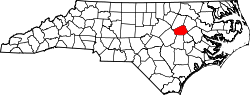
Website: www.wilson-co.com Wilson County[1] ist ein County im Bundesstaat North Carolina der Vereinigten Staaten von Amerika. Der Verwaltungssitz (County Seat) ist Wilson.
Inhaltsverzeichnis
Geografie
Das County liegt im mittleren Osten von North Carolina und hat eine Fläche von 969 Quadratkilometern, wovon 8 Quadratkilometer Wasserfläche sind. Es grenzt im Uhrzeigersinn an folgende Countys: Nash County, Edgecombe County, Pitt County, Greene County, Wayne County und Johnston County.
Wilson County ist in zehn Townships aufgeteilt: Black Creek, Cross Roads, Gardners, Old Fields, Saratoga, Springhill, Stantonsburg, Taylors, Toisnot und Wilson.
Geschichte
Wilson County wurde 1855 aus Teilen des Edgecombe County, Johnston County, Nash County und des Wayne County gebildet. Benannt wurde es, ebenso wie die Bezirkshauptstadt Wilson, nach Louis D. Wilson, einem Politiker und Offizier, der im Mexikanisch-Amerikanischen Krieg gefallen ist.
Demografische Daten
Historische Einwohnerzahlen Census Einwohner ± in % 1860 9720 — 1870 12.258 30 % 1880 16.064 30 % 1890 18.644 20 % 1900 23.596 30 % 1910 28.269 20 % 1920 36.813 30 % 1930 44.914 20 % 1940 50.219 10 % 1950 54.506 9 % 1960 57.716 6 % 1970 57.486 -0,4 % 1980 63.132 10 % 1990 66.061 5 % 2000 73.814 10 % Vor 1900[2] Nach der Volkszählung im Jahr 2000 lebten im Wilson County 73.814 Menschen. Davon wohnten 1.865 Personen in Sammelunterkünften, die anderen Einwohner lebten in 28.613 Haushalten und 19.771 Familien. Die Bevölkerungsdichte beträgt 77 Einwohner pro Quadratkilometer. Ethnisch betrachtet setzte sich die Bevölkerung zusammen aus 55,83 Prozent Weißen, 39,33 Prozent Afroamerikanern, 0,27 Prozent amerikanischen Ureinwohnern, 0,42 Prozent Asiaten, 0,02 Prozent Bewohnern aus dem pazifischen Inselraum und 3,21 Prozent aus anderen ethnischen Gruppen; 0,92 Prozent stammten von zwei oder mehr Ethnien ab. 6,04 Prozent der Bevölkerung waren spanischer oder lateinamerikanischer Abstammung.
Von den 28.613 Haushalten hatten 31,9 Prozent Kinder unter 18 Jahren, die bei ihnen lebten. 48,1 Prozent davon waren verheiratete, zusammenlebende Paare, 16,5 Prozent waren allein erziehende Mütter und 30,9 Prozent waren keine Familien. 26,4 Prozent waren Singlehaushalte und in 10,2 Prozent lebten Menschen mit 65 Jahren oder älter. Die Durchschnittshaushaltsgröße betrug 2,51 und die durchschnittliche Familiengröße war 3,03 Personen.
25,6 Prozent der Bevölkerung waren unter 18 Jahre alt. 9,1 Prozent zwischen 18 und 24 Jahre, 28,8 Prozent zwischen 25 und 44 Jahre, 23,6 Prozent zwischen 45 und 64, und 12,9 Prozent waren 65 Jahre alt oder Älter. Das Durchschnittsalter betrug 36 Jahre. Auf alle weiblichen Personen kamen 91,3 männliche Personen. Auf alle Frauen im Alter von 18 Jahren oder darüber kamen 87,2 Männer.
Das jährliche Durchschnittseinkommen eines Haushalts betrug 33.116 $, das einer Familie 41.551 $. Männer hatten ein durchschnittliches Einkommen von 30.364 $, Frauen 21.997 $. Das Prokopfeinkommen betrug 17.102 $. 18,5 Prozent der Bevölkerung und 13,8 Prozent der Familien lebten unterhalb der Armutsgrenze. Darunter waren 24,7 Prozent der Kinder und Jugendlichen unter 18 Jahren und 21,3 Prozent der Personen im Alter ab 65 Jahren. [5]
Siehe auch
Einzelnachweise
- ↑ GNIS-ID: 1008596. Abgerufen am 22. Februar 2011 (englisch).
- ↑ U.S. Census Bureau - Census of Population and Housing. Abgerufen am 15. März 2011
- ↑ Auszug aus Census.gov. Abgerufen am 20. Februar 2011
- ↑ Auszug aus factfinder.census.gov Abgerufen am 20. Februar 2011
- ↑ Wilson County, North Carolina, Datenblatt mit den Ergebnissen der Volkszählung im Jahre 2000 bei factfinder.census.gov.

Liste der Countys in North Carolina
Alamance | Alexander | Alleghany | Anson | Ashe | Avery | Beaufort | Bertie | Bladen | Brunswick | Buncombe | Burke | Cabarrus | Caldwell | Camden | Carteret | Caswell | Catawba | Chatham | Cherokee | Chowan | Clay | Cleveland | Columbus | Craven | Cumberland | Currituck | Dare | Davidson | Davie | Duplin | Durham | Edgecombe | Forsyth | Franklin | Gaston | Gates | Graham | Granville | Greene | Guilford | Halifax | Harnett | Haywood | Henderson | Hertford | Hoke | Hyde | Iredell | Jackson | Johnston | Jones | Lee | Lenoir | Lincoln | Macon | Madison | Martin | McDowell | Mecklenburg | Mitchell | Montgomery | Moore | Nash | New Hanover | Northampton | Onslow | Orange | Pamlico | Pasquotank | Pender | Perquimans | Person | Pitt | Polk | Randolph | Richmond | Robeson | Rockingham | Rowan | Rutherford | Sampson | Scotland | Stanly | Stokes | Surry | Swain | Transylvania | Tyrrell | Union | Vance | Wake | Warren | Washington | Watauga | Wayne | Wilkes | Wilson | Yadkin | Yancey
Wikimedia Foundation.
Schlagen Sie auch in anderen Wörterbüchern nach:
Wilson County, North Carolina — Infobox U.S. County county = Wilson County state = North Carolina map size = 250 founded = 1855 seat = Wilson | area total sq mi =374 area land sq mi = 371 area water sq mi =3 area percentage = 0.85% census yr = 2000 pop = 73814 density km2 =77… … Wikipedia
National Register of Historic Places listings in Wilson County, North Carolina — Map of all coordinates from Google Map of all coordinates from Bing … Wikipedia
Montclair, Wilson County, North Carolina — Montclair is an unincorporated community in Wilson County, North Carolina. It lies at an elevation of 108 feet (33 m). Coordinates: 35°44′33″N 77°54′23″W / … Wikipedia
Wilson Creek (North Carolina) — The Wilson Creek area is located in the Grandfather district of the scenic Pisgah National Forest, northwestern section of Caldwell County, North Carolina. Wilson Creek itself is a water system that originates in Calloway Peak and stretches for… … Wikipedia
Johnston County, North Carolina — Infobox U.S. County county = Johnston County state = North Carolina map size = 250 founded = 1746 seat = Smithfield | area total sq mi =796 area land sq mi =792 area water sq mi =4 area percentage = 0.50% census yr = 2007 pop = 157,437 density… … Wikipedia
Wayne County, North Carolina — Infobox U.S. County county = Wayne County state = North Carolina map size = 250 founded = 1779 seat = Goldsboro | area total sq mi =557 area land sq mi =553 area water sq mi =4 area percentage = 0.74% census yr = 2000 pop = 113329 density km2 =79 … Wikipedia
Nash County, North Carolina — Location in the state of North Carolina … Wikipedia
Greene County, North Carolina — Infobox U.S. County county = Greene County state = North Carolina map size = 250 founded = 1791 seat = Snow Hill | area total sq mi =266 area water sq mi =0 area percentage = 0.18% census yr = 2000 pop = 18974 density km2 =28 web =… … Wikipedia
Edgecombe County, North Carolina — Infobox U.S. County county = Edgecombe County state = North Carolina map size = 250 founded = 1741 seat = Tarboro | area total sq mi =507 area water sq mi =2 area percentage = 0.31% census yr = 2000 pop = 55606 density km2 =43 web = |Edgecombe… … Wikipedia
Pitt County, North Carolina — Infobox U.S. County county = Pitt County state = North Carolina map size = 250 founded = 1760 seat = Greenville | area total sq mi =655 area land sq mi =652 area water sq mi =3 area percentage = 0.49% census yr = 2000 pop = 133798 density km2 =79 … Wikipedia
Wilson County (North Carolina)

18+
© Academic, 2000-2024
- Kontaktieren Sie uns: Unterstützung, Werbung
Wörterbücher Export, schritte mit PHP, Joomla, Drupal, WordPress, MODx.