- Boyle County
-
Verwaltung US-Bundesstaat: Kentucky Verwaltungssitz: Danville Adresse des
Verwaltungssitzes:County Courthouse
321 W Main Street
Danville, KY 40422-9048Gründung: 15. Februar 1842 Gebildet aus: Lincoln County
Mercer CountyVorwahl: 001 859 Demographie Einwohner: 27.697 (2000) Bevölkerungsdichte: 58,8 Einwohner/km² Geographie Fläche gesamt: 474 km² Wasserfläche: 3 km² Karte 
Website: www.danville-ky.com Boyle County ist ein County im US-Bundesstaat Kentucky der Vereinigten Staaten von Amerika. Bei der Volkszählung im Jahr 2000 hatte das County 27.697 Einwohner und eine Bevölkerungsdichte von 59 Einwohnern pro Quadratkilometer. Der Verwaltungssitz (County Seat) ist Danville, das nach seinem Gründer Walker Daniel benannt wurde.
Inhaltsverzeichnis
Geografie
Das County liegt etwas östlich des geographischen Zentrums von Kentucky und hat eine Fläche von 474 Quadratkilometern, wovon 3 Quadratkilometer Wasserfläche sind. Es grenzt im Uhrzeigersinn an folgende Countys: Mercer County, Garrard County, Lincoln County, Casey County, Marion County und Washington County.
Geschichte
Boyle County wurde am 15. Februar 1842 aus Teilen des Lincoln County und des Mercer County gebildet. Benannt wurde es nach John Boyle, einem frühen Richter in diesem Gebiet und Mitglied im US-Kongress. Während des Sezessionskriegs fand hier am 8. Oktober 1862 die Schlacht von Perryville statt, ausgetragen zwischen der Mississippi-Armee der Konföderierten und der Ohio-Armee der Union, die siegreich waren. Insgesamt fielen bei dieser Schlacht 7407 Mann.
Demografische Daten
Historische Einwohnerzahlen Census Einwohner ± in % 1850 9116 — 1860 9304 2 % 1870 9515 2 % 1880 11.930 30 % 1890 12.948 9 % 1900 13.817 7 % 1910 14.668 6 % 1920 14.998 2 % 1930 16.282 9 % 1940 17.075 5 % 1950 20.532 20 % 1960 21.257 4 % 1970 21.861 3 % 1980 25.066 10 % 1990 25.641 2 % 2000 27.697 8 % 1850–1890[2] 1900–1990[3]
 Alterspyramide für das Boyle County
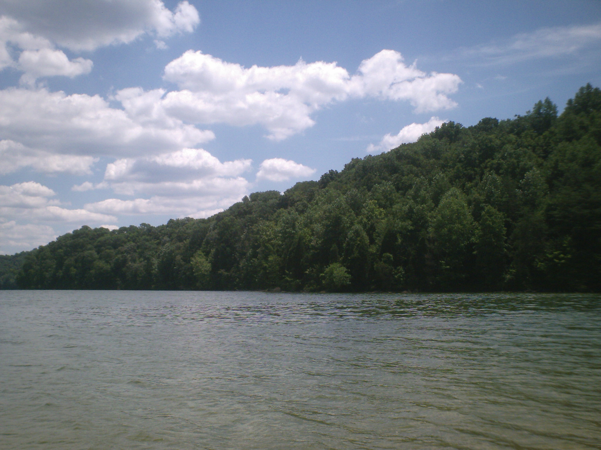
 Der Herrington Lake im Boyle County
Nach der Volkszählung im Jahr 2000 lebten im Boyle County 27.697 Menschen in 10.574 Haushalten und 7.348 Familien. Die Bevölkerungsdichte betrug 59 Einwohner pro Quadratkilometer. Ethnisch betrachtet setzte sich die Bevölkerung zusammen aus 87,77 Prozent Weißen, 9,68 Prozent Afroamerikanern, 0,19 Prozent amerikanischen Ureinwohnern, 0,56 Prozent Asiaten, 0,03 Prozent Bewohnern aus dem pazifischen Inselraum und 0,65 Prozent aus anderen ethnischen Gruppen; 1,12 Prozent stammten von zwei oder mehr Ethnien ab. 1,44 Prozent der Bevölkerung waren spanischer oder lateinamerikanischer Abstammung.
Von den 10.574 Haushalten hatten 31,0 Prozent Kinder und Jugendliche unter 18 Jahre, die bei ihnen lebten. 53,7 Prozent waren verheiratete, zusammenlebende Paare, 12,5 Prozent waren allein erziehende Mütter, 30,5 Prozent waren keine Familien, 27,1 Prozent waren Singlehaushalte und in 12,1 Prozent lebten Menschen im Alter von 65 Jahren oder darüber. Die Durchschnittshaushaltsgröße betrug 2,38 und die durchschnittliche Familiengröße lag bei 2,87 Personen.
Auf das gesamte County bezogen setzte sich die Bevölkerung zusammen aus 22,7 Prozent Einwohnern unter 18 Jahren, 11,0 Prozent zwischen 18 und 24 Jahren, 28,6 Prozent zwischen 25 und 44 Jahren, 23,7 Prozent zwischen 45 und 64 Jahren und 14,1 Prozent waren 65 Jahre alt oder darüber. Das Durchschnittsalter betrug 37 Jahre. Auf 100 weibliche Personen kamen 98,3 männliche Personen. Auf 100 Frauen im Alter von 18 Jahren alt oder darüber kamen statistisch 96,0 Männer.
Das jährliche Durchschnittseinkommen eines Haushalts betrug 35.241 USD, das Durchschnittseinkommen der Familien betrug 42.699 USD. Männer hatten ein Durchschnittseinkommen von 33.411 USD, Frauen 23.635 USD. Das Prokopfeinkommen betrug 18.288 USD. 9,1 Prozent der Familien und 11,9 Prozent der Bevölkerung lebten unterhalb der Armutsgrenze. Davon waren 15,8 Prozent Kinder oder Jugendliche unter 18 Jahre und 12,1 Prozent waren Menschen über 65 Jahre. [4]
Siehe auch
Einzelnachweise
- ↑ Auszug aus dem National Register of Historic Places. Abgerufen am 13. März 2011
- ↑ U.S. Census Bureau _ Census of Population and Housing. Abgerufen am 17. Februar 2011
- ↑ Auszug aus Census.gov. Abgerufen am 17. Februar 2011
- ↑ Boyle County, Kentucky, Datenblatt mit den Ergebnissen der Volkszählung im Jahre 2000 bei factfinder.census.gov.
Weblinks
-
 Commons: Boyle County, Kentucky – Sammlung von Bildern, Videos und Audiodateien

Liste der Countys in Kentucky
Adair | Allen | Anderson | Ballard | Barren | Bath | Bell | Boone | Bourbon | Boyd | Boyle | Bracken | Breathitt | Breckinridge | Bullitt | Butler | Caldwell | Calloway | Campbell | Carlisle | Carroll | Carter | Casey | Christian | Clark | Clay | Clinton | Crittenden | Cumberland | Daviess | Edmonson | Elliott | Estill | Fayette | Fleming | Floyd | Franklin | Fulton | Gallatin | Garrard | Grant | Graves | Grayson | Green | Greenup | Hancock | Hardin | Harlan | Harrison | Hart | Henderson | Henry | Hickman | Hopkins | Jackson | Jefferson | Jessamine | Johnson | Kenton | Knott | Knox | LaRue | Laurel | Lawrence | Lee | Leslie | Letcher | Lewis | Lincoln | Livingston | Logan | Lyon | Madison | Magoffin | Marion | Marshall | Martin | Mason | McCracken | McCreary | McLean | Meade | Menifee | Mercer | Metcalfe | Monroe | Montgomery | Morgan | Muhlenberg | Nelson | Nicholas | Ohio | Oldham | Owen | Owsley | Pendleton | Perry | Pike | Powell | Pulaski | Robertson | Rockcastle | Rowan | Russell | Scott | Shelby | Simpson | Spencer | Taylor | Todd | Trigg | Trimble | Union | Warren | Washington | Wayne | Webster | Whitley | Wolfe | Woodford
Wikimedia Foundation.
Schlagen Sie auch in anderen Wörterbüchern nach:
Boyle County — Admin ASC 2 Code Orig. name Boyle County Country and Admin Code US.KY.021 US … World countries Adminstrative division ASC I-II
Boyle County High School — Infobox Secondary school name = Boyle County High School motto = established = 1964? type = Public Secondary principal = Elmer Thomas students = 900 grades = 9–12 city = Danville state = Kentucky country = United States district = Boyle County… … Wikipedia
Boyle County, Kentucky — Infobox U.S. County county = Boyle County state = Kentucky founded year = 1842 founded date = seat wl = Danville area total sq mi = 183 area total km2 = 474 area land sq mi = 182 area land km2 = 471 area water sq mi = 1 area water km2 = 3 area… … Wikipedia
Boyle, County Roscommon — Infobox Irish Place name = Boyle gaeilge = Mainistir na Búille crest motto = map pin coords = left: 51px; top: 24px north coord = 53.9667 | west coord = 8.3 | irish grid = G803019 area = | elevation = 83 m province = Connacht county = County… … Wikipedia
National Register of Historic Places listings in Boyle County, Kentucky — Location of Boyle County in Kentucky This is a list of the National Register of Historic Places listings in Boyle County, Kentucky. This is intended to be a complete list of the properties and districts on the National Register of Historic Places … Wikipedia
Boyle — may refer to:*Boyle (crater), a lunar crater *Boyle s law in physics, one of the gas laws; named after Irish natural philosopher Robert Boyle Equipment *Boyle s machine as used in the administration of general anaesthesia to patients Places… … Wikipedia
County Roscommon — Not to be confused with Roscommon County, Michigan, United States. County Roscommon Contae Ros Comáin … Wikipedia
Boyle Heights, Los Angeles, California — Boyle Heights is a district east of Downtown Los Angeles on the East Side of Los Angeles, California, USA. The Heights are on the East side of the Los Angeles River. For much of the twentieth century, Boyle Heights was a gateway for new… … Wikipedia
Boyle Abbey — • Irish Cistercian house Catholic Encyclopedia. Kevin Knight. 2006. Boyle Abbey Boyle Abbey † … Catholic encyclopedia
County Roscommon — Contae Ros Comáin Karte Basisdaten Staat: Irland Verwaltungssitz: Roscommon Provinz … Deutsch Wikipedia
Boyle County


18+
© Academic, 2000-2024
- Kontaktieren Sie uns: Unterstützung, Werbung
Wörterbücher Export, schritte mit PHP, Joomla, Drupal, WordPress, MODx.