- Ayer Rajah Expressway
-
Ayer Rajah Expressway in Singapur 
Karte 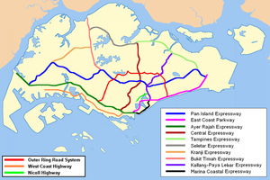
Basisdaten Betreiber: Land Transport Authority Gesamtlänge: 27 km - Tuas
- Clementi
- West Coast
- Bukit Merah
- Keppel
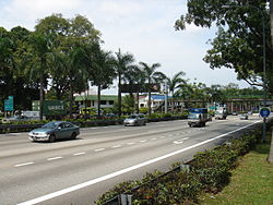
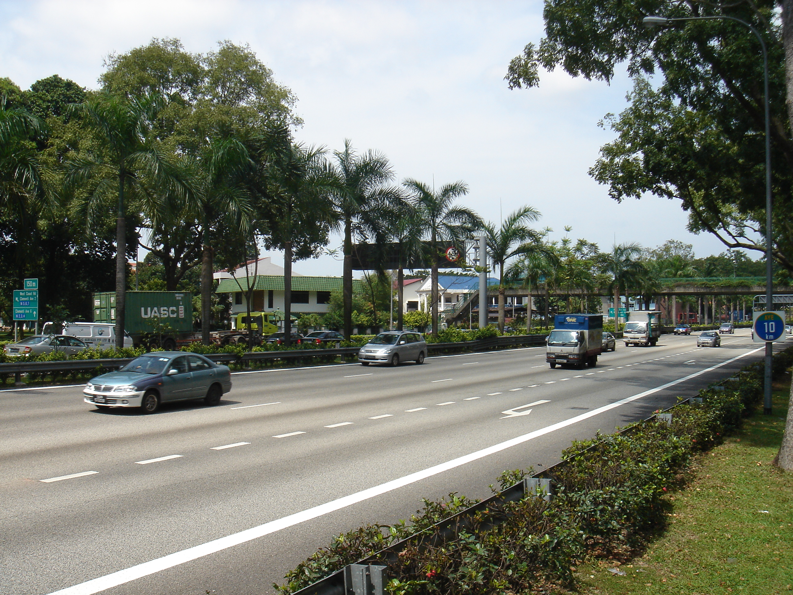
AYE bei Abfahrt Clementi Straßenverlauf


Keppel Viaduct 
(2AB) Keppel IC (2C) Radin Mas IC 
(3) Lower Delta IC (6) Gillman IC (7A) Normanton Park IC (7B) Portsdown Rd IC (8) Buona Vista IC (9) National University of Singapore IC (10) Clementi IC (11) Pandan IC West Coast Way (13) Jurong Town Hall IC (14) Penjuru Rd IC Jurong Lake Bridge (15) Jurong Park IC (17) Jurong Hill IC (18) Pioneer Circus IC (20) Benoi IC (22) Tuas IC 
(24) Tuas West Rd IC (26AB) Tuas West Dr IC Tuas Checkpoint Viaduct) Second Link Bridge (Jambatan Kedua) 1920m Grenzübergang Singapur-Malaysia 
Weiter auf 
Der Ayer Rajah Expressway (Abkürzung: AYE; chin.: 亚 逸 拉 惹 高速公路; Pinyin: Yàyìlārě Gāosù Gōnglù; Tamil: ஆயர் ராஜா விரவுச்சாலை); malay: Lebuhraya Ayer Rajah) beginnt am westlichen Ende des East Coast Parkway und verläuft dann in westlicher Richtung nach Tuas bis zur Grenze zu Malaysia. Zusammen mit dem East Coast Parkway, bildet der AYE eine zweite Ost-West-Verbindung die den Pan Island Expressway ergänzen soll.
Stadtteile entlang der Autobahn
- Tuas
- Clementi
- West Coast
- Bukit Merah
- Keppel
Schlagen Sie auch in anderen Wörterbüchern nach:
Ayer Rajah Expressway — Infobox Singapore Expressway routebox length km = direction = West East start/end1 = Tuas start/end2 = Keppel (ECP) area = Tuas Clementi West Coast Bukit Merah Keppel construct start = 1983 construct end = 1998 intersection = PIE, CTE, ECP cost … Wikipedia
Ayer Rajah — Single Member Constituency Ayer Rajah SMC redirects here.SG neighbourhood englishname=Ayer Rajah chinesename=亚逸拉惹 poj= pengim= pinyin=Yàyì Lārě malayname=Ayer Rajah tamilname=Ayer Rajah is an area located in the Queenstown Planning Area in the… … Wikipedia
Rajah (disambiguation) — NOTOC : See also Raja (disambiguation).Rajah may refer to:* Rajah, an alternate spelling of Raja, meaning an Indian monarch * Rajah (comics), a fictional character in the Marvel Universe * Rajah (dog), famed New Zealand German Shepherd police… … Wikipedia
Expressway Monitoring and Advisory System — The Expressway Monitoring and Advisory System (Chinese: 电子监控与信息系统), also known by its acronym of EMAS, is a computerised system that is used to monitor traffic on Singapore s expressways. EMAS enables Land Transport Authority (LTA) personnel to… … Wikipedia
Marina Coastal Expressway — Route information Length: 5 km (3 mi) Existed: 2008 – present … Wikipedia
North–South Expressway, Malaysia — For North–South Expressway in Singapore, see North–South Expressway, Singapore. North–South Expressway Route information … Wikipedia
Second Link Expressway — E3 Expressway Second Link Expressway Route information Maintained by PLUS Expressway Berhad and Linkedua Malaysia Berhad Length … Wikipedia
Pan Island Expressway — Infobox Singapore Expressway routebox length km = km to mi|num=42.8|abbr=no|spell=Commonwealth|precision=2|wiki=yes direction = West East start/end1 = Tuas (AYE) start/end2 = Changi South (ECP) area = Jurong Bukit Timah Toa Payoh Eunos Bedok… … Wikipedia
North–South Expressway, Singapore — For North–South Expressway in Malaysia, see North–South Expressway, Malaysia. North–South Expressway Route information Length: 21.5 km (13.4 mi) … Wikipedia
Kallang-Paya Lebar Expressway — Infobox Singapore Expressway routebox length km = km to mi|num=12|abbr=no|spell=Commonwealth|precision=2|wiki=yes direction = Northeast South start/end1 = Tanjong Rhu (ECP, MCE) start/end2 = Lorong Halus (TPE) area = Kallang Paya Lebar construct… … Wikipedia
Ayer Rajah Expressway


18+
© Academic, 2000-2024
- Kontaktieren Sie uns: Unterstützung, Werbung
Wörterbücher Export, schritte mit PHP, Joomla, Drupal, WordPress, MODx.