- Cadaujac
-
Cadaujac 
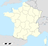

Region Aquitanien Département Gironde Arrondissement Bordeaux Kanton La Brède Koordinaten 44° 45′ N, 0° 32′ W44.755555555556-0.537Koordinaten: 44° 45′ N, 0° 32′ W Höhe 7 m (3–36 m) Fläche 15,33 km² Einwohner 4.744 (1. Jan. 2008) Bevölkerungsdichte 309 Einw./km² Postleitzahl 33140 INSEE-Code 33080 Website http://www.mairie-cadaujac.fr/ Cadaujac ist eine französische Gemeinde im Département Gironde in der Region Aquitanien. Die Gemeinde liegt im näheren Einzugsgebiet der Stadt Bordeaux. Während Cadaujac im Jahr 1962 noch über 1863 Einwohner verfügte, zählt man aktuell mit 4744 Einwohner (Stand 1. Januar 2008).
Die Gemeinde gehört zum Kanton La Brède im Arrondissement Bordeaux.
Cadaujac ist ein Weinbauort in der Weinbauregion Graves und gehört zur Appellation Pessac-Léognan.
Weblinks
Ayguemorte-les-Graves | Beautiran | La Brède | Cabanac-et-Villagrains | Cadaujac | Castres-Gironde | Isle-Saint-Georges | Léognan | Martillac | Saint-Médard-d’Eyrans | Saint-Morillon | Saint-Selve | Saucats
Wikimedia Foundation.
Schlagen Sie auch in anderen Wörterbüchern nach:
Cadaujac — Saltar a navegación, búsqueda Cadaujac … Wikipedia Español
Cadaujac — is a commune in the Gironde department in Aquitaine in southwestern France.ee also*Communes of the Gironde departmentReferences Based on the article in the French Wikipedia … Wikipedia
Cadaujac — Cadaujac, Sorte Bordeauxwein, s.d. B) a) ee) … Pierer's Universal-Lexikon
Cadaujac — 44° 45′ 23″ N 0° 31′ 44″ W / 44.7563888889, 0.528888888889 … Wikipédia en Français
Cadaujac — Original name in latin Cadaujac Name in other language Cadaujac State code FR Continent/City Europe/Paris longitude 44.75437 latitude 0.53128 altitude 10 Population 4826 Date 2012 01 18 … Cities with a population over 1000 database
Gare de Cadaujac — Cadaujac Localisation Pays France Commune Cadaujac Adresse … Wikipédia en Français
Liste des monuments historiques de l'arrondissement de Bordeaux — Localisation de l arrondissement de Bordeaux en Aquitaine. Cet article recense les monuments historiques de l arrondissement de Bordeaux, dans le département de la Gironde, en France … Wikipédia en Français
Villenave-d'Ornon — 44° 46′ 50″ N 0° 33′ 57″ W / 44.7805555556, 0.565833333333 … Wikipédia en Français
Château d'Eck — Château d Eck, anciennement dénommé château des Freytets Période ou style Médiéval Type Château Destination actuelle Domain … Wikipédia en Français
Liste des châteaux d'Aquitaine — Légende Symbole Signification Ruine Château fort … Wikipédia en Français
Cadaujac


18+
© Academic, 2000-2024
- Kontaktieren Sie uns: Unterstützung, Werbung
Wörterbücher Export, schritte mit PHP, Joomla, Drupal, WordPress, MODx.