- Barrington River (New South Wales)
-
Barrington River 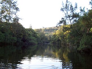
Unterlauf des Barrington River außerhalb des Nationalparks
Daten Lage New South Wales, Australien Flusssystem Manning River Abfluss über Gloucester River → Manning River → Tasmansee Quelle Caseys Peak / Barrington Peak (Barrington-Tops-Nationalpark)
32° 2′ 23″ S, 151° 25′ 38″ O-32.039722222222151.427222222221460Quellhöhe 1.460 m[1] Mündung Gloucester River nördlich von Gloucester -31.985151.9619444444484.5Koordinaten: 31° 59′ 6″ S, 151° 57′ 43″ O
31° 59′ 6″ S, 151° 57′ 43″ O-31.985151.9619444444484.5Mündungshöhe 84,5 m[1] Höhenunterschied 1.375,5 m Länge 93,1[1] Rechte Nebenflüsse Kerripit River, Mackays Creek Linke Nebenflüsse Beean Beean Creek, Moppy River, Cobark River Der Barrington River ist ein Fluss im Osten des australischen Bundesstaates New South Wales.
Geografie
Er entspringt im Barrington-Tops-Nationalpark unterhalb des Careys Peak und des Barrington Peak. Von dort fließt er nach Osten und mündet nördlich von Gloucester in den Gloucester River.
Wegen seiner Wildwasserabschnitte und der attraktiven Szenerie ist er bei Kanufahrern beliebt.
Nebenflüsse[1] mit Mündungshöhen
- Beean Beean Creek – 619 m
- Moppy River – 355 m
- Cobark River – 220 m
- Kerripit River – 215 m
- Mackays Creek – 186 m
Einzelnachweise
Kategorien:- Flusssystem Manning River
- Fluss in New South Wales
- Fluss in Australien und Ozeanien

Wikimedia Foundation.