Cerro del Aripo

Cerro del Aripo

f1

Cerro del Aripo
Höhe 940 m
Lage Trinidad
Gebirge Northern Range
Geographische Lage 10° 43′ 0″ N, 61° 15′ 0″ W10.716666666667-61.25940Koordinaten: 10° 43′ 0″ N, 61° 15′ 0″ W
Cerro del Aripo (Trinidad und Tobago)
Cerro del Aripo

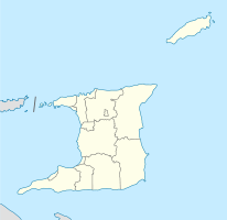
Der Berg Cerro del Aripo ist mit 940 m über Meer der höchste Punkt in Trinidad und Tobago. Er gehört zu der Northern Range, einem im Norden von Trinidad gelegenen Gebirge. Erreicht werden kann der Gipfel vom kleinen Bergdorf Aripo aus, in dem teilweise noch Patois gesprochen wird.

Der Pawi (Trinidad Piping-guan), ein endemischer Hühnervogel, ist hier im dichten Regenwald zu Hause. In großen Kalksteinhöhlen unterhalb des Gipfelplateaus leben Tausende von nachtaktiven Ölvögeln, die sich tagsüber in den Höhlen aufhalten und nachts von tropischen Früchten ernähren.

Literatur

  • Dominique De-Light, Polly Thomas: The Rough Guide to Trinidad and Tobago. Rough Guides 2001, ISBN 1858287472, S. 167

Weblinks


Wikimedia Foundation.

Игры ⚽ Поможем написать реферат

Schlagen Sie auch in anderen Wörterbüchern nach:

  • Cerro del Aripo — El Cerro del Aripo País Trinidad Coordenadas …   Wikipedia Español

  • El Cerro del Aripo — Infobox Mountain Name = El Cerro del Aripo Photo = Caption = Elevation = convert|940|m|ft|0 Location = Trinidad Range = Northern Range Prominence = convert|949|m|ft|0|abbr=on pushpin pushpin label position = bottom pushpin map caption = pushpin… …   Wikipedia

  • Aripo — is the name of several places in Trinidad. * The Heights of Aripo and the Aripo Massif are part of the Northern Range and include El Cerro del Aripo, the highest point in Trinidad and Tobago. * The Aripo Valley, a valley in the Northern Range… …   Wikipedia

  • List of Trinidad and Tobago-related topics — This is a list of topics related to Trinidad and Tobago. Those interested in the subject can monitor changes to the pages by clicking on Related changes in the sidebar.Trinidad and Tobago* Trinidad and Tobago * [http://www.trinilocal.com Trinidad …   Wikipedia

  • Geografía de Trinidad y Tobago — Continente Sudamérica Región Islas Caribe …   Wikipedia Español

  • Trinidad and Tobago — Trinidadian and Tobagonian. an independent republic in the West Indies, comprising the islands of Trinidad and Tobago: member of the Commonwealth of Nations. 1,273,141; 1980 sq. mi. (5128 sq. km). Cap.: Port of Spain. * * * Trinidad and Tobago… …   Universalium

  • Países por punto más alto — Anexo:Países por punto más alto Saltar a navegación, búsqueda Países desde el punto más alto Esta es una lista de los países por punto de mayor altitud por encima del Nivel del mar. Rank País Punto más alto Altura …   Wikipedia Español

  • Geography of Trinidad and Tobago — Map of Trinidad and Tobago Topography of Trindad and Tobago Trinidad and Tobago is an archipelagic republic in the southern Caribbean between the …   Wikipedia

  • Trinidad (Insel) — Trinidad Die Insel Trinidad Gewässer Karibisches Meer Inselgruppe Kleine Antillen …   Deutsch Wikipedia

  • Liste Des Pays Par Point Culminant — Cet article fait partie de la série Liste des pays du monde disparus par continent par population …   Wikipédia en Français

Share the article and excerpts

Direct link
Do a right-click on the link above
and select “Copy Link”