- Dětmarovice
-
Dětmarovice 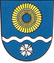
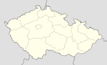

Basisdaten Staat: Tschechien Region: Moravskoslezský kraj Bezirk: Karviná Fläche: 1376 ha Geographische Lage: 49° 53′ N, 18° 28′ O49.88666666666718.462222222222214Koordinaten: 49° 53′ 12″ N, 18° 27′ 44″ O Höhe: 214 m n.m. Einwohner: 4.017 (1. Jan. 2011) [1] Postleitzahl: 735 71 Struktur Status: Gemeinde Ortsteile: 2 Verwaltung Bürgermeister: Ladislav Rosman (Stand: 2011) Adresse: Dětmarovice 27
735 71 DětmaroviceGemeindenummer: 598941 Website: www.detmarovice.cz Dětmarovice (deutsch Dittmarsdorf auch Dittmannsdorf, polnisch Dziećmorowice) ist eine Gemeinde mit 3.934 Einwohner. Die Gemeinde liegt drei Kilometer südöstlich von Dolní Lutyně und gehört zum Okres Karviná in Schlesien.
Inhaltsverzeichnis
Gemeindegliederung
Die Gemeinde Dětmarovice besteht aus den Ortsteilen Dětmarovice (Dittmarsdorf) und Koukolná (Konkolna).
Sehenswürdigkeiten
- Kapelle
- Kirche
Weblinks
 Commons: Dětmarovice – Sammlung von Bildern, Videos und Audiodateien
 Kirche
Einzelnachweise
- ↑ Český statistický úřad – Die Einwohnerzahlen der tschechischen Gemeinden vom 1. Januar 2011 (XLS, 1,3 MB)
Städte und Gemeinden im Okres Karviná (Bezirk Karwin)Albrechtice | Bohumín | Český Těšín | Dětmarovice | Dolní Lutyně | Doubrava | Havířov | Horní Bludovice | Horní Suchá | Chotěbuz | Karviná | Orlová | Petrovice u Karviné | Petřvald | Rychvald | Stonava | Těrlicko
Wikimedia Foundation.
Schlagen Sie auch in anderen Wörterbüchern nach:
Dětmarovice — Village Mary Magdalene Church … Wikipedia
Detmarovice — Original name in latin Dtmarovice Name in other language Detmarovice, Dittmannsdorf, Dziecmorowice, Dziemorowice, Dtmarovice State code CZ Continent/City Europe/Prague longitude 49.89412 latitude 18.46079 altitude 230 Population 3821 Date 2007 12 … Cities with a population over 1000 database
Dolní Lutyně — Village Saint John the Baptist Church … Wikipedia
Český Těšín — Czeski Cieszyn Town Town hall of Český Těšín … Wikipedia
Těrlicko — Cierlicko Village Saint Lawrence Church before reconstruction … Wikipedia
Chotěbuz — Kocobędz Village Archeopark Podobora … Wikipedia
Orlová — Orłowa Town Orlová downtown 2008 … Wikipedia
List of German exonyms for places in the Czech Republic — Below are links to subpages with more detailed listings of the German language names of towns and villages in different regions of the Czech Republic. Many of these German names are now exonyms, but used to be endonyms commonly used by the local… … Wikipedia
Doubrava — Village Národní dům (National House) … Wikipedia
Bahnstrecke Zilina–Bohumin — Žilina–Bohumín Kursbuchstrecke (ČD): 320 Kursbuchstrecke (ZSSK): 127 Streckenlänge: 100 km … Deutsch Wikipedia
Dětmarovice


18+
© Academic, 2000-2024
- Kontaktieren Sie uns: Unterstützung, Werbung
Wörterbücher Export, schritte mit PHP, Joomla, Drupal, WordPress, MODx.