Carp Island

Carp Island
Ngercheu
Rock Islands von Palau
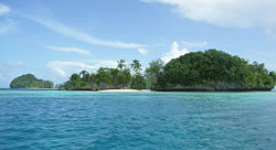
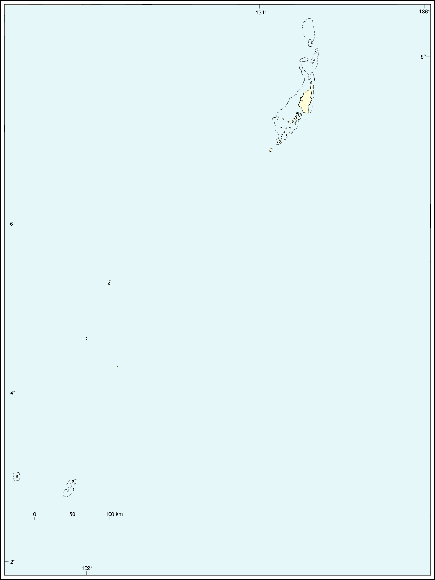
Gewässer Pazifischer Ozean
Inselgruppe Palauinseln
Geographische Lage 7° 5′ 34″ N, 134° 16′ 44″ O7.0926583333333134.2789972222231Koordinaten: 7° 5′ 34″ N, 134° 16′ 44″ O
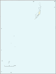
Ngercheu (Palau)
DEC
Ngercheu
Länge 1,4 km
Breite 800 m
Fläche 1 km²dep1
Höchste Erhebung 31 m
Einwohner 20
Hauptort ---

Ngercheu, auch Ngeroi oder Carp Island genannt, ist eine kleine Insel im westlichen Pazifischen Ozean; sie gehört geographisch zu den Palauinseln und geopolitisch zum Verwaltungsgebiet Peleliu der Inselrepublik Palau. Die Insel liegt knapp 5 Kilometer nordwestlich der Insel Peleliu direkt auf dem südwestlichen Außenriff von Palau.

Das etwa 1 km² große, sternförmige und dicht bewaldete Eiland gehört zur Untergruppe der Ngeroi-Inseln, welche im Süden der Chelbacheb-Inseln (Rock Islands) liegen.

Auf Ngercheu befindet sich nur das Carp Island Resort, eine speziell auf (asiatische) Touristen ausgelegte Tauchbasis mit angeschlossener Hotelanlage.

Weblinks


Wikimedia Foundation.

Игры ⚽ Поможем написать реферат

Schlagen Sie auch in anderen Wörterbüchern nach:

  • Carp Lake — ist der Name mehrerer Seen in den Vereinigten Staaten: Carp Lake (Florida) Carp Lake (Georgia) Carp Lake (Iowa) Carp Lake (Alcona County, Michigan) Carp Lake (Alger County, Michigan) Carp Lake (Wexford County, Michigan) Carp Lake (Minnesota) Carp …   Deutsch Wikipedia

  • Island Harbour Marina — Island Harbour Marina, near Newport, Isle of Wight, UK, was created from the former Medina Yacht Harbour in 1987 by Don Lang Design and Bellwinch PLC. The design of 96 cottage style houses and residents marina won an Award for Design Excellence… …   Wikipedia

  • USS Carp (SS-338) — USS Carp (SS/AGSS/IXSS 338), a Balao class submarine, was the second ship of the United States Navy to be named for the carp, a fresh water fish inhabiting the waters of Europe, Asia, Africa, North and South America. Carp (SS 338) was launched 12 …   Wikipedia

  • Myre-Big Island State Park — Coordinates: 43°38′9″N 93°18′32″W / 43.63583°N 93.30889°W / 43.63583; 93.30889 …   Wikipedia

  • Bateman Island — is an island located on the Columbia River between the cities of Richland and Kennewick, Washington. It is approximately 2 miles (3.2 km) long and 1 mile (1.6 km) wide (160 acres, 64 hectares).HistoryLewis and Clark mentioned Bateman Island in… …   Wikipedia

  • Ngercheu — Rock Islands von Palau Gewässer Pazifischer Ozean Inselgruppe …   Deutsch Wikipedia

  • Ngeroi-Inseln — Rock Islands von Palau Gewässer Pazifischer Ozean …   Deutsch Wikipedia

  • Ngemelis-Inseln — Chelbacheb Inseln Gewässer Pazifischer Ozean Geog …   Deutsch Wikipedia

  • Peleliu (Insel) — Peleliu Karte von Peleliu Gewässer Pazifischer Ozean Inselgruppe …   Deutsch Wikipedia

  • Meißendorf Lakes and Bannetze Moor — Island with Cormorants and incoming Greylag Geese …   Wikipedia

Share the article and excerpts

Direct link
Do a right-click on the link above
and select “Copy Link”