Cayo Saetía — Saltar a navegación, búsqueda Playa en Cayo Saetía Cayo Saetía (también Sae Tia) es una isla de 42 km² (16,2 millas cuadradas) ubicada en la Provincia de Holguín, Cuba. Se encuentra a 120 km (75 millas) al sureste de Holguín entre la Bahía de… … Wikipedia Español
Cayo Saetía — Vorlage:Infobox Insel/Wartung/Höhe fehlt Cayo Saetía Strand auf Cayo Saetía Gewässer Nipebucht … Deutsch Wikipedia
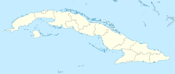
Cayo Saetia — Location map Cuba1 lon dir = W lat dir = N lat deg = 20 lat min = 45 lat sec = 34 lon deg = 75 lon min = 31 lon sec = 15 caption = Location of Cayo Saetia in Cuba width = 280Cayo Saetia (also spelled Sae Tia ) is a km2 to mi2|42|abbr=yes cay in… … Wikipedia
List of islands in the Caribbean — This is a list of islands of the Caribbean region, organized by the political territory each island belongs to.Anguilla* Anguilla * Anguillita * Blowing Rock * Cove Cay * Crocus Cay * Deadman s Cay * Dog Island * East Cay * Little Island * Little … Wikipedia
Antillas — Imagen por satélite de la parte oriental de las Islas Antillas y el Mar Caribe Localización geográfica / administrativa … Wikipedia Español
Tourismus Kubas — Dieser Artikel behandelt den Tourismus in Kuba, allgemeine Informationen finden sich im Hauptartikel Kuba. Capitol in Havanna Castillo del Morro in Santiago de Cuba … Deutsch Wikipedia
Antillas españolas — Saltar a navegación, búsqueda De este a oeste, Puerto Rico, La Española y Cuba. Al sur, Jamaica (la única de las Antillas Mayores que no era de soberanía española, sino inglesa, desde el siglo XVII). Las Ant … Wikipedia Español
Tourismus in Kuba — Dieser Artikel behandelt den Tourismus in Kuba, allgemeine Informationen finden sich im Hauptartikel Kuba. Capitol in Havanna … Deutsch Wikipedia
Bahia de Nipe — Die Bahía de Nipe ist eine Bucht an der nördlichen Atlantikküste im Osten Kubas, in der Provinz Holguín. Die Bucht hat eine maximale Ausdehnung von 25,9 km in der Länge und 16,8 km in der Breite. Die Gesamtoberfläche beträgt rund 120 km² und das… … Deutsch Wikipedia
Bucht von Nipe — Die Bahía de Nipe ist eine Bucht an der nördlichen Atlantikküste im Osten Kubas, in der Provinz Holguín. Die Bucht hat eine maximale Ausdehnung von 25,9 km in der Länge und 16,8 km in der Breite. Die Gesamtoberfläche beträgt rund 120 km² und das… … Deutsch Wikipedia

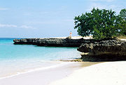 Strand auf Cayo Saetía
