- Abragão
-
Abragão Wappen Karte 
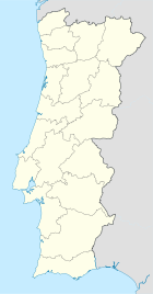

Basisdaten Region: Norte Unterregion: Tâmega Distrikt: Porto Concelho: Penafiel Koordinaten: 41° 10′ N, 8° 14′ W41.166667-8.233333Koordinaten: 41° 10′ N, 8° 14′ W Einwohner: 2.527 (Stand: 2001) Fläche: 8,87 km² Bevölkerungsdichte: 285 Einwohner pro km² Abragão ist ein Ort (Vila) im Norden Portugals.
Abragão gehört zum Kreis Penafiel im Distrikt Porto, besitzt eine Fläche von 8,87 km² und hat 2.527 Einwohner (2001). Die Erhebung der Freguesia in den Stand einer Vila datiert auf den 12. Juli 2001.
Weblinks
- Karte der Freguesia Abragão beim Instituto Geográfico do Exército
 Freguesias im Concelho Penafiel
Abragão | Boelhe | Bustelo | Cabeça Santa | Canelas | Capela | Castelões | Croca | Duas Igrejas | Eja | Figueira | Fonte Arcada | Galegos | Guilhufe | Irivo | Lagares | Luzim | Marecos | Milhundos | Novelas | Oldrões | Paço de Sousa | Penafiel | Perozelo | Pinheiro | Portela | Rans | Rio de Moinhos | Santa Marta | Santiago de Subarrifana | São Mamede de Recezinhos | São Martinho de Recezinhos | São Miguel de Paredes | Sebolido | Urrô | Valpedre | Vila Cova
Wikimedia Foundation.
Schlagen Sie auch in anderen Wörterbüchern nach:
Abragão — Freguesia de Portugal … Wikipedia Español
Абраган — Район Абраган Abragão Страна ПортугалияПортугалия … Википедия
Städte in Portugal — Dies ist eine Liste der Städte in Portugal, nach Einwohnerzahl und alphabetisch geordnet in Cidades (Städte mit Stadtrecht) und Vilas (was man etwa mit Großgemeinden übersetzen könnte). Städte nach Einwohnerzahl Alphabetische Übersicht der… … Deutsch Wikipedia
Районы округа Порту — … Википедия
Monuments of Portugal — The Monuments of Portugal were constructed throughout the Portuguese territory, and date back to the period of pre historic settlement of occupation. Subsequently, the region that is today Portugal has been colonized by many civilizations, which… … Wikipedia
List of towns in Portugal — A vila is a town in Portugal. It does not necessarily correspond to a municipality . There are 533 towns in Portugal.Alphabetically, the towns are as follows:Source: Instituto Nacional de Estatística NOTOC A* A dos Cunhados * Abragão * Abraveses… … Wikipedia
List of postal codes in Portugal — Aveiro districtMealhada municipality*3050 Antes *3050 Barcouço *3050 Casal Comba *3050 Luso *3050 Mealhada *3050 Pampilhosa *3050 Vacariça *3050 Ventosa do BairroMurtosa municipality*3870 Bunheiro *3870 Monte *3870 Murtosa *3870 TorreiraOliveira… … Wikipedia
Penafiel — (pron. IPA2|pɨnɐfi ɛɫ or [IPA|penɐfi ɛɫ] ) is a Portuguese city of the Porto district in the North of the country.The city of Penafiel itself had, as of 2001, a population of 9,343. The municipal areas surrounding Penafiel City have a population… … Wikipedia
Edgar Cardoso — (born 11th May 1913, Resende died 5th July 2000, Porto) was a noted Portuguese civil engineer and university professor. In Portugal, Edgar Cardoso was a pioneer of experimental analysis of structures and of high precision instruments development… … Wikipedia
Boelhe — Wappen Karte … Deutsch Wikipedia
Abragão


18+
© Academic, 2000-2024
- Kontaktieren Sie uns: Unterstützung, Werbung
Wörterbücher Export, schritte mit PHP, Joomla, Drupal, WordPress, MODx.