- Lindenwold
-
Lindenwold 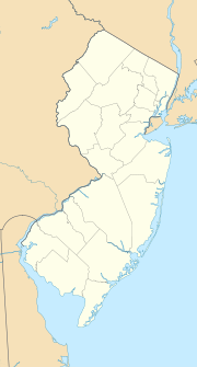

Lindenwold Lage in New JerseyBasisdaten Gründung: 1929 Staat: Vereinigte Staaten Bundesstaat: New Jersey County: Koordinaten: 39° 49′ N, 75° 0′ W39.824166666667-74.997521Koordinaten: 39° 49′ N, 75° 0′ W Zeitzone: Eastern Standard Time (UTC−5) Einwohner: 17.613 (Stand: Volkszählung 2010) Bevölkerungsdichte: 1.726,8 Einwohner je km² Fläche: 10,3 km² (ca. 4 mi²)
davon 10,2 km² (ca. 4 mi²) LandHöhe: 21 m Postleitzahl: 08021 Vorwahl: +1 856 FIPS: 34-40440 GNIS-ID: 0885279 Webpräsenz: www.lindenwold.net Bürgermeister: Frank DeLucca, Jr. Lindenwold ist eine Gemeinde (Borough) im Camden County im US-Bundesstaat New Jersey. Sie ist 4,0 mi² (10,3 km²) groß und hatte (2010) 17.613 Einwohner. Der Name leitet sich aus dem deutschen Wort Lindenwald ab.
Die Gemeinde wurde am 23. April 1929 gemeinsam mit vier weiteren Orten aus der Clementon Township ausgegründet.
Lindenwold ist seit 1969 östlicher Endpunkt der Schnellbahn PATCO Speedline, die von Philadelphia in Pennsylvania aus über Camden hierher führt. Der Bahnhof ist auch Zwischenhalt für die Züge der Atlantic City Line von Philadelphia nach Atlantic City.
Literatur
- Charles W. Shaylor: History of Lindenwold. White Horse Historical Society, Kirkwood 1979.
- John Parr Snyder: The story of New Jersey's civil boundaries, 1606-1968. New Jersey Dept. of Environmental Protection, Division of Water Resources, Geological Survey, Trenton, NJ 1988.
Kategorie:- Ort in New Jersey

Wikimedia Foundation.