- Charlotte Harbor
-
Charlotte Harbor 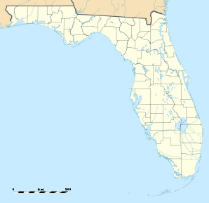

Charlotte Harbor Lage in FloridaBasisdaten Staat: Vereinigte Staaten Bundesstaat: Florida County: Koordinaten: 26° 58′ N, 82° 4′ W26.963888888889-82.0622222222221Koordinaten: 26° 58′ N, 82° 4′ W Zeitzone: Eastern Standard Time (UTC−5) Einwohner: 3647 (Stand: 2000) Bevölkerungsdichte: 651,3 Einwohner je km² Fläche: 5,7 km² (ca. 2 mi²)
davon 5,6 km² (ca. 2 mi²) LandHöhe: 1 m FIPS: 12-11625 GNIS-ID: 0280326 Charlotte Harbor ist eine Stadt im Charlotte County im US-Bundesstaat Florida, Vereinigte Staaten, mit 3.647 Einwohnern (Stand: 2000). Die geographischen Koordinaten sind: 26,96° Nord, 82,06° West. Das Stadtgebiet hat eine Größe von 5,7 km².
Demografische Daten
Das durchschnittliche Einkommen eines Haushalts liegt bei 29.468 USD, das durchschnittliche Einkommen einer Familie bei 39.583 USD. Männer haben ein durchschnittliches Einkommen von 26.157 USD gegenüber den Frauen mit durchschnittlich 19.097 USD. Das Pro-Kopf-Einkommen liegt bei 22.211 USD. 10,3 % der Einwohner und 4,5 % der Familien leben unterhalb der Armutsgrenze. 9,4 % der Einwohner sind unter 18 Jahre alt und auf 100 Frauen ab 18 Jahre und darüber kommen statistisch 69,3 Männer. Das Durchschnittsalter beträgt 70 Jahre. (Stand: 2000).
Städte und Gemeinden im Charlotte County (Florida)Boca Grande | Charlotte Harbor | Charlotte Park | Cleveland | Englewood | Grove City | Harbour Heights | Manasota Key | Port Charlotte | Punta Gorda | Rotonda | Solana
Wikimedia Foundation.
Schlagen Sie auch in anderen Wörterbüchern nach:
Charlotte Harbor — Lugar designado por el censo de los Estados Unidos … Wikipedia Español
Charlotte Harbor — Charlotte Harbor, FL U.S. Census Designated Place in Florida Population (2000): 3647 Housing Units (2000): 2277 Land area (2000): 2.181383 sq. miles (5.649756 sq. km) Water area (2000): 0.037502 sq. miles (0.097129 sq. km) Total area (2000):… … StarDict's U.S. Gazetteer Places
Charlotte Harbor, FL — U.S. Census Designated Place in Florida Population (2000): 3647 Housing Units (2000): 2277 Land area (2000): 2.181383 sq. miles (5.649756 sq. km) Water area (2000): 0.037502 sq. miles (0.097129 sq. km) Total area (2000): 2.218885 sq. miles… … StarDict's U.S. Gazetteer Places
Charlotte Harbor — est une baie américaine située sur la côte ouest de la péninsule de Floride et donnant sur le golfe du Mexique. C est également le nom d une ville de Floride située dans le comté de Charlotte. Portail du monde maritime … Wikipédia en Français
Charlotte Harbor — Original name in latin Charlotte Harbor Name in other language State code US Continent/City America/New York longitude 26.95839 latitude 82.06703 altitude 5 Population 3714 Date 2011 05 14 … Cities with a population over 1000 database
Charlotte Harbor Preserve State Park — IUCN Category V (Protected Landscape/Seascape) … Wikipedia
Charlotte Harbor, Florida — Charlotte Harbor redirects here. For the body of water, see Charlotte Harbor (estuary). Charlotte Harbor, Florida CDP … Wikipedia
Charlotte Harbor Light — The Charlotte Harbor lighthouse (from U.S. Coast Guard archives) Location Charlotte Harbor, on the channel to Punta Gorda, Florida Coordinates Est … Wikipedia
Charlotte Harbor and Northern Railway Depot — U.S. National Register of Historic Places … Wikipedia
Charlotte Harbor (southwest Florida bay) — Portion of a 1901 map of Charlotte Harbor by George F. Cram Coordinates … Wikipedia
Charlotte Harbor

18+
© Academic, 2000-2024
- Kontaktieren Sie uns: Unterstützung, Werbung
Wörterbücher Export, schritte mit PHP, Joomla, Drupal, WordPress, MODx.