- Puszczykowo
-
Puszczykowo 

Puszczykowo Basisdaten Staat: Polen Woiwodschaft: Großpolen Landkreis: Posen Fläche: 16,1 km² Geographische Lage: 52° 17′ N, 16° 51′ O52.28166666666716.854166666667Koordinaten: 52° 16′ 54″ N, 16° 51′ 15″ O Einwohner: 9635
(31. Dez. 2010)[1]Postleitzahl: 62-040 Telefonvorwahl: (+48) 61 Kfz-Kennzeichen: PKL Gemeinde Gemeindeart: Stadtgemeinde Fläche: 133,6 km² Einwohner: 9635
(31. Dez. 2010) [2]Bevölkerungsdichte: 72 Einw./km² Gemeindenummer (GUS): 3021021 Verwaltung Bürgermeister: Andrzej Balcerek Adresse: ul. Podleśna 4
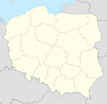
62-040 PuszczykowoPuszczykowo (deutsch Unterberg, 1943–1945 Unterberg (Kr. Posen))[3] ist eine Stadt und Sitz der gleichnamigen Stadtgemeinde im Powiat Poznański der Wojewodschaft Großpolen in Polen.
Inhaltsverzeichnis
Politik
Städtepartnerschaften
- Châteaugiron, Frankreich
Weblinks
 Commons: Puszczykowo – Sammlung von Bildern, Videos und Audiodateien
- Anordnung über Ortsnamenänderung im Reichsgau Wartheland im Verordnungsblatt des Reichstatthalters im Warthegau vom 18. Mai 1943 (pdf)
Fußnoten
- ↑ Population. Size and Structure by Territorial Division. As of December 31, 2010. Główny Urząd Statystyczny (GUS), abgerufen am 23. Juni 2011.
- ↑ Population. Size and Structure by Territorial Division. As of December 31, 2010. Główny Urząd Statystyczny (GUS), abgerufen am 23. Juni 2011.
- ↑ Vgl. Weblink "Anordnung über Ortsnamenänderung im Reichsgau Wartheland" - Landkreis Posen
 Städte und Gemeinden im Powiat Poznański
Buk | Czerwonak | Dopiewo | Kleszczewo | Komorniki | Kórnik | Kostrzyn Wielkopolski | Luboń | Mosina | Murowana Goślina | Pobiedziska | Puszczykowo | Rokietnica | Stęszew | Suchy Las | Swarzędz | Tarnowo Podgórne
Wikimedia Foundation.
Schlagen Sie auch in anderen Wörterbüchern nach:
Puszczykowo — Héraldique … Wikipédia en Français
Puszczykowo — Infobox Settlement name = Puszczykowo image shield = POL Puszczykowo COA.svg pushpin subdivision type = Country subdivision name = POL subdivision type1 = Voivodeship subdivision name1 = Greater Poland subdivision type2 = County subdivision name2 … Wikipedia
Puszczykowo — Original name in latin Puszczykowo Name in other language Puszczykowo State code PL Continent/City Europe/Warsaw longitude 52.2857 latitude 16.84925 altitude 76 Population 9143 Date 2011 07 31 … Cities with a population over 1000 database
Пущыково — Город Пущиково Puszczykowo Герб … Википедия
Voivodeship road 430 (Poland) — Voivodeship road 430 Droga wojewódzka nr 430 Route information Length: 25 km (16 mi) … Wikipedia
Poznań County — Infobox Settlement name = Poznań County native name = Powiat poznański settlement type = image shield = POL powiat poznański COA.svg map caption = Location within the voivodeship subdivision type = Country subdivision name = POL subdivision type1 … Wikipedia
Kamieniec — Kamieniec … Deutsch Wikipedia
Пущиково — Город Пущиково Puszczykowo Герб … Википедия
Wielkopolska National Park — Infobox protected area | name = Wielkopolska National Park native name=Wielkopolski Park Narodowy iucn category = II caption = locator x = locator y = location = Greater Poland Voivodeship, Poland nearest city = lat degrees = lat minutes = lat… … Wikipedia
Babayaga Ojo — Infobox musical artist Name = Babayaga Ojo Img capt = Babayaga Ojo Img size = 250 Landscape = Background = group or band Birth name = Alias = Cmentarna Elita Born = Died = Origin = Puszczykowo, Poland Instrument = Voice type = Genre = Punk rock,… … Wikipedia
Puszczykowo


18+
© Academic, 2000-2024
- Kontaktieren Sie uns: Unterstützung, Werbung
Wörterbücher Export, schritte mit PHP, Joomla, Drupal, WordPress, MODx.