- Radnorshire
-
Radnorshire 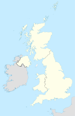

Radnorshire 
Hauptstadt New Radnor Fläche 1.219 km² Bevölkerung 18.431 (1961) Bevölkerungsdichte 15 Ew./km² Radnorshire (Walisisch: Sir Faesyfed) ist eine der dreizehn traditionellen Grafschaften sowie eine ehemalige Verwaltungsgrafschaft von Wales. Historische Hauptstadt und namensgebender Ort ist die Stadt New Radnor. Seit 1974 ist Radnorshire ein Teil von Powys.
Geografie
Die Grafschaft grenzt an Montgomeryshire, Shropshire, Herefordshire, Brecknockshire und Cardiganshire. Die Landschaft ist bergig und wird durch die Cambrian Mountains geprägt. Die höchste Erhebung mit 660 m liegt im Radnor Forest.
Der Wye, der Teme, der Elan und der Ithon sind die wichtigsten Flüsse. Bedeutende Orte neben New Radnor sind Knighton, Llandrindod Wells, Presteigne, Rhayader und Newbridge on Wye.
1961 hatte die Grafschaft 18.431 Einwohner auf 1.219 km².[1]
Verwaltungsgeschichte
Bis 1974 war Radnorshire eine eigenständige Verwaltungsgrafschaft und wurde dann neben Brecknockshire und Montgomeryshire einer der drei Districts der neuen Grafschaft Powys. 1996 wurden alle Districts aufgelöst und Powys wurde eine Unitary Authority mit dem Status eines County. Bei der Volkszählung 2001 hatte das Gebiet des früheren Districts Radnorshire 24.805 Einwohner.[2]
Einzelnachweise
- ↑ rororo Duden-Lexikon 1966
- ↑ Einwohnerzahl 2001

Anglesey | Brecknockshire | Caernarfonshire | Cardiganshire | Carmarthenshire | Denbighshire | Flintshire | Glamorgan | Merionethshire | Monmouthshire | Montgomeryshire | Pembrokeshire | Radnorshire
Wikimedia Foundation.
Schlagen Sie auch in anderen Wörterbüchern nach:
Radnorshire — Welsh: Sir Faesyfed Motto: Ewch yn Uwch (Go Higher) Pre 1974 extent of Radnorshire Geography … Wikipedia
Radnorshire — Saltar a navegación, búsqueda Radnorshire, uno de los condados históricos de Gales. Radnorshire o Maldwyn (en galés: Sir Faesyfed) fue uno de los trece condados históricos de Gales, en la isla de Gran Bretaña del Reino Unido … Wikipedia Español
Radnorshire — (spr. ráddnorschir, wallisisch Maesyfed), Grafschaft in Südwales, grenzt an Montgomery , Shrop , Hereford , Brecknock und Cardiganshire und hat einen Flächenraum von 1219 qkm (22,1 QM.) mit (1901) 23,281 Einw. (19 auf 1 qkm). Hauptstadt ist… … Meyers Großes Konversations-Lexikon
Radnorshire — [ rædnəʃɪə], ehemalige County in Wales, seit 1974 Teil der County Powys … Universal-Lexikon
Radnorshire — [rad′nər shir΄] former county of EC Wales, now part of Powys county: also called Radnor … English World dictionary
Radnorshire — /rad neuhr shear , sheuhr/, n. a historic county in Powys, in E Wales. Also called Radnor. * * * ▪ historical county, Wales, United Kingdom Welsh Sir Faesyfed historic county, east central Wales, on the English border. It covers an area… … Universalium
Radnorshire — 52°15′N 3°15′W / 52.25, 3.25 Le Radnorshire (en gallois : Sir Faesyfed) est l un des treize comtés histo … Wikipédia en Français
Radnorshire Arms — The Radnorshire Arms is a well preserved Jacobean building in the Welsh border town of Presteigne, in Powys, and the hub of its tourist industry. It is unique for an extensive network of subterranean passages and dungeons, used during the English … Wikipedia
Radnorshire (district) — infobox historic subdivision Name= District of Radnorshire HQ= Llandrindod Wells Status= District Start= 1974 End= 1996 Replace= Powys Civic= PopulationFirst= 18,271Fact|date=September 2008 PopulationFirstYear= 1971 PopulationLast=… … Wikipedia
Radnorshire (UK Parliament constituency) — UK former constituency infobox Name = Radnorshire Type = County Year = 1542 Abolition = 1918 members = oneRadnorshire was a constituency of the House of Commons of the Parliament of England then of the Parliament of Great Britain from 1707 to… … Wikipedia
Radnorshire


18+
© Academic, 2000-2024
- Kontaktieren Sie uns: Unterstützung, Werbung
Wörterbücher Export, schritte mit PHP, Joomla, Drupal, WordPress, MODx.