- River Crake
-
Crake 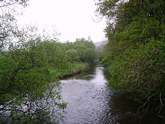
Der River Crake bei der Bouthrey Bridge
Daten Lage Cumbria, England Flusssystem Leven Flussgebietseinheit North West Ursprung Coniston Water
54° 17′ 53″ N, 3° 5′ 26″ W54.298045-3.090684Mündung in den River Leven 54.233681-3.050694Koordinaten: 54° 14′ 1″ N, 3° 3′ 2″ W
54° 14′ 1″ N, 3° 3′ 2″ W54.233681-3.050694Länge 9,5 km Gemeinden Lowick Bridge, Spark Bridge, Greenodd Der River Crake ist ein 9,5 km langer Fluss im Lake District, Cumbria, England. Der Crake entwässert den See Coniston Water an dessen südlichen Ende und fließt bei Greenodd in den River Leven kurz vor dessen Mündung in die Morecambe Bay.
Im 19. Jahrhundert siedelte sich eine Reihe von Fabriken am Fluss an, die das Wasser nutzten um Maschinen anzutreiben. So gab es eine Baumwollspinnerei und eine Eisengießerei. Bis in die 1970er Jahre gab es in Spark Bridge eine Drechselerei, die hölzerne Spindeln für die Spinnereien in Lancashire herstellte. Heute gibt es keine Überreste der Betriebe am Fluss mehr.
Der River Crake ist dafür bekannt, dass Lachse in ihm leben.
Kategorien:- Flusssystem Leven (Cumbria)
- Fluss in Europa
- Fluss in England
- Cumbria

Wikimedia Foundation.