Shumagin Islands

Shumagin Islands
Shumagin Islands
Big Koniuji Island, eine Insel der Shumagin Islands
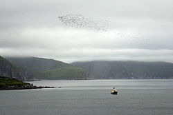
Gewässer Golf von Alaska
Geographische Lage 55° 14′ N, 160° 1′ W55.228056-160.018056Koordinaten: 55° 14′ N, 160° 1′ W
Shumagin Islands (Alaska)
Shumagin Islands
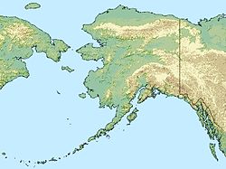
Anzahl der Inseln
Gesamtfläche 1.192 km²

Die Shumagin Islands sind eine der Alaska-Halbinsel vorgelagerte Inselgruppe im Golf von Alaska. Administrativ gehören sie zum Aleutians East Borough. Die einzige größere Siedlung ist Sand Point auf Popof Island mit 893 Einwohnern (Stand 2007).

Die Inselgruppe umfasst neben mehreren kleineren Inseln Popof Island, Korovin Island, Nagai Island, Simeonof Island sowie Big und Little Koniuji Island. Unga Island wurde 1968 wegen der wissenschaftlichen Bedeutung der an der Küste zu findenden versteinerte Bäume als National Natural Landmark ausgewiesen. Simeonof Island ist Teil des Alaska Maritime National Wildlife Refuge.

Benannt wurden die Shumagin Islands 1741 durch Vitus Bering nach Nikita Shumagin, einem seiner Matrosen, der an Skorbut verstorben und auf Nagai Island beerdigt worden war. Von Innokenti Weniaminow, einem russisch-orthodoxen Priester, der die aleutische Bevölkerung missionierte, wurde 1840 deren Bezeichnung für die Inselgruppe als „Kagigun“ dokumentiert. Adam Johann von Krusenstern von der kaiserlich-russischen Armee veröffentlichte 1827 den französischen Namen „I(les) Choumagin“.

Weblinks

 Commons: Shumagin Islands – Sammlung von Bildern, Videos und Audiodateien

Wikimedia Foundation.

Игры ⚽ Поможем решить контрольную работу

Schlagen Sie auch in anderen Wörterbüchern nach:

  • Shumagin Islands — The Shumagin Islands are a group of 20 islands in the Aleutians East Borough south of the mainland of Alaska, USA, at 54°54 –55°20 North 159°15 –160°45 West. The largest islands are Unga Island, Popof Island, Korovin Island, and Nagai Island.… …   Wikipedia

  • Shumagin Islands — Sp Šumãgino sãlos Ap Shumagin Islands L Š Ramiajame vand., JAV (Aliaska) …   Pasaulio vietovardžiai. Internetinė duomenų bazė

  • Shumagin — geographical name islands SW Alaska S of Alaska Peninsula; largest Unga …   New Collegiate Dictionary

  • Islas Shumagin — (Shumagin Islands) Vista de la isla Big Koniuji, en las Shumagins …   Wikipedia Español

  • List of islands of Alaska — This is an incomplete list of islands in the U.S. state of Alaska. There are about 2,670 named islands in the state.Cref|A [Cite web title=Alaska Office of Economic Development publisher=Alaska Department of Commerce, Community and Economic… …   Wikipedia

  • Nagai Island — Shumagin Islands, Nagai Island, 1985 Nagai Island is one of the largest of the Shumagin Islands in the Gulf of Alaska, south of the Alaska Peninsula considered a part of the NE Aleutian Range. It is located at …   Wikipedia

  • Aethia — Zwergalk (Aethia pusilla) Systematik Klasse: Vögel (Aves) Ordnung …   Deutsch Wikipedia

  • Aleut — Infobox Ethnic group group = Aleut Traditional Aleut dress pop = 17,000 to 18,000 region1 = flagcountry|United States pop1 = 17,000 [including 5,000 part AleutFact|date=February 2007] ref1 = region2 = flagcountry|Russia pop2 = 700 ref2 =… …   Wikipedia

  • The Aleut Corporation — The Aleut Corporation, or TAC, is one of thirteen Alaska Native Regional Corporations created under the Alaska Native Claims Settlement Act of 1971 (ANCSA) in settlement of aboriginal land claims. The Aleut Corporation was incorporated in Alaska… …   Wikipedia

  • Liste der National Natural Landmarks in Alaska — Die Liste der National Natural Landmarks in Alaska führt alle geologischen und ökologischen Objekte im US amerikanischen Bundesstaat Alaska auf, die zu National Natural Landmarks erklärt wurden. National Natural Landmarks Name Bild Datum der… …   Deutsch Wikipedia

Share the article and excerpts

Direct link
Do a right-click on the link above
and select “Copy Link”