- Yakutiye
-
Yakutiye 
Hilfe zu Wappen

Basisdaten Provinz (il): Erzurum Koordinaten: 39° 54′ N, 41° 16′ O39.90541.2730555555561918Koordinaten: 39° 54′ 18″ N, 41° 16′ 23″ O Höhe: 1.918 m Einwohner: 174.958[1] (2010) Telefonvorwahl: (+90) 442 Postleitzahl: 2505x Kfz-Kennzeichen: 25 Struktur und Verwaltung (Stand: 2011) Bürgermeister: Ali Korkut (AKP) Postanschrift: Kuloğlu Mahallesi
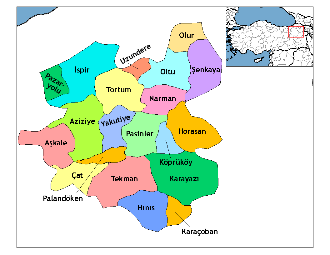
25100 ErzurumWebpräsenz: Landkreis Yakutiye Einwohner: 176.501[1] (2010) Fläche: 309 km² Bevölkerungsdichte: 571 Einwohner je km² Kaymakam: Yüksel Çelik Webpräsenz (Kaymakam): Yakutiye ist ein Stadtbezirk von Erzurum und gleichzeitig ein Landkreis der Provinz Erzurum im Osten der Türkei. Die Gesamtbevölkerung betrug im Jahr 2010 176.501, von denen 174.958 innerhalb der Stadt leben. Neben 42 Stadtvierteln (Machalla) der Stadt Erzurum gehören noch 14 Dörfer zum Landkreis. Die Fläche ist 308,6 km² groß, wobei nur 8,6 km² auf die Stadtviertel entfallen.
Der Landkreis wurde im März 2008 gegründet und gehört neben Aziziye und Palandöken zu den drei Landkreisen, die das Stadtgebiet von Erzurum umfassen.
Einzelnachweise
- ↑ a b Türkisches Institut für Statistik, abgerufen am 17. Mai 2011
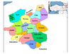 Landkreise der Provinz Erzurum
Aşkale | Çat | Hınıs | Horasan | İspir | Karaçoban | Karayazı | Köprüköy | Narman | Oltu | Olur | Pasinler | Pazaryolu | Şenkaya | Tekman | Tortum | Uzundere
Landkreise mit Hauptsitz in der Provinzhauptstadt, die gleichzeitig Stadtbezirke sind
Aziziye | Palandöken | Yakutiye
Wikimedia Foundation.
Schlagen Sie auch in anderen Wörterbüchern nach:
Palandöken (Erzurum) — Vorlage:Infobox Ort in der Türkei/Wartung/LandkreisVorlage:Infobox Ort in der Türkei/Wartung/LandkreisOhneEinwohnerOderFläche Palandöken (Erzurum) Hilfe zu Wappen … Deutsch Wikipedia
Bayburt — Infobox Settlement settlement type = subdivision type = Country subdivision name = TUR timezone=EET utc offset=+2 map caption =Location of PAGENAME within Turkey. timezone DST=EEST utc offset DST=+3official name = Bayburt image caption = Bayburt… … Wikipedia
Narman District — is a district of Erzurum Province of Turkey … Wikipedia
Oltu — (Armenian: Ողթիկ, Voght ik; Georgian: ოლთისი, Oltisi; Russian: Олти, Olti) is a town and district of Erzurum Province in the Eastern Anatolia region of Turkey. The mayor is İbrahim Ziyrek (AKP). The population is 19,969 (as of 2010). Contents 1… … Wikipedia
Olur — (Armenian: Տայոց քար, T ayots k ar, meaning a rock from Tayk , Georgian: ტაოსკარი, t aosk ari, meaning the door of Tao , formerly Tavusker) was a historic district Taoskari of Georgia, nowadays the town and district of Erzurum Province in the… … Wikipedia
Districts of Turkey — Republic of Turkey This article is part of the series: Politics and government of the Republic of Turkey … Wikipedia
Narman — For the town formerly called Narman, see Ünlükaya. Narman, formerly Mamervan and İd, is a town and district of Erzurum Province in the Eastern Anatolia region of Turkey. The mayor is Yücel Ahmet İşleyen (MHP). The population is 4,989 (as of 2010) … Wikipedia
Aziziye — Vorlage:Infobox Ort in der Türkei/Wartung/Landkreis Aziziye Hilfe zu Wappen … Deutsch Wikipedia
Aşkale — Vorlage:Infobox Ort in der Türkei/Wartung/Landkreis Aşkale Hilfe zu Wappen … Deutsch Wikipedia
Erzerum — Erzurum … Deutsch Wikipedia
Yakutiye


18+
© Academic, 2000-2024
- Kontaktieren Sie uns: Unterstützung, Werbung
Wörterbücher Export, schritte mit PHP, Joomla, Drupal, WordPress, MODx.