- Yenicekent
-
Yenicekent 

Basisdaten Provinz (il): Denizli Landkreis (ilçe): Buldan Koordinaten: 38° 4′ N, 28° 56′ O38.06584444444428.928130555556Koordinaten: 38° 3′ 57″ N, 28° 55′ 41″ O Einwohner: 2.560[1] (2010) Telefonvorwahl: (+90) 258 Postleitzahl: 20410 Kfz-Kennzeichen: 20 Struktur und Verwaltung (Stand: 2010) Bürgermeister: Hacı Mehmet Kesmez[2] (MHP) Webpräsenz: Yenicekent ist eine Kleinstadt im Landkreis Buldan der türkischen Provinz Denizli. Yenicekent liegt etwa 45 km nordwestlich der Provinzhauptstadt Denizli und 15 km nordöstlich von Buldan. Yenicekent hatte laut der letzten Volkszählung 2.560 Einwohner (Stand Ende Dezember 2010).
Das Verwaltungsgebiet von Yenicekent gliedert sich in vier Stadtteile, Cumhuriyet Mahallesi, İstiklal Mahallesi, Kurtuluş Mahallesi und Narlıdere Mahallesi, die jeweils von einem Muhtar verwaltet werden.
 Ruinen der antiken Stadt Tripolis
Südöstlich der Kleinstadt befinden sich die Reste der antiken Stadt Tripolis (griechisch Τρίπολις).
Einzelnachweise
- ↑ Türkisches Institut für Statistik, abgerufen 16. Juni 2011
- ↑ Yerelnet.org, abgerufen 16. Juni 2011
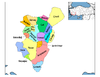 Ortschaften im Landkreis Buldan
Städte/Kleinstädte: Buldan | Yenicekent
Dörfer: Aktaş | Alacaoğlu | Alandız | Beyler | Boğazçiftlik | Bostanyeri | Bozalan | Bölmekaya | Çamköy | Çatak | Derbent | Dımbazlar | Doğan | Gülalan | Hasanbeyler | Kadıköy | Karaköy | Kaşıkcı | Kırandamı | Kovanoluk | Kurudere | Mahmutlu | Oğuz | Sarımahmutlu | Süleymanlı | Türlübey | Yayla | Yeniçam
Wikimedia Foundation.
Schlagen Sie auch in anderen Wörterbüchern nach:
Yenicekent — Infobox Settlement settlement type = subdivision type = Country subdivision name = TUR timezone=EET utc offset=+2 map caption =Location of PAGENAME within Turkey. timezone DST=EEST utc offset DST=+3official name = Yenicekent image caption = Ruins … Wikipedia
Denizli Province — Denizli ili Province of Turkey Location of Denizli Province in Turkey … Wikipedia
Danishmends — Danishmend ← 1071–1178 … Wikipedia
Buldan — Infobox Settlement settlement type = Town subdivision type = Country subdivision name = TUR timezone=EET utc offset=+2 map caption =Location of Buldan within Turkey. timezone DST=EEST utc offset DST=+3official name = Buldan image caption =… … Wikipedia
Menteşe — The Beylik of Mentes (blue) in 1300. The Anatolian beylik of Menteş (1260 1424), with capital in Milas in southwest Anatolia and headquartered in Beçin castle near that city, was one of the frontier principalities established by Oghuz Turkish… … Wikipedia
Karamanoğlu Mehmet Bey — This article is about Bey of Karaman. For Ottoman grand vizier, see Karamani Mehmed Pasha. Statue depicting Mehmed Beg declaring Turkish language as the official language of the state and all its institutions. Mehmed Beg or Mehmed Bey of Karaman… … Wikipedia
Artuklu Palace — General information Type Palace Location Diyarbakır, Turkey Coordinates … Wikipedia
Tzachas — (Greek: Τζαχᾶς, Tzachas), also known as Chaka Bey (Turkish: Çaka Bey)[dn 1] or Emmir Chaka of Smyrna,[1] was an 11th century Seljuk Turkish emir who ruled an independent state based in Smyrna (present day Izmir). Chaka was taken as a prisoner… … Wikipedia
Chobanids (beylik) — Chobanids (Turkish: Çobanoğulları or Çobanoğulları Beyliği) was an Anatolian beylik founded by the dynasty of the same name and controlled the region in and around the northern Central Anatolian city of Kastamonu in the 13th century, ruling as an … Wikipedia
Dulkadirids — For other meanings, see Dulkadir. The Anatolian beylik of Dulkadir (Modern Turkish: Dulkadiroğulları Beyliği ), was one of the frontier principalities established by Oghuz Turkish Alevi Qizilbash[citation needed] clans after the decline of Seljuk … Wikipedia
Yenicekent


18+
© Academic, 2000-2024
- Kontaktieren Sie uns: Unterstützung, Werbung
Wörterbücher Export, schritte mit PHP, Joomla, Drupal, WordPress, MODx.