- Coruche
-
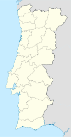
Coruche Wappen Karte 

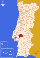
Basisdaten Region: Alentejo Unterregion: Lezíria do Tejo Distrikt: Santarém Concelho: Coruche Koordinaten: 38° 57′ N, 8° 32′ W38.95694-8.52694Koordinaten: 38° 57′ N, 8° 32′ W Einwohner: 9.200 (Stand: 2001) Kreis Coruche Flagge Karte 
Einwohner: 21332 (Stand: 2001) Fläche: 1.113,95 km² Bevölkerungsdichte: 19,15 Einwohner pro km² Anzahl der Gemeinden: 8 Verwaltung Adresse der Verwaltung: Câmara Municipal de Coruche
Praça da Liberdade
2100-121 CorucheCoruche ist eine Kleinstadt (Vila) in Portugal.
Geschichte
Coruche bekam das Stadtrecht im Jahre 1182.
Verwaltung
 Coruche ist Verwaltungssitz eines gleichnamigen Kreises. Die Nachbarkreise sind (im Uhrzeigersinn im Norden beginnend): Almeirim, Chamusca, Ponte de Sor, Mora, Arraiolos, Montemor-o-Novo, Montijo, Benavente sowie Salvaterra de Magos.
Die folgenden Gemeinden (freguesias) liegen im Kreis Coruche:
- Biscainho
- Branca
- Coruche
- Couço
- Erra
- Fajarda
- Santana do Mato
- São José de Lamarosa
 Coruche
Weblinks
-
 Commons: Coruche – Sammlung von Bildern, Videos und Audiodateien
 - Karte der Freguesia Coruche beim Instituto Geográfico do Exército

Abrantes | Alcanena | Almeirim | Alpiarça | Benavente | Cartaxo | Chamusca | Constância | Coruche | Entroncamento | Ferreira do Zêzere | Golegã | Mação | Ourém | Rio Maior | Salvaterra de Magos | Santarém | Sardoal | Tomar | Torres Novas | Vila Nova da Barquinha
Wikimedia Foundation.
Schlagen Sie auch in anderen Wörterbüchern nach:
Coruche — Saltar a navegación, búsqueda Coruche Escudo Bandera … Wikipedia Español
Coruche — For other uses, see Coruche (disambiguation). Coruche Municipality … Wikipedia
Coruche — 38°57′25″N 8°31′37″O / 38.95694, 8.52694 … Wikipédia en Français
Coruche — Original name in latin Coruche Name in other language Coruche State code PT Continent/City Europe/Lisbon longitude 38.95955 latitude 8.52524 altitude 21 Population 8776 Date 2012 01 17 … Cities with a population over 1000 database
Coruche — Sp Korùšė Ap Coruche L Portugalija … Pasaulio vietovardžiai. Internetinė duomenų bazė
Coruche — Admin ASC 2 Code Orig. name Coruche Country and Admin Code PT.18.1409 PT … World countries Adminstrative division ASC I-II
Coruche (Aguiar da Beira) — Coruche Wappen Karte … Deutsch Wikipedia
Coruche (Aguiar da Beira) — Saltar a navegación, búsqueda 40°47′37″N 7°32′27″O / 40.79361, 7.54083 … Wikipedia Español
Coruche wine — Coruche is a Portuguese wine region encompassing the town of Coruche in the Ribatejo region. The region was initially a separate Indicação de Proveniencia Regulamentada (IPR) region, but in 2003, it became one of six subregions of the Ribatejo… … Wikipedia
Coruche IPR — Coruche is a Portuguese wine region centered around the town of Coruche in the Ribatejo region. The region has the second tier Indicação de Proveniencia Regulamentada (IPR) classification and may some day be promoted to Denominação de Origem… … Wikipedia
Coruche


18+
© Academic, 2000-2024
- Kontaktieren Sie uns: Unterstützung, Werbung
Wörterbücher Export, schritte mit PHP, Joomla, Drupal, WordPress, MODx.