- Adams County (Nebraska)
-
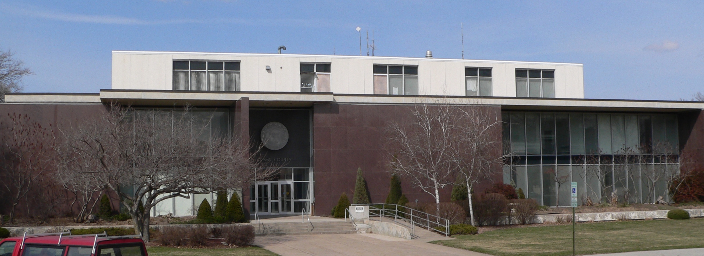
 Das Adams County Courthouse in Hastings
Verwaltung US-Bundesstaat: Nebraska Verwaltungssitz: Hastings Adresse des
Verwaltungssitzes:County Courthouse
500 West Fourth, Room 108
Hastings, NE 68901-7509Gründung: 1867 Vorwahl: 001 402 Demographie Einwohner: 31.364 (2010) Bevölkerungsdichte: 21,5 Einwohner/km² Geographie Fläche gesamt: 1.461 km² Wasserfläche: 2 km² Karte 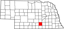
Website: www.adamscounty.org Das Adams County[1] ist ein County im US-amerikanischen Bundesstaat Minnesota. Bei der Volkszählung im Jahr 2010 hatte das County 31.364 Einwohner und eine Bevölkerungsdichte von 21,5 Einwohnern pro Quadratkilometer. Der Verwaltungssitz (County Seat) ist Hastings, das nach Colonel D.T. Hastings von der St. Joseph and Grand Island Railroad benannt wurde.
Inhaltsverzeichnis
Geografie
Das County liegt im Südwesten von Nebraska, ist im Süden etwa 40 km von Kansas entfernt und hat eine Fläche von 1.461 Quadratkilometern, wovon 2 Quadratkilometer Wasserfläche sind. Es grenzt an folgende Countys:
Buffalo County Hall County Kearney County 
Clay County Webster County Geschichte
 J. Adams
Das Adams County wurde 1867 gebildet. Benannt wurde es nach John Adams (1735-1826), dem zweiten Präsidenten der USA (1797-1801).
Demografische Daten
Historische Einwohnerzahlen Census Einwohner ± in % 1870 19 — 1880 10.235 50.000 % 1890 24.303 100 % 1900 18.840 -20 % 1910 20.900 10 % 1920 22.621 8 % 1930 26.275 20 % 1940 24.576 -6 % 1950 28.855 20 % 1960 28.944 0,3 % 1970 30.553 6 % 1980 30.656 0,3 % 1990 29.625 -3 % 2000 31.151 5 % 2010 31.364 0,7 % Vor 1900[2] 1900–1990[3] 2000[4] 2010[5]  Alterspyramide des Adams County
Nach der Volkszählung im Jahr 2000 lebten im Adams County 31.151 Menschen. Davon wohnten 1.642 Personen in Sammelunterkünften, die anderen Einwohner lebten in 12.141 Haushalten und 7.964 Familien. Die Bevölkerungsdichte betrug 21 Einwohner pro Quadratkilometer. Ethnisch betrachtet setzte sich die Bevölkerung zusammen aus 94,54 Prozent Weißen, 0,64 Prozent Afroamerikanern, 0,36 Prozent amerikanischen Ureinwohnern, 1,60 Prozent Asiaten, 0,04 Prozent Bewohnern aus dem pazifischen Inselraum und 1,99 Prozent aus anderen ethnischen Gruppen; 0,83 Prozent stammten von zwei oder mehr Ethnien ab. 4,58 Prozent der Bevölkerung waren spanischer oder lateinamerikanischer Abstammung, die verschiedenen der genannten Gruppen angehörten.
Von den 12.141 Haushalten hatten 30,9 Prozent Kinder und Jugendliche unter 18 Jahre, die bei ihnen lebten. 54,4 Prozent waren verheiratete, zusammenlebende Paare, 8,3 Prozent waren allein erziehende Mütter, 34,4 Prozent waren keine Familien, 28,6 Prozent waren Singlehaushalte und in 13,0 Prozent lebten Menschen im Alter von 65 Jahren oder darüber. Die Durchschnittshaushaltsgröße lag bei 2,43 und die durchschnittliche Familiengröße bei 3,00 Personen.
Auf das gesamte County bezogen setzte sich die Bevölkerung zusammen aus 24,4 Prozent Einwohnern unter 18 Jahren, 11,9 Prozent zwischen 18 und 24 Jahren, 26,2 Prozent zwischen 25 und 44 Jahren, 21,7 Prozent zwischen 45 und 64 Jahren und 15,9 Prozent waren 65 Jahre alt oder darüber. Das Durchschnittsalter betrug 36 Jahre. Auf 100 weibliche kamen statistisch 96,1 männliche Personen. Auf 100 Frauen im Alter von 18 Jahren oder darüber kamen statistisch 92,8 Männer.
Das jährliche Durchschnittseinkommen eines Haushalts betrug 37.160 USD, das Durchschnittseinkommen der Familien betrug 45.620 USD. Männer hatten ein Durchschnittseinkommen von 29.842 USD, Frauen 21.236 USD. Das Pro - Kopf - Einkommen betrug 18.308 USD. 5,5 Prozent der Familien und 9,3 Prozent der Bevölkerung lebten unterhalb der Armutsgrenze. Darunter waren 10,4 Prozent der Kinder und Jugendlichen unter 18 Jahren und 6,7 Prozent der Senioren ab 65 Jahren.[6]
Städte und Gemeinden
- Ayr
- Holstein
- Juniata
- Kenesaw
- Prosser
- Roseland
- Trumbull1
1 - teilweise im Clay County
Einzelnachweise
- ↑ GNIS-ID: 835823. Abgerufen am 22. Februar 2011 (englisch).
- ↑ U.S. Census Bureau _ Census of Population and Housing Abgerufen am 17. Februar 2011
- ↑ Auszug aus Census.gov Abgerufen am 17. Februar 2011
- ↑ Auszug aus factfinder.census.gov Abgerufen am 18. Februar 2011
- ↑ United States Census 2010 Abgerufen am 13. August 2011
- ↑ Adams County, Nebraska Datenblatt mit den Ergebnissen der Volkszählung im Jahre 2000 bei factfinder.census.gov
Weblinks
-
 Commons: Adams County, Nebraska – Sammlung von Bildern, Videos und Audiodateien
 - Offizielle Webseite
- Yahoo Bildersuche - Adams County
- U.S. Census Buero, State & County QuickFacts - Adams County
- www.city-data.com - Adams County

Liste der Countys in Nebraska
Adams | Antelope | Arthur | Banner | Blaine | Boone | Box Butte | Boyd | Brown | Buffalo | Burt | Butler | Cass | Cedar | Chase | Cherry | Cheyenne | Clay | Colfax | Cuming | Custer | Dakota | Dawes | Dawson | Deuel | Dixon | Dodge | Douglas | Dundy | Fillmore | Franklin | Frontier | Furnas | Gage | Garden | Garfield | Gosper | Grant | Greeley | Hall | Hamilton | Harlan | Hayes | Hitchcock | Holt | Hooker | Howard | Jefferson | Johnson | Kearney | Keith | Keya Paha | Kimball | Knox | Lancaster | Lincoln | Logan | Loup | Madison | McPherson | Merrick | Morrill | Nance | Nemaha | Nuckolls | Otoe | Pawnee | Perkins | Phelps | Pierce | Platte | Polk | Red Willow | Richardson | Rock | Saline | Sarpy | Saunders | Scotts Bluff | Seward | Sheridan | Sherman | Sioux | Stanton | Thayer | Thomas | Thurston | Valley | Washington | Wayne | Webster | Wheeler | York
Wikimedia Foundation.
Schlagen Sie auch in anderen Wörterbüchern nach:
Adams County, Nebraska — Infobox U.S. County county = Adams County state = Nebraska founded = Information needed seat = Hastings largest city = Hastings area total sq mi =564 area land sq mi =563 area water sq mi =1 area percentage = 0.13% census yr = 2000 pop = 31151… … Wikipedia
National Register of Historic Places listings in Adams County, Nebraska — Location of Adams County in Nebraska This is a list of the National Register of Historic Places listings in Adams County, Nebraska. It is intended to be a complete list of the properties and districts on the National Register of Historic Places… … Wikipedia
Cottonwood Township, Adams County, Nebraska — Map of Adams County highlighting Cottonwood Township. Cottonwood Township is one of sixteen townships in Adams County, Nebraska, United States. The population was 348 at the 2000 census. A 2006 estimate placed the township s population at 436.[1] … Wikipedia
Denver Township, Adams County, Nebraska — Denver Township is one of sixteen townships in Adams County, Nebraska, United States. The population was 1,052 at the 2000 census. A 2006 estimate placed the township s population at 1,100.[1] See also County government in Nebraska References ^ … Wikipedia
Ayr Township, Adams County, Nebraska — Ayr Township is one of sixteen townships in Adams County, Nebraska, United States. The population was 373 at the 2000 census. A 2006 estimate placed the township s population at 464. [cite web | url = http://www.census.gov/popest/cities/files/SUB … Wikipedia
Blaine Township, Adams County, Nebraska — Blaine Township is one of sixteen townships in Adams County, Nebraska, United States. The population was 463 at the 2000 census. A 2006 estimate placed the township s population at 500. [cite web | url =… … Wikipedia
Zero Township, Adams County, Nebraska — Zero Township is one of sixteen townships in Adams County, Nebraska, United States. The population was 259 at the 2000 census. A 2006 estimate placed the township s population at 339. [cite web | url =… … Wikipedia
Hanover Township, Adams County, Nebraska — Hanover Township is one of sixteen townships in Adams County, Nebraska, United States. The population was 202 at the 2000 census. A 2006 estimate placed the township s population at 270. [cite web | url =… … Wikipedia
Highland Township, Adams County, Nebraska — Highland Township is one of sixteen townships in Adams County, Nebraska, United States. The population was 685 at the 2000 census. A 2006 estimate placed the township s population at 401. [cite web | url =… … Wikipedia
Juniata Township, Adams County, Nebraska — Juniata Township is one of sixteen townships in Adams County, Nebraska, United States. The population was 976 at the 2000 census. A 2006 estimate placed the township s population at 1,122. [cite web | url =… … Wikipedia
Adams County (Nebraska)


18+
© Academic, 2000-2024
- Kontaktieren Sie uns: Unterstützung, Werbung
Wörterbücher Export, schritte mit PHP, Joomla, Drupal, WordPress, MODx.