Dover (New Hampshire)

Dover (New Hampshire)
Dover
Spitzname: The Garrison City
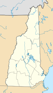
Dover (New Hampshire)
Dover
Dover
Lage in New Hampshire
Basisdaten
Gründung: 1623
Staat: Vereinigte Staaten
Bundesstaat: New Hampshire
County:

Strafford County

Koordinaten: 43° 12′ N, 70° 53′ W43.194722222222-70.87515Koordinaten: 43° 12′ N, 70° 53′ W
Zeitzone: Eastern Standard Time (UTC−5)
Einwohner: 28.216 (Stand: 2003)
Bevölkerungsdichte: 407,7 Einwohner je km²
Fläche: 75,2 km² (ca. 29 mi²)
davon 69,2 km² (ca. 27 mi²) Land
Höhe: 15 m
Postleitzahlen: 03820-03822
Vorwahl: +1 603
FIPS: 33-18820
GNIS-ID: 0866618
Webpräsenz: www.ci.dover.nh.us
Bürgermeister: Scott Myers

Dover ist eine Stadt (City) im US-Bundesstaat New Hampshire. Sie ist Verwaltungssitz von Strafford County im Osten des Staates.

Geographie

Die Stadt hat eine Fläche von 75,2 km², davon sind 69,2 km² Land und 6,1 km² (8,09 %) Wasserfläche. Dover wird durch die Flüsse Cochecho River und Bellamy River entwässert. Die Stadt liegt 15 m über dem Meeresspiegel, der höchste Punkt ist Long Hill (dt. Langer Hügel) mit 91 m Höhe 5 km nordwestlich des Stadtzentrums.

Geschichte

Dover wurde 1623 als Gemeinde (Town) gegründet und 1855 zur Stadt (City) erhoben.

Weblinks

 Commons: Dover, New Hampshire – Sammlung von Bildern, Videos und Audiodateien

Wikimedia Foundation.

Игры ⚽ Поможем решить контрольную работу

Schlagen Sie auch in anderen Wörterbüchern nach:

  • Dover, New Hampshire — City of Dover   City   Central Square c. 1905 …   Wikipedia

  • Dover (New Hampshire) — Pour les articles homonymes, voir Dover. Dover Surnom : « The Garrison City » Administration Pays …   Wikipédia en Français

  • St. Thomas Episcopal Church (Dover, New Hampshire) — Infobox nrhp name =St. Thomas Episcopal Church Dover, New Hampshire nrhp type = |thumb caption = location =5 Hale Street Dover, New Hampshire nearest city = lat degrees = 43 lat minutes = 11 lat seconds = 35 lat direction = N long degrees = 70… …   Wikipedia

  • County Farm Bridge (Dover, New Hampshire) — County Farm Bridge U.S. National Register of Historic Places …   Wikipedia

  • St. Thomas Aquinas High School (Dover, New Hampshire) — Infobox Secondary school name = St. Thomas Aquinas native name = motto = Lux In Tenebris (Light in Darkness) established = 1960 city = Dover state = New Hampshire province = country = United States campus = Suburban type = Roman Catholic… …   Wikipedia

  • Dover High School (New Hampshire) — Dover Senior High School Location 25 Alumni Dr. Dover, NH, USA Information Type …   Wikipedia

  • New Hampshire locations by per capita income — New Hampshire is the seventh richest state in the United States of America, with a per capita income of $23,844 (2000) and a personal per capita income of $34,702 (2003). New Hampshire counties ranked by per capita income There are ten counties… …   Wikipedia

  • New Hampshire Junior Monarchs — New Hampshire Jr. Monarchs City Hooksett, New Hampshire League Eastern Junior Hockey League …   Wikipedia

  • New Hampshire communities by population — The 234 incorporated cities and towns in the New Hampshire ranked by population, from the 2010 United States Census. Location of New Hampshire in the United States …   Wikipedia

  • New Hampshire communities by household income — The 234 incorporated cities and towns in the New Hampshire ranked by household income, calculated in 2006, and published in 2007. Rank Community Median Household Income 1 Windham, New Hampshire $94,794 2 Hollis, New Hampshire $92,847 3 …   Wikipedia

Share the article and excerpts

Direct link
Do a right-click on the link above
and select “Copy Link”