Etimesgut

Etimesgut

Vorlage:Infobox Ort in der Türkei/Wartung/Landkreis

Etimesgut
Wappen fehlt
Hilfe zu Wappen
Etimesgut (Türkei)
Paris plan pointer b jms.svg
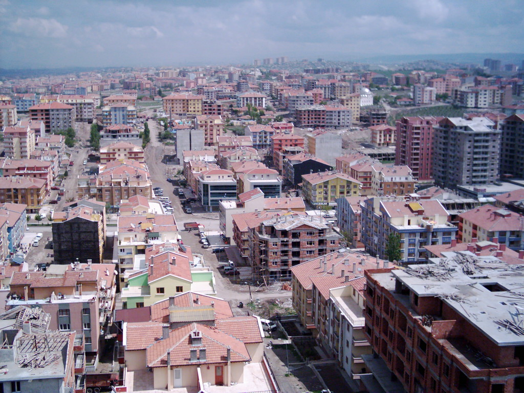
Basisdaten
Provinz (il): Ankara
Koordinaten: 39° 57′ N, 32° 40′ O39.94583333333332.669444444444Koordinaten: 39° 56′ 45″ N, 32° 40′ 10″ O
Telefonvorwahl: (+90) 312
Postleitzahl: 06 xxx
Kfz-Kennzeichen: 06
Struktur und Verwaltung (Stand: 2009)
Bürgermeister: Enver Demirel (MHP)
Webpräsenz:
Landkreis Etimesgut
Einwohner: 313.770[1] (2008)
Fläche: 49 km²
Bevölkerungsdichte: 6.403 Einwohner je km²
Kaymakam: Recep Erkılıç
Webpräsenz (Kaymakam):

Vorlage:Infobox Ort in der Türkei/Wartung/EinwohnerOrtFehlt

Blick über Etimesgut

Etimesgut ist ein türkischer Landkreis (İlçe) der Provinz Ankara und wurde am 19. August 1990 gegründet. Vorher gehörte er dem Landkreis Yenimahalle an.

Etimesgut grenzt an die Landkreise Yenimahalle und Sincan und gehört zum Stadtgebiet von Ankara. Stadt und Landkreis Etimesgut sind flächen- und einwohnermäßig identisch.

Etimesgut war bis in die 1990er Jahre Standort eines Langwellenrundfunksenders, der auf der Frequenz 198 kHz sendete [2].

In Etimesgut befindet sich ein mittlerweile ausschließlich militärisch genutzter Flughafen.

Einwohner

        Jahr         Einwohner
1927 200
1990 69.960
1997 126.182
2000 171.293
2005 274.126

Sport

Der Fußballverein Etimesgut Şekerspor spielt in der Saison 2007/08 in der Türkiye İkinci Lig B-Kategorisi.

Einzelnachweise

  1. Türkisches Institut für Bevölkerungsstatistik abgerufen 1. November 2009
  2. wowturkey

Wikimedia Foundation.

Игры ⚽ Поможем решить контрольную работу

Schlagen Sie auch in anderen Wörterbüchern nach:

  • Etimesgut — Administration Pays …   Wikipédia en Français

  • Etimesgut — Infobox Settlement settlement type = District subdivision type = Country subdivision name = TUR subdivision type1=Region subdivision name1 = Central Anatolia subdivision type2=Province subdivision name2 = Ankara timezone= EET utc offset=+2 map… …   Wikipedia

  • Etimesgut — Original name in latin Etimesgut Name in other language Etimesgut, Etimesut State code TR Continent/City Europe/Istanbul longitude 39.95328 latitude 32.63285 altitude 805 Population 0 Date 2012 01 18 …   Cities with a population over 1000 database

  • Etimesgut Şekerspor — Şekerspor Voller Name Etimesgut Şekerspor Gegründet 1947 Vereinsfarben …   Deutsch Wikipedia

  • Etimesgut Şekerspor — Football club infobox clubname = Etimesgut Şeker S.A.Ş. fullname = Etimesgut Şeker Spor Anonim Şirketi nickname = Keçiler (The Goats)| founded = 1947 ground = Ostim Stadium, Ankara capacity = 5,000| chairman = manager = league = TFF Second League …   Wikipedia

  • Etimesgut — is., t u, öz. Ankara iline bağlı ilçelerden biri …   Çağatay Osmanlı Sözlük

  • Güzelkent, Etimesgut — Güzelkent (literally beautiful city in Turkish) is a neighbourhood of Etimesgut district in Ankara, Turkey. It is located near the Eryaman neighbourhood, 25 km far from the city centre of Ankara, and is bordered by Eryaman, Sincan, Fatih and… …   Wikipedia

  • Eryaman, Etimesgut — Eryaman is a neighbourhood of Etimesgut district in Ankara, Turkey. It is located 28 km west of the city centre of Ankara. Population of the neighbourhood is around 150,000.ee also* Güzelkent, EtimesgutImage galleryReferences* [http://www.eryaman …   Wikipedia

  • Sekerspor — Şekerspor Voller Name Etimesgut Şekerspor Gegründet 1947 Vereinsfarben grün weiß orange …   Deutsch Wikipedia

  • Şekerspor — Voller Name Etimesgut Şekerspor Gegründet 1947 Vereinsfarben grün weiß orange …   Deutsch Wikipedia

Share the article and excerpts

Direct link
Do a right-click on the link above
and select “Copy Link”