- Akaiwa
-
Akaiwa-shi
赤磐市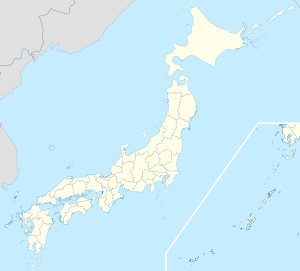

Geographische Lage in Japan Region: Chūgoku Präfektur: Okayama Koordinaten: 34° 45′ N, 134° 1′ O34.755397222222134.01884444444Koordinaten: 34° 45′ 19″ N, 134° 1′ 8″ O Basisdaten Fläche: 209,43 km² Einwohner: 43.332
(1. September 2011)Bevölkerungsdichte: 207 Einwohner je km² Gemeindeschlüssel: 33213-5 Rathaus Adresse: Akaiwa City Hall
311-1, Shimoichi
Akaiwa-shi
Okayama 715-8601Webadresse: http://www.city.akaiwa.lg.jp Lage Akaiwas in der Präfektur Okayama 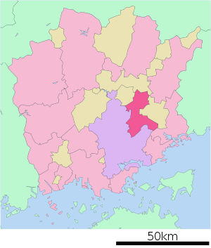
Akaiwa (jap. 赤磐市, -shi, wörtlich: roter Fels) ist eine Stadt mit rund 45.000 Einwohnern in der japanischen Präfektur Okayama.
Inhaltsverzeichnis
Geschichte
Die kommunale Verwaltungseinheit Akaiwa wurde am 7. März 2005 aus der Vereinigung der Gemeinden Akasaka (赤坂町, -chō), Kumayama (熊山町, -chō), Sanyō (山陽町, -chō) und Yoshii (吉井町, -chō) des Landkreises Akaiwa gegründet.
Sehenswürdigkeiten
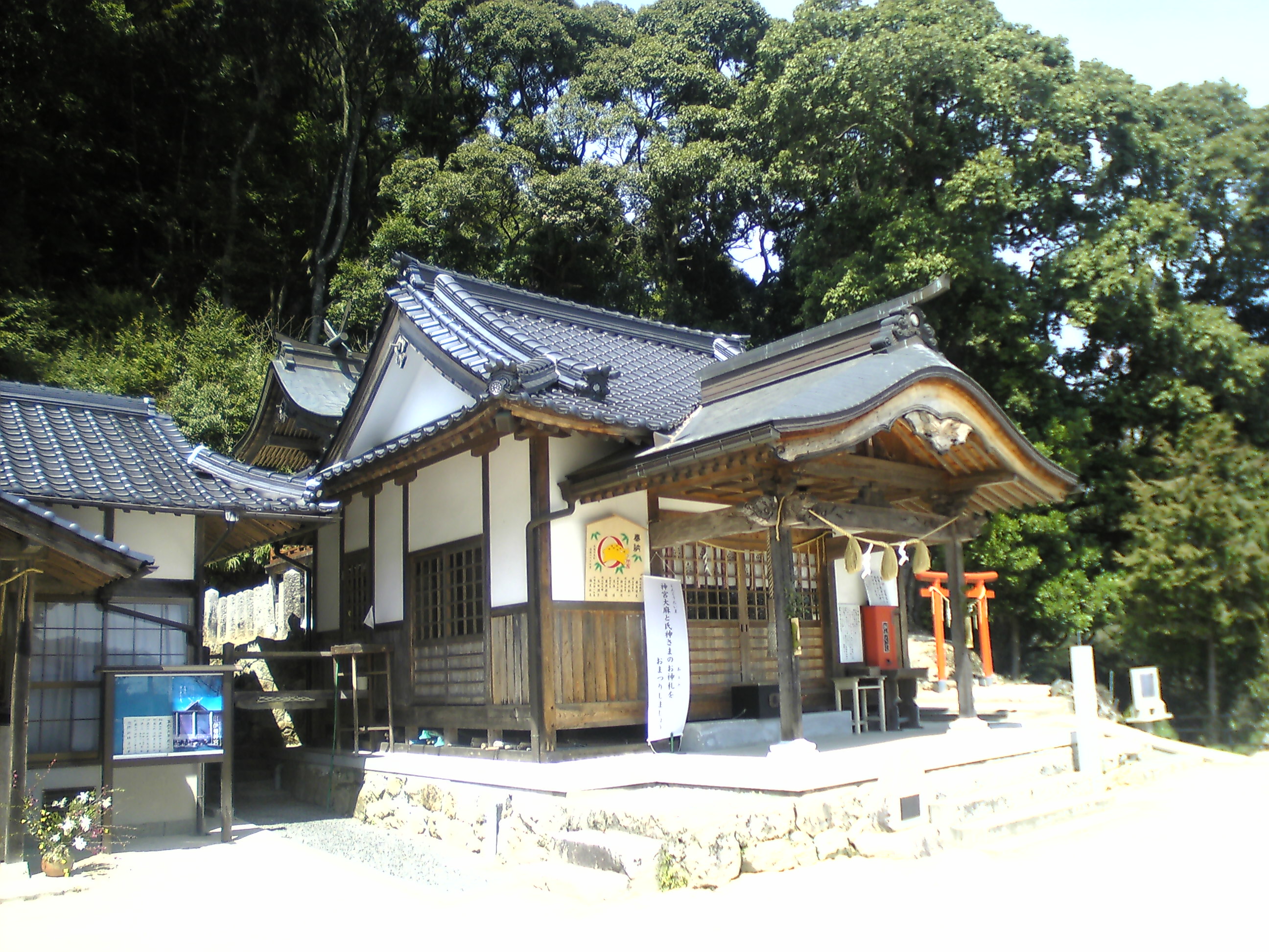
 Isonokamifutsumitama-Schrein
Zu den Hauptattraktionen der Stadt zählen die Kumayama-Ruinen (熊山遺跡, Kumayama iseki), ein wichtiges buddhistisches Zeugnis der frühen Nara-Zeit und der Isonokamifutsumitama-Schrein (石上布都魂神社, Isonokamifutsumitama-jinja)
Verkehr
Die Stadt wird straßenmässig erschlossen durch die Sanyo-Autobahn sowie die Nationalstraßen 374 und 484. Zudem liegt sie an den Bahnstrecken JR und der Sanyo-Hauptlinie.
Angrenzende Städte und Gemeinden
Im Westen grenzt Akaiwa an die Hauptstadt der Präfektur Okayama und im Osten liegt Bizen.
Weblinks
 Commons: Akaiwa – Sammlung von Bildern, Videos und Audiodateien
 Gemeinden und Landkreise in der Präfektur Okayama
Kreisfreie Städte (shi): Akaiwa | Asakuchi | Bizen | Ibara | Kasaoka | Kurashiki | Maniwa | Mimasaka | Niimi | Okayama (Verwaltungssitz) | Setouchi | Sōja | Takahashi | Tamano | Tsuyama
Aida-gun: Nishiawakura | Asakuchi-gun: Satoshō | Kaga-gun: Kibichūō | Katsuta-gun: Nagi | Shōō | Kume-gun: Kumenan | Misaki | Maniwa-gun: Shinjō | Oda-gun: Yakage | Tomata-gun: Kagamino | Tsukubo-gun: Hayashima | Wake-gun: Wake
Wikimedia Foundation.
Schlagen Sie auch in anderen Wörterbüchern nach:
Akaiwa — shi (赤磐市) Mairie Administration Pays Japon Région Chūgoku Préfecture … Wikipédia en Français
Akaiwa District, Okayama — Akaiwa (赤磐郡; gun) was a district located in Okayama, Japan. As of 2004, the district has an estimated population of 14,945.The total area is 41.78 km². The district had only one town. * SetoOn January 22, 2007, the district dissolved when Seto… … Wikipedia
Akaiwa, Okayama — Infobox City Japan Name= Akaiwa JapaneseName= 赤磐 Map Region= Chūgoku Prefecture= Okayama District= Area km2= 209.43 PopDate= 2006 Population= 45,542 Density km2= 217.46 Coords= coord|34|45|N|134|1|E|region:JP type:city Tree= Flower= Bird= Symbol… … Wikipedia
Akaiwa Station — Infobox Station name= nihongo|Akaiwa Station|赤岩駅|Akaiwa eki type= image size= image caption= address= coordinates= coord|37.8057|140.335|display=inline,title line= other= structure= platform= depth= levels= tracks= parking= bicycle= baggage check … Wikipedia
Akaiwa-gun — Admin ASC 2 Code Orig. name Akaiwa gun Country and Admin Code JP.00.1865558 JP … World countries Adminstrative division ASC I-II
Akaiwa-shi — Admin ASC 2 Code Orig. name Akaiwa shi Country and Admin Code JP.31.7405227 JP … World countries Adminstrative division ASC I-II
District d'Akaiwa — Akaiwa (赤磐郡; gun) était un district situé dans la Préfecture d Okayama au Japon. En 2004, la population estimée du district s élevait à 14 945 personnes. La superficie totale était de 41.78 km². Le district n était composé que d une seule… … Wikipédia en Français
Yoshii, Okayama (Akaiwa) — was a town located in Akaiwa District, Okayama, Japan. On March 7, 2005, Yoshii merged with the towns of San yō, Akasaka, and Kumayama to form the new city of Akaiwa.As of 2006, the town had an estimated population of 5,386 and a density of 62.58 … Wikipedia
List of mergers in Okayama Prefecture — The following is a list of mergers that occurred in the 2000s in Okayama Prefecture, Japan.(as of January 22, 2007)Mergers from April 1, 1999 to March 31, 2000Mergers from April 1, 2000 to March 31, 2001Mergers from April 1, 2001 to March 31,… … Wikipedia
JP-33 — Karte Basisdaten Verwaltungssitz: Okayama Region: Chūgoku … Deutsch Wikipedia
Akaiwa


18+
© Academic, 2000-2024
- Kontaktieren Sie uns: Unterstützung, Werbung
Wörterbücher Export, schritte mit PHP, Joomla, Drupal, WordPress, MODx.