- Fort Dodge
-
Fort Dodge 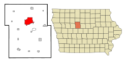 Lage in Iowa
Basisdaten Gründung: 1869 Staat: Vereinigte Staaten Bundesstaat: Iowa County: Koordinaten: 42° 30′ N, 94° 11′ W42.506666666667-94.180277777778352Koordinaten: 42° 30′ N, 94° 11′ W Zeitzone: Central Standard Time (UTC−6) Einwohner: 25.136 (Stand: 2000) Bevölkerungsdichte: 666,7 Einwohner je km² Fläche: 38,4 km² (ca. 15 mi²)
davon 37,7 km² (ca. 15 mi²) LandHöhe: 352 m Postleitzahl: 50501 Vorwahl: +1 515 FIPS: 19-28515 GNIS-ID: 0456686 Webpräsenz: www.fortdodgeiowa.org Bürgermeister: Terry Lutz Fort Dodge ist eine Stadt im Webster County im US-Bundesstaat Iowa. Die Stadt hat 25.136 Einwohner auf einer Fläche von 38,4 km². Die Stadt liegt am Des Moines River an der Kreuzung der Highways U.S. Highway 169 und am U.S. Highway 20. Hauptindustrien sind Gips- und Kalksteinabbau sowie die Herstellung von Impfstoffen.
Söhne und Töchter der Stadt
- Samuel Z. Arkoff, Filmproduzent, galt als König des Low-Budget-Films
- Holm Olaf Bursum, Politiker
- Mack Hellings, Autorennfahrer
- Mary Kelly, Konzeptkünstlerin
- Robert Pierce, Journalist und Evangelist
Kategorien:- Ort in Iowa
- County Seat in Iowa

Wikimedia Foundation.