- Herias
-
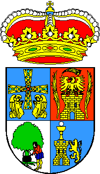
Parroquia Herias Wappen Karte von Spanien 
Hilfe zu WappenBasisdaten Autonome Gemeinschaft:  Illano (Spanien)
Provinz:  Asturien
Comarca: Eo Navia Koordinaten 43° 19′ N, 6° 48′ W43.314833620833-6.8054986080556515Koordinaten: 43° 19′ N, 6° 48′ W Höhe: 515 msnm Fläche: 25,65 km² Einwohner: 73 (2007 INE) Bevölkerungsdichte: 2,85 Einwohner/km² Postleitzahl: 33731 Gemeindenummer (INE): 33 029 0200 Nächster Flughafen: Flughafen Asturias Lage der Stadt 
Herias ist eine von 5 Parroquias der Gemeinde Illano in der autonomen Region Asturien im Norden Spaniens.
Die 73 Einwohner (2007) leben im Tal des Rio Villar. Die Gemeindehauptstadt Illano ist 14 km entfernt. Der Haupterwerbszweig der Gegend ist die Land - und Viehwirtschaft, in den kleinen Gasthäusern finden sich nur vereinzelt naturliebende Wanderer ein. Im benachbarten Ponticiella sind Steinzeitliche Funde und Dolmen zu sehen. Herias liegt am Camino a Oviedo des Jakobswegs, diese Route wird auch Camino de los Moros oder Klassischer Umweg nach Oviedo genannt.
Inhaltsverzeichnis
Sehenswertes
- Kapelle „Capilla de Herías“
- Kirche „Iglesia de Nuestra Señora del Rebollín“ in Herías
Zugehörige Ortsteile und Weiler
- Cernías - 2 Einwohner 2007 43° 17′ 58″ N, 6° 49′ 39″ W43.2994823225-6.8274358341667274
- Estela - 4 Einwohner 2007 43° 17′ 42″ N, 6° 47′ 51″ W43.295012257778-6.7974427594444465
- Herias - 22 Einwohner 2007 43° 18′ 53″ N, 6° 48′ 20″ W43.314833620833-6.8054986080556515
- Navedo - 2 Einwohner 2007 43.323472365833-6.7789594322222866
- Riodecoba - 3 Einwohner 2007 43° 18′ 26″ N, 6° 47′ 33″ W43.307343996667-6.7924798136111583
- Sarzol - 37 Einwohner 2007
- Tamagordas - unbewohnt 2007 43° 17′ 28″ N, 6° 49′ 30″ W43.2911187425-6.82504558392
- Río del Villar - 3 Einwohner 2007
Quellen
- Bevölkerungszahlen siehe INE
- Postleitzahlen siehe [1]
- Koordinaten und Höhenangaben siehe Google Earth
Weblinks
Wikimedia Foundation.

