- Houston County (Minnesota)
-
Verwaltung US-Bundesstaat: Minnesota Verwaltungssitz: Caledonia Adresse des
Verwaltungssitzes:County Courthouse
304 South Marshall Street
Caledonia, MN 55921-1389Gründung: 4. April 1854 Gebildet aus: Fillmore County Vorwahl: 001 507 Demographie Einwohner: 19.027 (2010) Bevölkerungsdichte: 13,2 Einwohner/km² Geographie Fläche gesamt: 1.473 km² Wasserfläche: 27 km² Karte 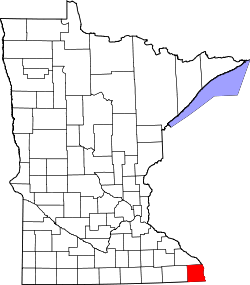
Website: www.houstoncounty.govoffice2.com Das Houston County[2] ist ein County im US-amerikanischen Bundesstaat Minnesota. Bei der Volkszählung im Jahr 2010 hatte das County 19.027 Einwohner und eine Bevölkerungsdichte von 13,2 Einwohnern pro Quadratkilometer. Der Verwaltungssitz (County Seat) ist Caledonia.
Inhaltsverzeichnis
Geografie
Das County liegt im äußersten Südosten von Minnesota und grenzt im Süden an Iowa, im Osten an Wisconsin wobei der Mississippi die natürliche Grenze bildet. Das Houston County hat eine Fläche von 1.473 Quadratkilometern, wovon 27 Quadratkilometer Wasserfläche sind. Es grenzt an folgende Countys:
Winona County La Crosse County
(Wisconsin)Fillmore County 
Vernon County
(Wisconsin)Winneshiek County
(Iowa)Allamakee County
(Iowa)Geschichte
 S. Houston
Das Houston County wurde am 4. April 1854 aus Teilen des Fillmore County gebildet. Benannt wurde es nach Sam Houston (1793-1863), einem US-amerikanischen Politiker und General, der als Schlüsselfigur in der Geschichte des Bundesstaates Texas gilt. Nach ihm wurde auch Houston, die viertgrößte Stadt der USA, benannt.
Demografische Daten
Historische Einwohnerzahlen Census Einwohner ± in % 1860 6645 — 1870 14.936 100 % 1880 16.332 9 % 1890 14.653 -10 % 1900 15.400 5 % 1910 14.297 -7 % 1920 14.013 -2 % 1930 13.845 -1 % 1940 14.735 6 % 1950 14.435 -2 % 1960 16.588 10 % 1970 17.556 6 % 1980 18.382 5 % 1990 18.497 0,6 % 2000 19.718 7 % 2010 19.027 -4 % Vor 1900[3] 1900–1990[4] 2000[5] 2010[6]  Alterspyramide des Houston County (2000)
Nach der Volkszählung im Jahr 2000 lebten im Houston County 19.718 Menschen in 7.633 Haushalten und 5.411 Familien. Die Bevölkerungsdichte betrug 14 Einwohner pro Quadratkilometer. Ethnisch betrachtet setzte sich die Bevölkerung zusammen aus 98,47 Prozent Weißen, 0,31 Prozent Afroamerikanern, 0,18 Prozent amerikanischen Ureinwohnern, 0,37 Prozent Asiaten, 0,02 Prozent Bewohnern aus dem pazifischen Inselraum und 0,14 Prozent aus anderen ethnischen Gruppen; 0,51 Prozent stammten von zwei oder mehr Ethnien ab. 0,61 Prozent der Bevölkerung waren spanischer oder lateinamerikanischer Abstammung, die verschiedenen der genannten Gruppen angehörten.
Von den 7.633 Haushalten hatten 34,4 Prozent Kinder unter 18 Jahren, die bei ihnen lebten. 60,0 Prozent davon waren verheiratete, zusammenlebende Paare. 7,4 Prozent waren alleinerziehende Mütter und 29,1 Prozent waren keine Familien. 25,4 Prozent waren Singlehaushalte und in 12,0 Prozent der Haushalte lebten alleinstehende Menschen im Alter von 65 Jahren oder darüber. Die Durchschnittshaushaltsgröße lag bei 2,53 Personen, die durchschnittliche Familiengröße bei 3,05 Personen.
27,2 Prozent der Bevölkerung waren unter 18 Jahre alt. 6,8 Prozent waren zwischen 18 und 24, 26,8 Prozent zwischen 25 und 44, 23,1 Prozent zwischen 45 und 64 und 16,0 Prozent waren älter als 65 Jahre. Das Durchschnittsalter betrug 39 Jahre. Auf 100 weibliche kamen statistisch 97,5 männliche Personen. Auf 100 Frauen im Alter von 18 Jahren oder darüber kamen 95,1 Männer.
Das jährliche Durchschnittseinkommen eines Haushalts betrug 40.680 USD und das Durchschnittseinkommen einer Familie betrug 49.196 USD. Männer hatten ein Durchschnittseinkommen von 32.557 USD, Frauen 22.158 USD. Das Pro - Kopf - Einkommen betrug 18.826 USD. 4,2 Prozent der Familien und 6,5 Prozent der Einwohner lebten unterhalb der Armutsgrenze.[7]
Städte und Gemeinden
- Houston
- La Crescent1
- Spring Grove
1 - teilweise im Winona County
Einzelnachweise
- ↑ Auszug aus dem National Register of Historic Places. Abgerufen am 13. März 2011
- ↑ GNIS-ID: 659473. Abgerufen am 22. Februar 2011 (englisch).
- ↑ U.S. Census Bureau - Census of Population and Housing Abgerufen am 15. März 2011
- ↑ Auszug aus Census.gov Abgerufen am 18. Februar 2011
- ↑ Auszug aus factfinder.census.gov Abgerufen am 18. Februar 2011
- ↑ United States Census 2010 Abgerufen am 26. Juli 2011
- ↑ Houston County, Minnesota Datenblatt mit den Ergebnissen der Volkszählung im Jahre 2000 bei factfinder.census.gov
Weblinks
-
 Commons: Houston County, Minnesota – Sammlung von Bildern, Videos und Audiodateien
 - Offizielle Webseite
- Houston County Visionary Committee
- Economic Development Authority
- www.city-data.com

Liste der Countys in Minnesota
Aitkin | Anoka | Becker | Beltrami | Benton | Big Stone | Blue Earth | Brown | Carlton | Carver | Cass | Chippewa | Chisago | Clay | Clearwater | Cook | Cottonwood | Crow Wing | Dakota | Dodge | Douglas | Faribault | Fillmore | Freeborn | Goodhue | Grant | Hennepin | Houston | Hubbard | Isanti | Itasca | Jackson | Kanabec | Kandiyohi | Kittson | Koochiching | Lac qui Parle | Lake | Lake of the Woods | Le Sueur | Lincoln | Lyon | Mahnomen | Marshall | Martin | McLeod | Meeker | Mille Lacs | Morrison | Mower | Murray | Nicollet | Nobles | Norman | Olmsted | Otter Tail | Pennington | Pine | Pipestone | Polk | Pope | Ramsey | Red Lake | Redwood | Renville | Rice | Rock | Roseau | Scott | Sherburne | Sibley | St. Louis | Stearns | Steele | Stevens | Swift | Todd | Traverse | Wabasha | Wadena | Waseca | Washington | Watonwan | Wilkin | Winona | Wright | Yellow Medicine
Wikimedia Foundation.
Schlagen Sie auch in anderen Wörterbüchern nach:
Houston Township, Houston County, Minnesota — Infobox Settlement official name = Houston Township, Minnesota settlement type = Township nickname = motto = imagesize = image caption = image |pushpin pushpin label position =left pushpin map caption =Location within the state of Minnesota… … Wikipedia
Houston County, Minnesota — Infobox U.S. County county = Houston County state = Minnesota founded year = 1854 [http://www.house.leg.state.mn.us/hinfo/govseries/No32.htm] founded date = February 23 seat wl = Caledonia largest city wl = La Crescent area total sq mi = 569 area … Wikipedia
National Register of Historic Places listings in Houston County, Minnesota — This is a list of NRHP sites in Houston County, Minnesota. See List of RHPs in MN. Map of all coordinates from Google Map of all coordinates from Bing … Wikipedia
Crooked Creek Township, Houston County, Minnesota — Crooked Creek Township, Minnesota Township … Wikipedia
Money Creek Township, Houston County, Minnesota — Money Creek Township, Minnesota Township … Wikipedia
Mound Prairie Township, Houston County, Minnesota — Mound Prairie Township, Minnesota Township … Wikipedia
Mayville Township, Houston County, Minnesota — Mayville Township is a township in Houston County, Minnesota, United States. The population was 427 at the 2000 census. Geography According to the United States Census Bureau, the township has a total area of 30.6 square miles… … Wikipedia
Black Hammer Township, Houston County, Minnesota — Infobox Settlement official name = Black Hammer Township, Minnesota settlement type = Township nickname = motto = imagesize = image caption = image |pushpin pushpin label position =left pushpin map caption =Location within the state of Minnesota… … Wikipedia
Brownsville Township, Houston County, Minnesota — Infobox Settlement official name = Brownsville Township, Minnesota settlement type = Township nickname = motto = imagesize = image caption = image |pushpin pushpin label position =left pushpin map caption =Location within the state of Minnesota… … Wikipedia
Caledonia Township, Houston County, Minnesota — Infobox Settlement official name = Caledonia Township, Minnesota settlement type = Township nickname = motto = imagesize = image caption = image |pushpin pushpin label position =left pushpin map caption =Location within the state of Minnesota… … Wikipedia
Houston County (Minnesota)


18+
© Academic, 2000-2024
- Kontaktieren Sie uns: Unterstützung, Werbung
Wörterbücher Export, schritte mit PHP, Joomla, Drupal, WordPress, MODx.