- ICESat
-
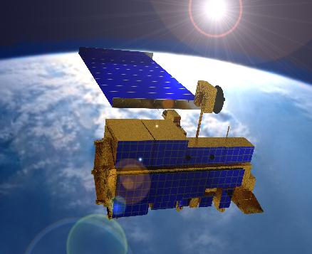
 ICESat in der Erdumlaufbahn (künstlerische Darstellung)
ICESat (Ice, Cloud and Land Elevation Satellite), Teil des NASA-Erdbeobachtungssystems, ist der Name einer Satellitenmission zur Ermittlung von Eispanzerdicken, deren Veränderung, der Messung von Höhenprofilen von Wolken und Aerosolen sowie der Höhe der Vegetation und der Meereisdicke. ICESat wurde am 12. Januar 2003 mittels einer Boeing Delta II-Rakete von der Vandenberg Air Force Base in Kalifornien auf eine nahezu kreisförmige Bahn geschossen, die die beiden Polregionen überspannt. Die Höhe der Bahn liegt bei 600 km.
2009 wurde ICESat von der NASA abgeschaltet, das Nachfolgemodell ICESat-2 soll 2016 den Betrieb aufnehmen.[1][2]
Weblinks
- ICESat (Goddard Space Flight Center) (engl.)
- ICESat (Center for Space Research, University of Texas) (engl.)
Einzelnachweise
- ↑ ICESat & ICESat-2. Vorstellung des Satelliten auf der NASA-Homepage, abgerufen am 05.11.11.
- ↑ Eisberg von Größe New Yorks entsteht in Antarktis. Yahoo!-Artikel, in dem die Satelliten ICESat und ICESat-2 erwähnt werden
 Zum Forschungsprogramm Earth Observing System (EOS) der NASA gehörende Missionen
SeaWiFS · TRMM · Landsat 7 · QuikSCAT · Terra · ACRIMSat · NMP/EO-1 · Jason-1 · Sage III · GRACE · Aqua · ADEOS-II/Midori-II · ICESat · SORCE · Aura · CloudSat · CALIPSO · OCO · Glory · OSTM · Aquarius · NPOESS Preparatory Project · ESSP · NMP/EO-3
Wikimedia Foundation.
Schlagen Sie auch in anderen Wörterbüchern nach:
ICESat — (Ice, Cloud, and Land Elevation Satellite), part of NASA s Earth Observing System, is a satellite mission for measuring ice sheet mass balance, cloud and aerosol heights, as well as land topography and vegetation characteristics. ICESat was… … Wikipedia
ICESat — (Ice, Cloud, and land Elevation Satellite c est à dire satellite glace, nuage et altitude) est une mission spatiale du programme d observation de la Terre de la NASA lancée en 2003. Ce satellite est chargé de mesurer la masse de la couche de… … Wikipédia en Français
ICESat — Organización NASA Estado Activo Fecha de lanzamiento 13 de enero de 2003 … Wikipedia Español
ICESat — noun A satellite designed to measure ice sheet mass balance, cloud and aerosol heights, as well as land topography and vegetation characteristics … Wiktionary
ICESat — 1. Ice, Cloud and land Elevation Satellite Contributor: CASI 2. Ice, Clouds, and Land Elevation Satellite Contributor: GSFC … NASA Acronyms
National Aeronautics and Space Administration — 38°52′59″N 77°0′59″O / 38.88306, 77.01639 … Wikipédia en Français
Operation IceBridge — is a 2009–2015 NASA mission that aims to monitor changes in polar ice from a fixed wing aircraft. It is a temporary replacement for the ICESat satellite. Equipment The P 3 Orion aircraft used in Operation IceBridge Since 2003 … Wikipedia
Salar de Uyuni — (or Salar de Tunupa) is the world s largest salt flatcite web | url=http://earthobservatory.nasa.gov/Newsroom/NewImages/images.php3?img id=17120 | title=Salar de Uyuni, Bolivia | publisher=NASA Earth Observatory | accessdate=2007 12 01] at 10,582 … Wikipedia
Erdbeobachtungssystem — Das Earth Observing System (englisch für Erdbeobachtungssystem), kurz EOS, ist ein Forschungsprogramm der NASA, zu dem eine Reihe künstlicher Satelliten mit wissenschaftlichen Instrumenten im Erdorbit gehören. Diese Erdbeobachtungssatelliten… … Deutsch Wikipedia
Liste der Erdbeobachtungssatelliten — Das ist die Liste der Erdbeobachtungssatelliten. Chronologische Übersicht (unvollständig) Inhaltsverzeichnis: 1960er · 1970er · 1980er · 1990er · 2000er · 2010er Startdatum Mission Bild Organisation (Land) Bemerkung 1960er … Deutsch Wikipedia
ICESat

18+
© Academic, 2000-2024
- Kontaktieren Sie uns: Unterstützung, Werbung
Wörterbücher Export, schritte mit PHP, Joomla, Drupal, WordPress, MODx.