- Jabal Marrah
-
Dieser Artikel erläutert den Vulkan Marra. Für die Schweizer Politikerin siehe Ada Marra. - Sabine Miehe: Vegetation ecology of the Jebel Marra Massif in the semiarid Sudan. Cramer, Berlin 1988. ISBN 3-443-64025-7
| Marra | ||
|---|---|---|
 |
||
| Höhe | 3.088 m | |
| Lage | im Westen Sudans | |
| Gebirge | Marra-Plateau | |
| Geographische Lage | 13° 2′ 39″ N, 24° 22′ 4″ O13.04416666666724.3677777777783088Koordinaten: 13° 2′ 39″ N, 24° 22′ 4″ O | |
|
||
| Typ | erloschener Vulkan | |
| Erstbesteigung | unbekannt | |
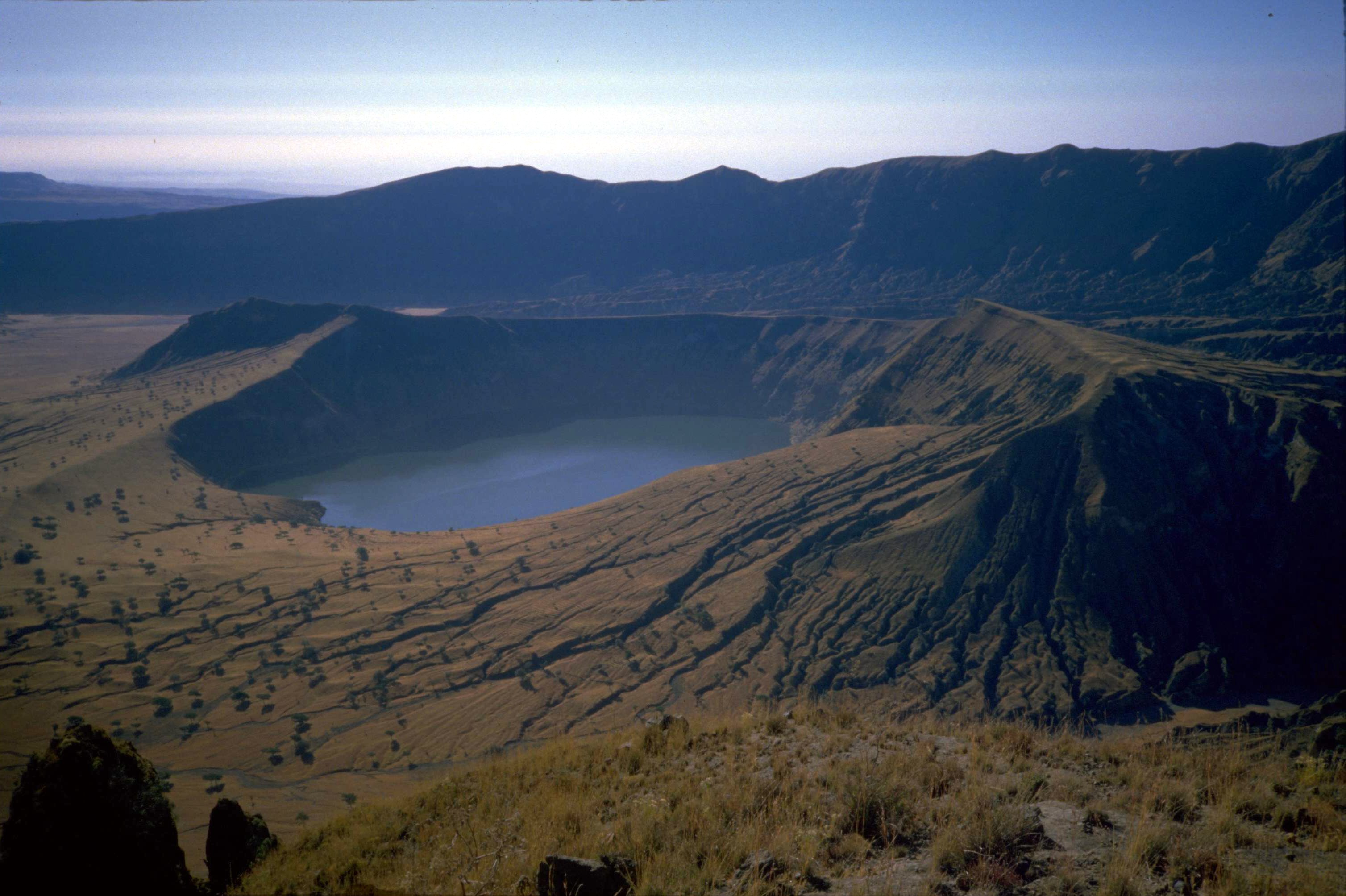 Einer der zwei Deriba-Seen im Zentrum des Vulkanberges. Photo von 1986. |
||

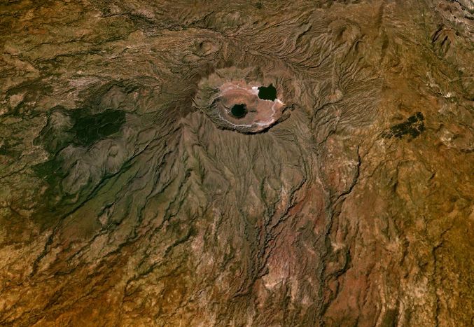
Der Marra (arabisch جبل مرة Dschabal Marra; auch Jebel Marra) ist ein erloschener Vulkan (3.088 m) auf dem Marra-Plateau im Westen Sudans.
Er liegt in den Bundesstaaten Schamal Darfur und Dschanub Darfur zwischen der Stadt al-Faschir und der Grenze zum Tschad.
Das Marra-Plateau umfasst eine Fläche von 1.500 km² und hat eine Höhe von 1.500 bis 3.088 m über dem Meeresspiegel.
Der Marra ist von einer Steinwüste umgeben und in seinem Zentrum findet man zwei Seen, die Deriba-Seen.
Siehe auch
Literatur
Wikimedia Foundation.