- Amherst (New York)
-
Amherst 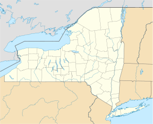

Amherst Lage in New YorkBasisdaten Gründung: 1818 (incorporated) Staat: Vereinigte Staaten Bundesstaat: New York County: Koordinaten: 42° 59′ N, 78° 48′ W42.978333333333-78.8181Koordinaten: 42° 59′ N, 78° 48′ W Zeitzone: Eastern Standard Time (UTC−5) Einwohner: 116.510 (Stand: 2000) Bevölkerungsdichte: 846,1 Einwohner je km² Fläche: 138,5 km² (ca. 53 mi²)
davon 137,7 km² (ca. 53 mi²) LandHöhe: 181 m Postleitzahlen: 14051, 14068, 14221, 14226, 14228 Vorwahl: +1 716 FIPS: 36-02000 GNIS-ID: 971947 Webpräsenz: www.amherst.ny.us Bürgermeister: Satish B. Mohan Amherst ist eine Stadt („Town“) im Erie County, New York, Vereinigte Staaten, nordöstlich der Stadt Buffalo. Die Stadt ist benannt nach Jeffrey Amherst, 1. Baron Amherst, einem britischen Feldmarschall des 18. Jahrhunderts.
In Amherst leben 116.510 Menschen (2000). Die Stadt ist ein Vorort von Buffalo. Sie hat eine Fläche von 138,6 km² und die Bevölkerungsdichte beträgt 844,8 /km². Amherst ist nicht weit von den Niagarafällen entfernt.
Amherst wurde 2005 zur sichersten Stadt Amerikas gewählt (2006 zweitsicherste).
Teilorte von Amherst
- Eggertsville
- Getzville
- Audubon
- East Amherst (auch: Transit Station)
- Grover Cleveland Terrace
- North Bailey
- Snyder (auch Snyderville)
- Swormville
- West Ameherst
- Williamsville
Universitäten
- University at Buffalo
- Daemen College
- Erie Community College
- Bryant and Stratton
Weblinks
 Commons: Amherst, New York – Sammlung von Bildern, Videos und Audiodateien
 Rathaus (Townhall) von Amherst
 Kategorien:
- Ort in New York
- Erie County (New York)


Wikimedia Foundation.