- Kondrovo
-
Stadt Kondrowo
КондровоFöderationskreis Zentralrussland Oblast Kaluga Rajon Dserschinski Bürgermeister Andrei Komarow Gegründet Anfang des 16. Jh. Stadt seit 1938 Fläche 19 km² Höhe des Zentrums 150 m Bevölkerung 16.881 Einw. (Stand: 2006) Bevölkerungsdichte 888 Ew./km² Zeitzone UTC+3 (Sommerzeit: UTC+4) Telefonvorwahl +7 (48434) Postleitzahl 249832 Kfz-Kennzeichen 40 OKATO 29 208 501 Geographische Lage Koordinaten: 54° 48′ N, 35° 56′ O54.835.933333333333150Koordinaten: 54° 48′ 0″ N, 35° 56′ 0″ O 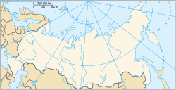

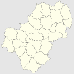 Oblast Kaluga
Liste der Städte in Russland Kondrowo (russisch Кондрово) ist eine Stadt in der Oblast Kaluga (Russland) mit 16.881 Einwohnern (Berechnung 2006).
Inhaltsverzeichnis
Geografie
Die Stadt liegt etwa 40 km nordwestlich der Oblasthauptstadt Kaluga an der Schanja, einem linken Nebenfluss der Ugra im Flusssystem der Wolga.
Kondrowo ist Verwaltungszentrum des Rajons Dserschinski.
Geschichte
Der Ort entstand zu Beginn des 16. Jahrhunderts auf Ländereien, welche für Verdienste im Feldzug 1500 bis 1501 gegen das Großfürstentum Litauen dem Wojwoden Dmitri Kondyrjow überschrieben worden waren, und wurde nach diesem Kondyrjowo genannt.
1790 entstand hier eine Papierfabrik, welche gegen Ende des 19. Jahrhunderts für ihre qualitativ hochwertigen Erzeugnisse bekannt war. Ab den 1840er Jahren kam die heutige Ortsnamensform in Gebrauch.
1938 wurde das Stadtrecht verliehen.
Im Zweiten Weltkrieg wurde Kondrowo am 9. Oktober 1941 von der deutschen Wehrmacht besetzt und am 19. Januar 1942 von der Westfront der Roten Armee im Rahmen der Rschew-Wjasmaer Operation zurückerobert.
Einwohnerentwicklung
Jahr Einwohnerzahlen 1959 13.100 * 1979 15.100 * 1989 17.212 ** 2002 17.177 ** 2006 16.881 Anmerkung: * Volkszählung (gerundet) ** Volkszählung
Wirtschaft und Infrastruktur
Wichtigstes Unternehmen der Stadt ist die Papierfabrik.
Die Stadt liegt an der auf diesem Abschnitt 1874 eröffneten Eisenbahnstrecke Wjasma–Kaluga–Uslowaja–Rjaschsk (Stationsname Gowardowo).
Weblinks
- Kondrowo auf mojgorod.ru (russisch)
 Orte in der Oblast Kaluga
Verwaltungszentrum: Kaluga
Balabanowo | Borowsk | Juchnow | Kirow | Kondrowo | Koselsk | Ljudinowo | Malojaroslawez | Medyn | Meschtschowsk | Mossalsk | Obninsk | Schisdra | Schukow | Sossenski | Spas-Demensk | Suchinitschi | Tarussa | Worotynsk


Wikimedia Foundation.