Liverpool Plains Shire

Liverpool Plains Shire
Shire of Liverpool Plains
Australia-Map-NSW-LGA-LiverpoolPlains.png
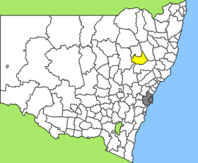
Lage des Liverpool Plains Shire in New South Wales
Gliederung
Staat: Australien Australien
Bundesstaat: Flag of New South Wales.svg New South Wales
Verwaltungssitz: Quirindi
Daten und Zahlen
Fläche: 5.086 km²
Einwohner: 7.540 (2006) [1]
Bevölkerungsdichte: 1,5 Einwohner je km²
-31.483333333333150.68333333333

Liverpool Plains Shire ist ein lokales Verwaltungsgebiet (LGA) im australischen Bundesstaat New South Wales. Das Gebiet ist 5.086 km² groß und hat etwa 7.800 Einwohner.

Liverpool Plains liegt im Nordosten des Staates nördlich der Hunter-Region etwa 370 km nördlich der Metropole Sydney und 640 km südwestlich von Brisbane. Das Gebiet umfasst 50 Ortsteile und Ortschaften, darunter Ardglen, Bundella, Caroona, Colly Blue, Currabubula, Old Warrah, Pine Ridge, Premer, Quirindi, Spring Ridge, Tamarang, Wallabadah, Werris Creek, Willow Tree, Yarraman und ein Teil von Blackville. Der Sitz des Shire Councils befindet sich in Quirindi im Osten der LGA, wo etwa 2.600 Einwohner leben.

Verwaltung

Der Liverpool Plains Shire Council hat sieben Mitglieder, die von den Bewohnern der LGA gewählt werden. Liverpool Plains ist nicht in Bezirke untergliedert. Aus dem Kreis der Councillor rekrutiert sich auch der Mayor (Bürgermeister) des Councils.

Weblinks

Einzelnachweise

  1. Australian Bureau of Statistics (25. Oktober 2007): Liverpool Plains (A) (Local Government Area) (Englisch). 2006 Census QuickStats. Abgerufen am 6. April 2010.

Wikimedia Foundation.

Игры ⚽ Поможем написать курсовую

Schlagen Sie auch in anderen Wörterbüchern nach:

  • Liverpool Plains Shire Council — Infobox Australian Place | type = lga name = Liverpool Plains Shire state = nsw caption = Location in New South Wales pop = 7,910 density = 1.55 area = 5086 est = seat = Quirindi (60 Station Street mayor = Ian Lobsey region = North West Slopes… …   Wikipedia

  • Liverpool Plains — The Liverpool Plains are an extensive pastoral area covering approximately 1.2 million hectares of the north western slopes of New South Wales in Australia.These plains are a region of prime agricultural land bounded to the east by the Great… …   Wikipedia

  • Moree Plains Shire — New South Wales Location in New South Wales Population …   Wikipedia

  • Liverpool (Begriffsklärung) — Folgende Städte tragen den Namen Liverpool: Stadt in England, siehe Liverpool Stadt in Kanada, siehe Liverpool (Nova Scotia) Stadt in New South Wales in Australien, siehe Liverpool (New South Wales) Städte in den USA, siehe Liverpool (Illinois)… …   Deutsch Wikipedia

  • Wakool Shire — Shire of Wakool New South Wales Location in New South Wales Population: 4,427(2009) …   Wikipedia

  • Muswellbrook Shire — New South Wales Location in New South Wales Population …   Wikipedia

  • Gunnedah Shire Council — Infobox Australian Place | type = lga name = Gunnedah Shire caption = Location in New South Wales state=New South Wales region=North West Slopes area=4994 est = seat=Gunnedah (63 Elgin Street} cite web title=Gunnedah Shire Council publisher =… …   Wikipedia

  • Cowra Shire — New South Wales Location in NSW Population: 12,945(2009) …   Wikipedia

  • Conargo Shire — New South Wales Location in New South Wales Population: 1,700(2009) …   Wikipedia

  • Murray Shire — This article is about the Murray Shire in New South Wales. For the Western Australia shire, see Shire of Murray. Murray Shire New South Wales …   Wikipedia

Share the article and excerpts

Direct link
Do a right-click on the link above
and select “Copy Link”