- Mayaguana
-
Mayaguana Gewässer Atlantischer Ozean Inselgruppe Bahamas Geographische Lage 22° 22′ 33″ N, 72° 54′ 30″ W22.375833333333-72.908333333333Koordinaten: 22° 22′ 33″ N, 72° 54′ 30″ W 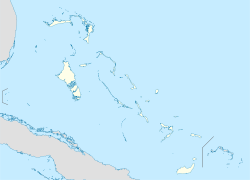

Einwohner 259 (2000) Hauptort Abraham’s Bay Mayaguana ist die östlichste Insel der Bahamas und eine von nur zwei Inseln, die ihren ursprünglichen arawakischen Namen behalten haben.
Die größte Siedlung ist Abraham’s Bay an der Südküste, andere Siedlungen sind Betsy Bay im Osten und Pirate’s Well im Norden.
In Mayaguana gab es keine große wirtschaftliche Entwicklung, die Insel wurde um 1812 von Bewohnern der Turks- und Caicosinseln besiedelt. Die Bevölkerung Mayaguana beträgt 259 (2000).
Der brasilianische Historiker Antonio Varnhagen vermutete 1824, dass Mayaguana "Guanahani" ist, die erste Insel, die von Christopher Columbus bei der Entdeckung Amerikas besucht wurde. Diese Theorie fand aber nur wenige Anhänger.

Abaco | Acklins | Andros | Berry Islands | Bimini | Cat Island | Cay Sal Bank | Crooked Island | Eleuthera | Exumas | Grand Bahama | Inaguas | Long Island | Mayaguana | New Providence | Ragged Island | Samana Cay | San Salvador
Wikimedia Foundation.
Schlagen Sie auch in anderen Wörterbüchern nach:
Mayaguana — Géographie Pays Bahamas Archipel … Wikipédia en Français
Mayaguana — Mayaguana, Insel der Bahamasgruppe … Pierer's Universal-Lexikon
Mayaguana — Location of Mayaguana. Mayaguana is the most easterly island and district of the Bahamas. It is one of only a few Bahamian islands which retain their Lucayan names. The population of Mayaguana in the 2000 census was 259, amounting to an estimate… … Wikipedia
Mayaguana — es la isla más oriental de las Bahamas (Antillas) y la menos desarrollada de todo el grupo. Es una de las dos islas de las Bahamas, que tienen un nombre en arawak (la otra es Inagua). Según el censo del 2000 tiene una oblación de 259 habitantes,… … Wikipedia Español
Mayaguana — Sp Majagvanà Ap Mayaguana L s. Bahamose … Pasaulio vietovardžiai. Internetinė duomenų bazė
Mayaguana — Admin ASC 1 Code Orig. name Mayaguana Country and Admin Code BS.16 BS … World countries Adminstrative division ASC I-II
Mayaguana Airport — IATA: MYG – ICAO: MYMM Summary Location Mayaguana Elevation AMSL 11 ft / 3 m Coordin … Wikipedia
Mayaguana — geographical name island in SE Bahamas NNE of Great Inagua Island area 110 square miles (285 square kilometers) … New Collegiate Dictionary
BS-MG — Mayaguana ist die östlichste Insel der Bahamas und eine von nur zwei Inseln, die ihren ursprünglichen arawakischen Namen behalten haben. Die größte Siedlung ist Abraham’s Bay an der Südküste, andere Siedlungen sind Betsy Bay im Osten und Pirate’s … Deutsch Wikipedia
MYG — Mayaguana, Bahamas internationale Flughafen Kennung … Acronyms
Mayaguana

18+
© Academic, 2000-2024
- Kontaktieren Sie uns: Unterstützung, Werbung
Wörterbücher Export, schritte mit PHP, Joomla, Drupal, WordPress, MODx.